Tuesday, January 25, 2000
A cool night in Beatrice, Nebraska.
Greetings from cold southeastern Nebraska! It seems the temperature has
been dropping as I progress eastward. I will need to become accustomed to
it soon! Tonight I am in Beatrice. The town was named after the
middle name of the daughter of one of the town's founders, and it is pronounced
with the accent on the "at." Beatrice has developed into a light
industrial and farming center.
I watched a very pretty sunrise this morning as I drove east on Route
50. It was another journey alongside the Santa Fe Trail.
Along the road I see endless acres of farmland and cattle, and intermittently I
drive through a small town. I find this so much more interesting than
driving the controlled access freeways! Each town, though somewhat similar
to the previous town, seems to have its own character. And the posted
markers and information are enjoyable and educational to read. Another
interesting sight is the extremely large flocks of birds I occasionally
see. There must be hundreds grouped together at times, and parts of the sky
are blackened behind them.
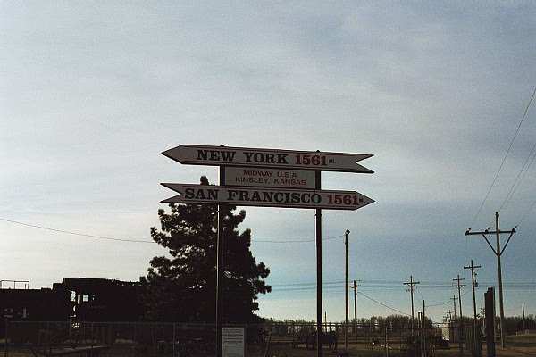
My first stop today was in Kinsley, Kansas. There was a large
sign indicating that San Francisco was 1561 miles to the west, and that New York
was 1561 miles to the east! The midpoint of the two cities! This was
also the town that I changed from Route 50 to Route 56 to continue following
along the Santa Fe Trail.
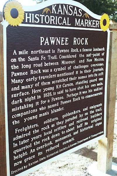
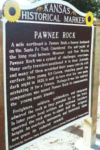
As the travelers in the nineteenth century would pass through this area, one
point of reference was the Pawnee Rock, a sixty foot tower of Dakota
sandstone. While some of it has been used in local building, the view of
the surrounding lands from the top is magnificent!
I continued along Route 56 until reaching Kansas Route 77, where I
turned North. This is the road that will lead me to Route 30, my next turn
to the east.
The landscape along this route was changing, as rolling hills began to
develop. It reminded me of the drive from central Ohio to the northern
part of the Ohio. Not at all as large as the Santa Cruz
mountains, though.
Farmland was the majority use, except for a munitions area further north.
There were military maneuvers in progress on the lands bordering either side of
the road. As I drove, I noticed several military vehicles with large guns
and also tanks pointing at me while they waited for me to pass. Of course,
it was because they needed to cross the road! I drove the speed limit, not
willing to push my luck! ;-) Also, signs were posted along the
area. At road entrances, signs read "No civilian vehicles allowed
beyond this point." On the fences, I noticed signs reading no
trespassing, with a reference to laser usage in the area. I stayed on the
road! ;-) Even with the multiple Air Force aircraft flying overhead,
I did not slow down!
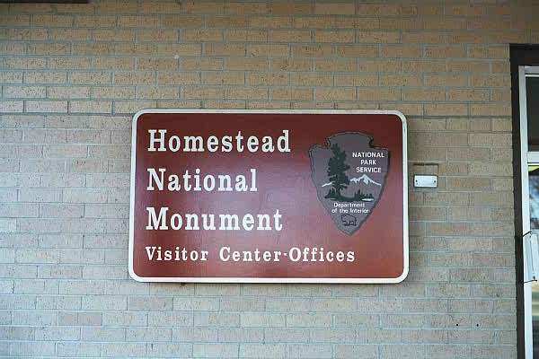
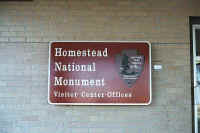
My final visit for the day was at the Homestead National Monument of
America. In 1936, Congress set aside this area to commemorate the
lives of the pioneers and the changes in the country as a result of the
Homestead Act of 1862. I viewed the informational video and toured the
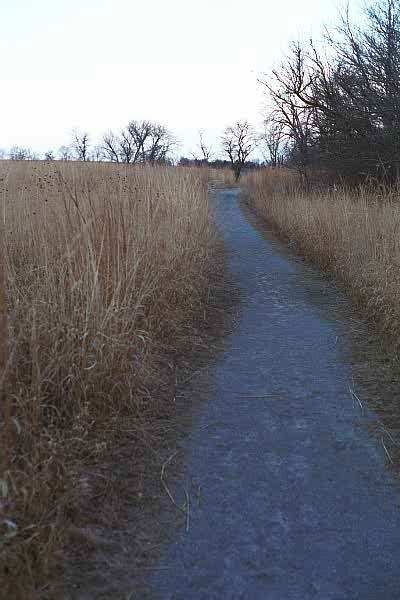
Visitor Center Museum. There is also a several hundred acre area that has
been seeded with prairie plants and left to grow as it did in the 1800s.
There is a trail with informational tablets and tagged plants through the
prairie land to better educate the visitor. Walking on the trail through
the grassland, it was mind boggling to imagine how the pioneers were able to get
through the lands, survey, and develop them. At the visitor center, I met
Scott, the National Park Service
volunteer, who was very informative and able to
answer my questions. Interestingly, Scott was from Martinez, California
(in the Bay area.) He wanted to see what this locale was like, so he took
this four month volunteer job. The National Park Service sets him up with
housing, and he provides the remainder. He had been here three weeks and
was just getting used to the area, and had not decided if he was going to
stay. I mentioned my plans, and he thought the history of New England
would be interesting. The location of the park is just west of
Beatrice, which has some small town qualities. However, Scott was somewhat
unhappy with the many chain food outlets and the Wal-Mart that recently opened
north of town. I told him the story of how McDonald's wanted to open up a
restaurant in Freeport, Maine. The only way they could do it was to place
the business in a one hundred year old building, preventing the normal obnoxious
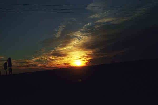
facade we are used to seeing. Back to the trail, I took my hike as the sun
was setting. It was another beautiful sunset!
Routes traveled today: 50 - 56 - 77
Tomorrow, I should be in Iowa, after I pass through Wahoo, Nebraska, the home
office to David Letterman's Top Ten List! I will let you know if I see any
references. Thank you visiting....Igor
Hotel: Beatrice
Inn, Beatrice Nebraska
Gas: $1.40
Click on picture to get enlarged
view:
|
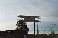
Kinsley Kansas, the
"Midway Point."
|
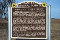
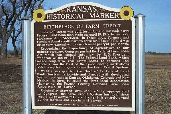
A historical marker indicating the birthplace of farm credit.
|
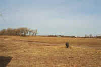
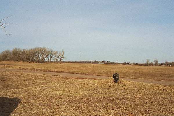
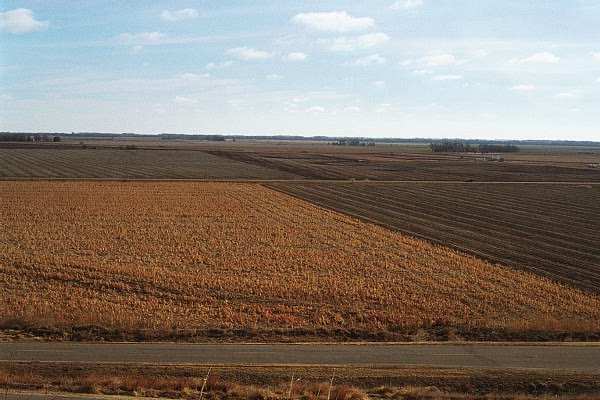
Kansas farmland
|
|
Unfortunately, a truck was
parked in front of this sign, hence the angled shot!
|
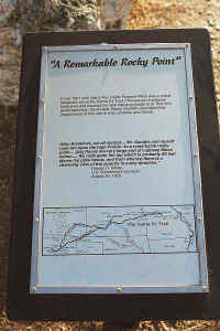
Pawnee Rock plaque
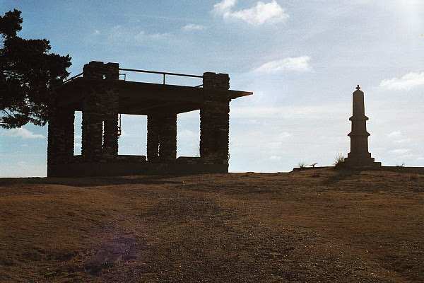
|
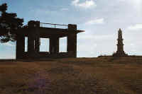
An observation tower and monument atop Pawnee Rock.
|
|
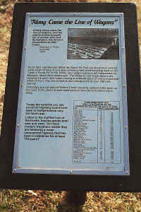
Another informational plaque.
|
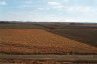
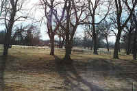
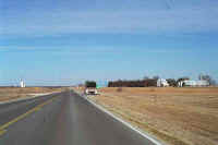
The look of the land today.
|

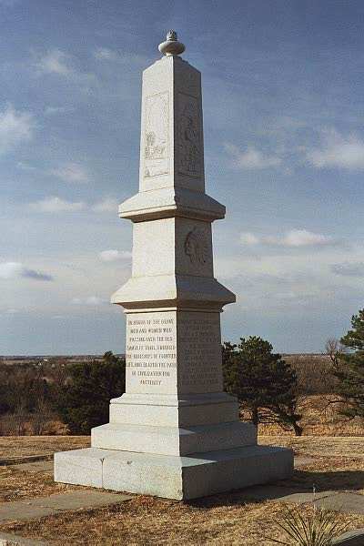
The monument on Pawnee.
|
|
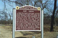
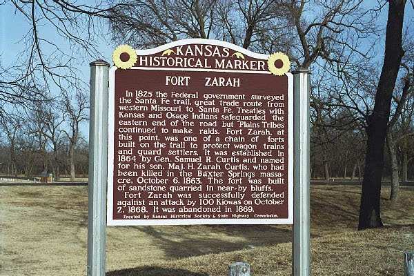
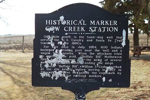
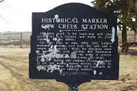
A historical marker for Fort Zarah.
|
Today's look at the fort.
|
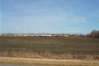
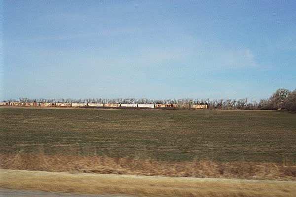
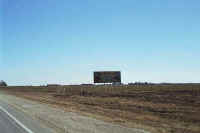
Old, parked railroad cars rusting in a field.
|
|
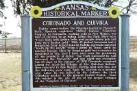
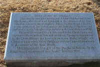
Historical marker describing a
visit by Coronado.
|
Two Buffalo Bills were in
this area.
|
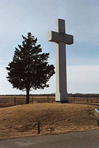
A plaque informing visitors
of the cross dedicated to Father Padilla.
|
|
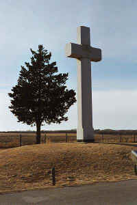
The cross from a distance.
|
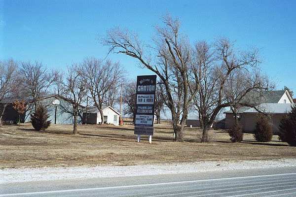
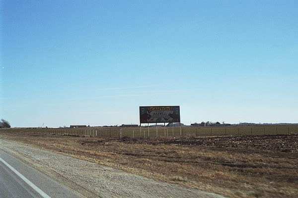
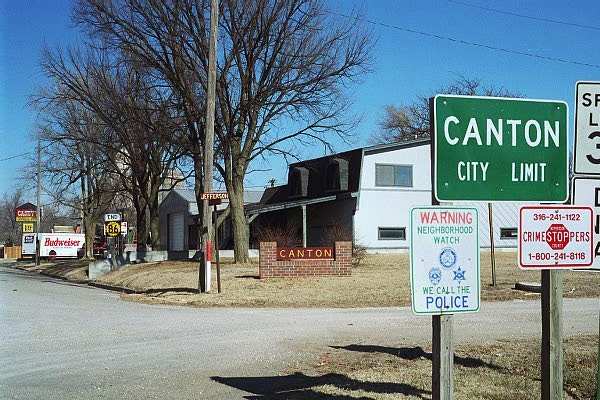
I decided to visit Canton,
Kansas.
|
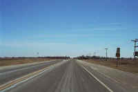
The level lands of Kansas
|
|
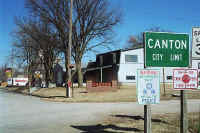
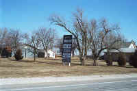
More signs, in case you
forgot where you were!
|

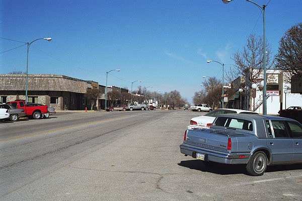
Downtown Canton. A
little different than my hometown, Canton, Ohio!
|
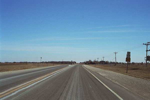
I have reached the junction
where I turn away from Route 50. Thanks for the wonderful
memories!
|
|
Leaving Kansas...
|
Entering Nebraska!
|
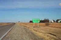
Main entrance to the Homestead National Monument.
|
|
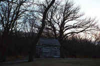
An old log cabin used many years ago, and brought to the site as part of
the walking tour of the Homestead Act years.
|
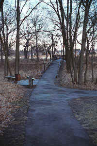
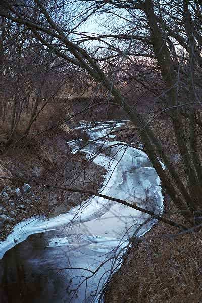
The path leads to a suspension bridge...
|
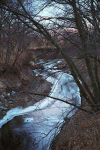
Crossing over a creek...
|
|
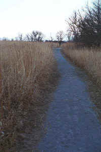
And taking you through grasslands reminiscent of the kind in the area many
years ago.
|
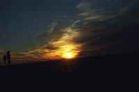
The sun setting from Beatrice, Nebraska.
|
|

This page
accessed  times since January 1, 2001.
Page
created by: igorn@igorn.com
Copyright
© 2001 Igor N. Nikishin
All
Rights Reserved
Pictures
may be used with permission.