Monday, January 24, 2000
Greetings from Dodge City, Kansas.
I made it to the next state, and to the Central Time zone. It was
another good day of driving and while there was a high layer of clouds, it
turned out to be a nice day. I was unable to see the sunrise this morning
due to the clouds. Still, I was able to get an early start and head east
on Route 50.
My first detour was a drive through the town of La Junta, Colorado, to
see historical buildings of this old railroad town. This was also the
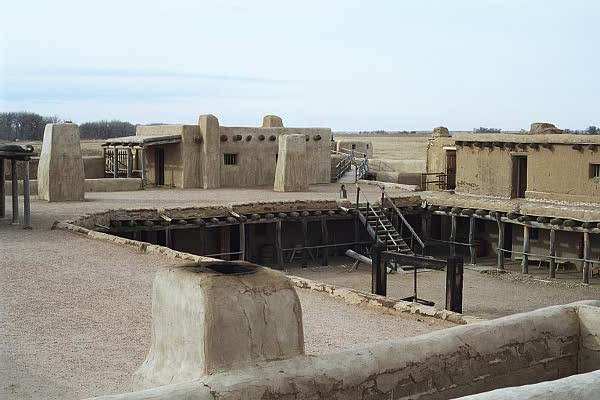
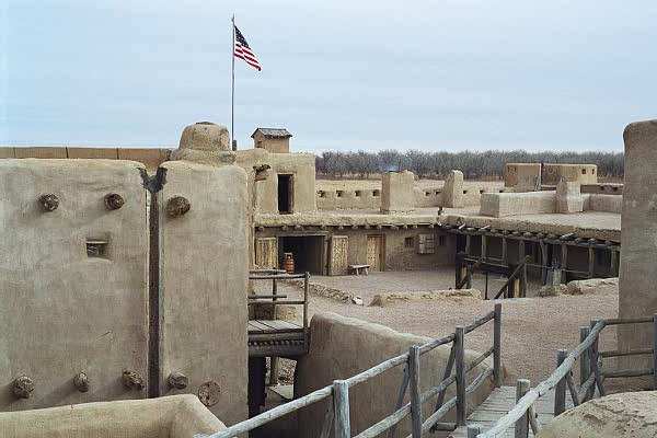
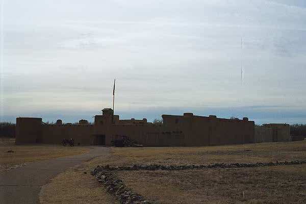
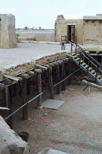
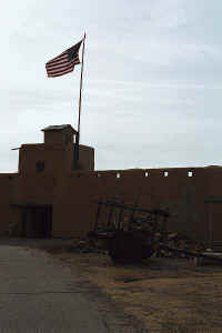
route to Bent's Old Fort National Historical Site. Reconstructed on
the original foundation of Bent's Fort built in 1833, the historical site
displays the facilities as they were with a ninety percent accuracy, with
information retrieved through drawings, sketches, and documentation. The
fort was used as a trading post and stopping place for traders, trappers, and
explorers. Even John C. Fremont was here (again, I cross the path of John
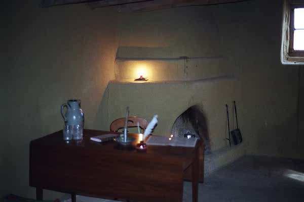
Fremont!) There are many exhibits to be seen, with rooms and buildings set
up as they were when the fort was in operation, and in the summer months, there
are demonstrations by park personnel in period clothing. I was the first
visitor there this morning, and other than the park staff, I had the fort to
myself for two hours! It was a great place to explore. As for the
staff, I was fortunate to meet Jennifer and Anthony, who were very helpful and
well-informed. I was able to learn much about of the fort, the Santa Fe
Trail, and other historical facts about the area. Another thing I enjoyed
was walking on the upper level of the fort and seeing a train far off in the
distance and hearing the whistle blow. It was a very serene setting.
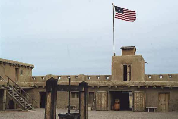
On a final note, the United
States flag that flies above the entrance to the fort has 27
stars, as it did when the fort was in operation!
I returned to Route 50 East and continued my drive, enjoying the small towns
along the way. The road follows the Arkansas River, and occasionally,
there are historical markers indicating the path of the Santa Fe
Trail. I gathered
more information and at certain points, you can actually see the ruts in the
ground made by the travelers of long ago. It was intriguing to think about
how people made their voyage through this area by horse and
wagon.
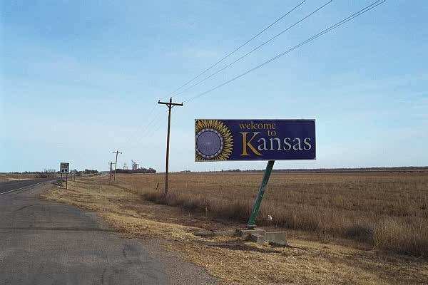
Finally, I stopped in Dodge City, Kansas, former home of
Wyatt Earp and Bat
Masterson. I did not drive around town yet, but from what I saw advertised
on the drive in, there appears to be some touristy presentations!
Additionally, in my room (a Best Western,) there is a printed sign that reads:
|
Do
Not Clean
Pheasants
in this
Room
$50.00
Charge will be made to anyone who does!
........Manager |
Guess I better get $50.00 bucks ready when I check out!!!! ;-)
Roads traveled today: 50 - 109 - 194 - 109 - 50
Tomorrow I should be writing from Nebraska. Thank you for reading about
my trip...Igor
Hotel: Best
Western Silver Spur Lodge, Dodge City, Kansas
Gas: $1.54
Click on picture to get enlarged
view:
|
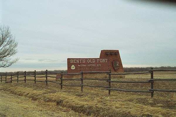
Entrance sign to Bent's Old
Fort.
|
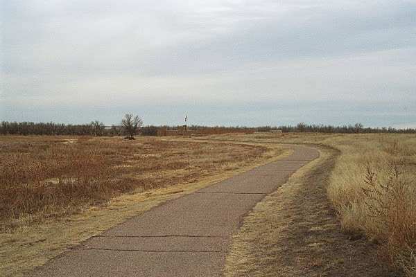
The parking lot is about a
quarter of a mile from the fort, which helps enhance the atmosphere.
|
The "General Store" inside the fort.
|
|
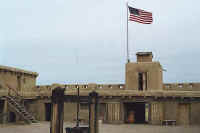
The 27 start flag flying over
the entrance, as viewed from the courtyard.
|
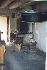
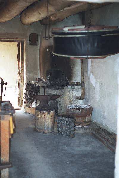
The Blacksmith Shop
|
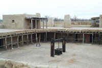
The courtyard as viewed from the uppoer level of the fort.
|
|
Looking south from the fort towards the Arkansas River.
|
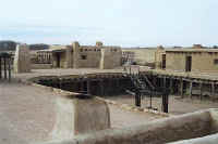
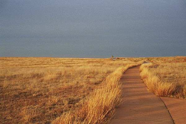
View of the upper level.
|
Great effort was made to recreate this fort to its original design.
|
|

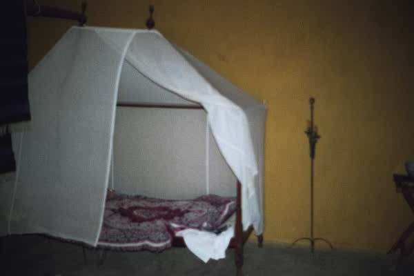
One of the bedrooms in the fort. While entrance was permitted in
most rooms, some where restricted.
|
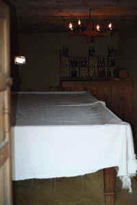
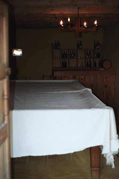
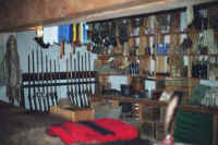
The bar, with the very long
pool table.
|
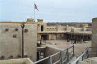
Looking towards the front of the fort.
|
|
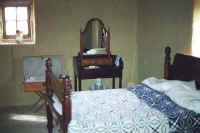
One of the fancier bedrooms.
|
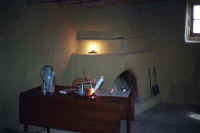
Inside another room, with an
interesting desk.
|
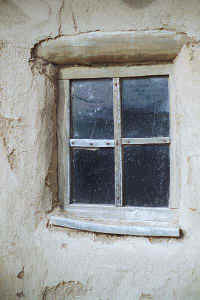
I liked this view of the
window frame construction.
|
|
A shot as I was departing.
|
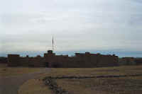
One more picture of the fort.
|
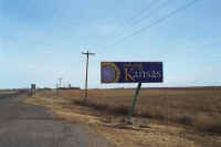
I made it to Kansas!
|
|
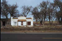
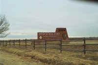
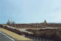
An interesting building near the border.
|
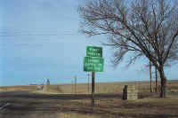
Another time zone behind me.
|
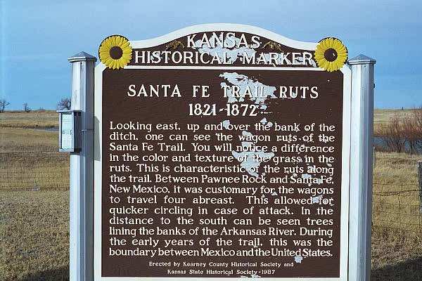
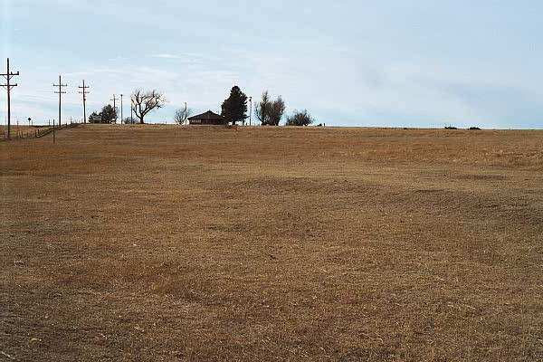
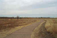
I stopped at this marker in a
parking area, describing the visible ruts of the Santa Fe Trail.
|
|
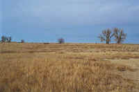
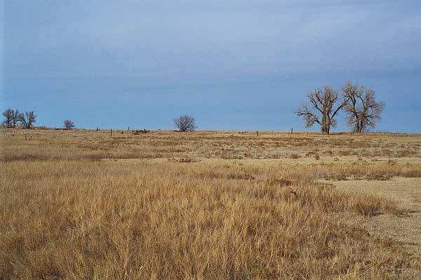
From the parking area, I was
able to walk around the area and see the ruts. Very interesting!
|
Though not easy to see in these pictures, the ruts are in the middle of
the picture.
|
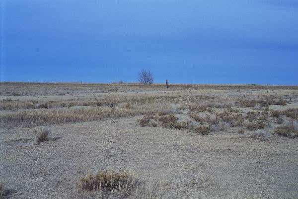
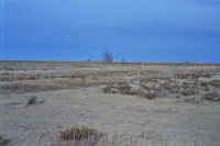
Another view, not easy to see in the pictures, but clearly visible at the
site.
|
|
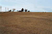
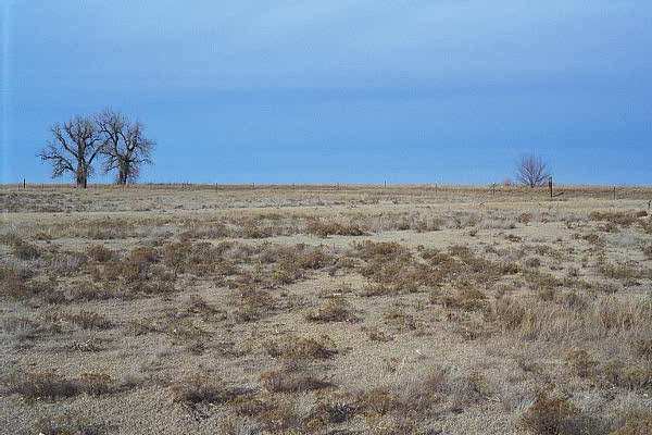
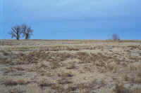
These ruts are more visible, seen going from the lower right towards the
upper left.
|
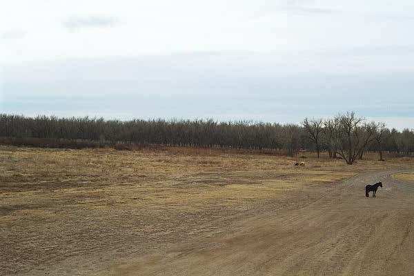
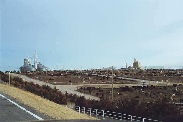
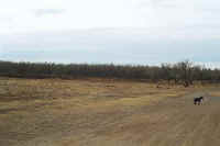
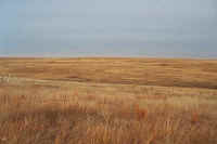
A beef farm along the road.
|
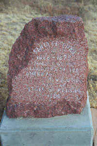
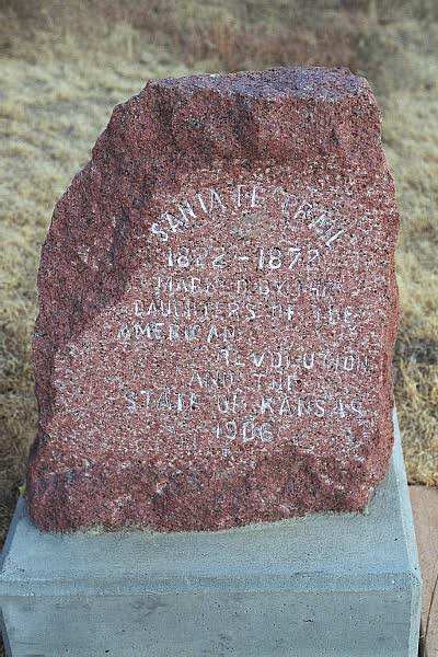
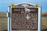
The Daughters of the American
Revolution placed seven of these markers along the trail in Kansas.
|
|
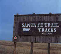
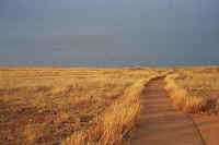
Another parking area and trail to view the Santa Fe Trail.
|
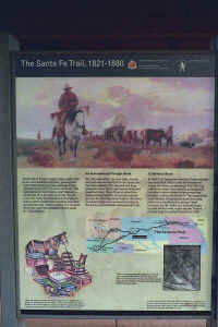
Description of the trail.
|
Ruts visible in this area.
|
|
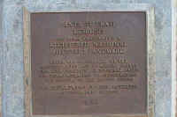
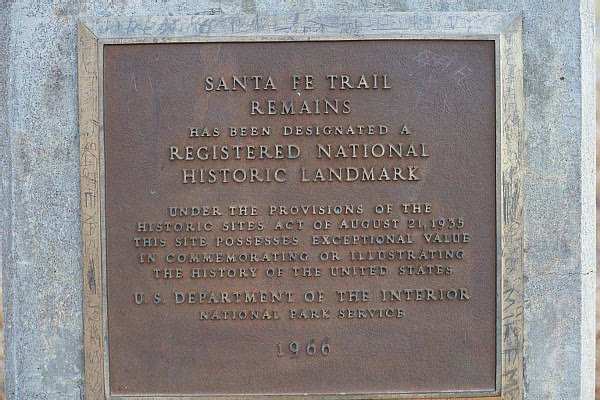
Registered National Historic
Landmark plaque.
|
To the left of the trail, where it bends to the right, ruts are clearly
visible.
|
|

This page
accessed  times since January
1, 2001.
times since January
1, 2001.
Page
created by: igorn@igorn.com
Copyright
© 2001 Igor N. Nikishin
All
Rights Reserved
Pictures
may be used with permission.