Saturday, January 8, 2000

Hello from Lone Pine, California...Again!

After driving almost 300 miles, I have ended up in the same motel as last night!  Actually, the miles were spent driving to and within Death Valley National Park.  I was impressed!  I had not been here before, and had some preconceived notions of what to expect.  Quite a unique area, with some very interesting sites.  


I began my day by packing up the car and driving off early.  I was able to watch the spectacular sunrise as I drove towards Death Valley, which was 105 miles away.  My actual destination was Badwater, an area near the lowest point in the park.  However, as I was driving I noticed many other reasons to stop.  


After stopping at the Death Valley Visitors Center, I headed south through the park.  At the Golden Canyon area, I noticed a Ranger giving a talk and tour on the trail.  I joined the group and was able to learn quite a bit about the geography of the area and the history of the park.  If you go the park, one of the Ranger guided tours would be highly recommended.  


Following the tour, I drove to Badwater (this link has panoramas.)  There is a trail out onto a salt flat that is in the area of the lowest point.  While walking out I took a picture for a family also walking the trail.  I began speaking with the father, and learned that he was the Superintendent of Schools for the Big Pine area.  We had an interesting discussion about schools, life, and challenges for the future.  After he and his family turned back to the parking lot, I continued on the trail.  After a few minutes, I was far away from everyone and everything.  I paused for a few minutes and stood there, amazed at how quiet it was.  There was NO sound, absolute quiet!  It felt strange as there were no noises from cars, people, or animals.  Even the wind was still.  I even held my breath several times to hear anything.  Again, absolute silence.


I began my journey back to Lone Pine from there with a stop at a place in the park called Artist's Palette.  It is an area of large multicolored rock formations.  The colors were absolutely incredible!  This is something you must see if you visit the park.


One other item for the day.  It appears they are filming another movie here in Lone Pine.  I had to slow to a crawl on the way to town as there was a film crew and production staff standing in the road!


Tomorrow I shall head North on Route 395.  I may stop at a site of sand dunes recommended by the gentleman I spoke with on the salt flat.  The dirt road to the area sounds a bit rough.  Normally that would not stop me, but since my car is packed full and riding very low, I do not want to take any chances. 


My routes today were:  395 - 136 - 109 - 136 - 395.  


Lodging - Best Western Frontier Motel

Fuel - $1.74


I will continue soon...Thanks for stopping by!

Igor


Click on picture to get enlarged view:

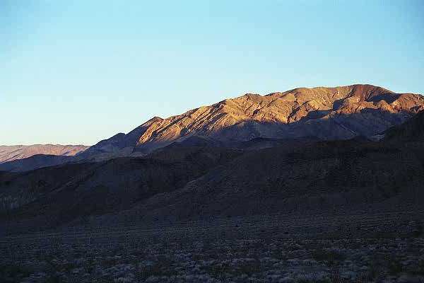
Route 136 East of Lone Pine looking West, on the road to Death Valley at dawn.

Continuing on Route 136, looking West as the sun rises.

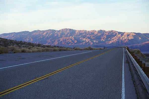
East on Route 190 towards Death Valley, looking back as the sun creeps down the Sierra Nevada Mountains.

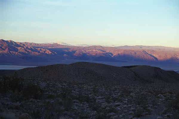
More spectacular views along the road.

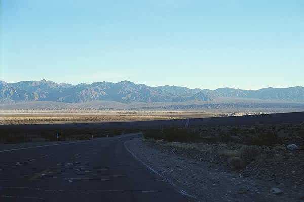
Nearing the Death Valley National Park entrance.

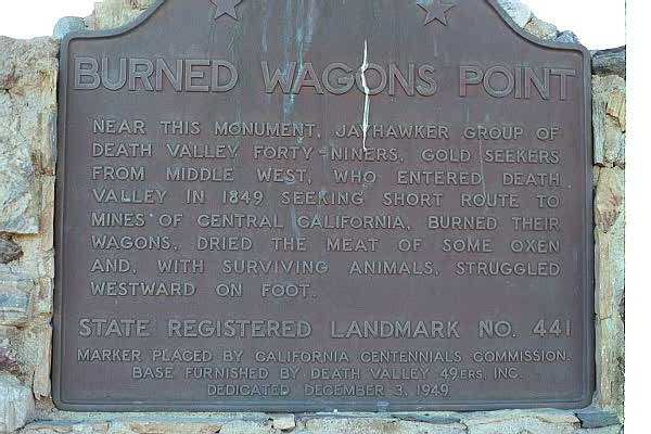
Burned Wagons Point Monument

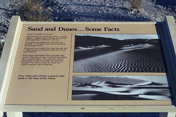
Death Valley Sand Dunes Display

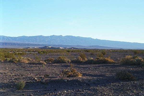
Sand dunes in the distance

The road to the dunes

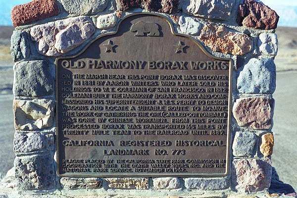
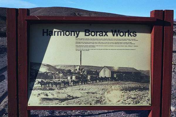
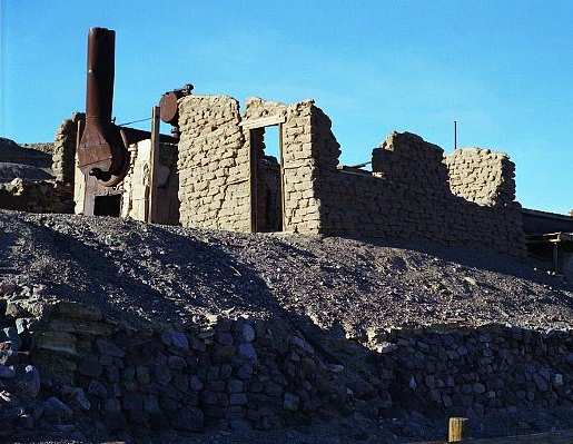
Harmony Borax Works exhibit entrance

The road to the Borax Works

Display panel with info
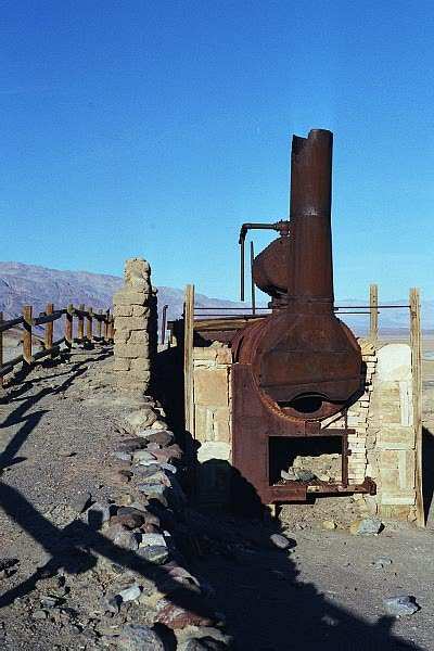
An old furnace

c08.jpg (30660 bytes)

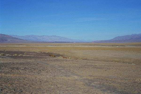
Looking North from Harmony

c10.jpg (40593 bytes)

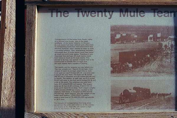
Another descriptive panel

c11.jpg (45384 bytes)

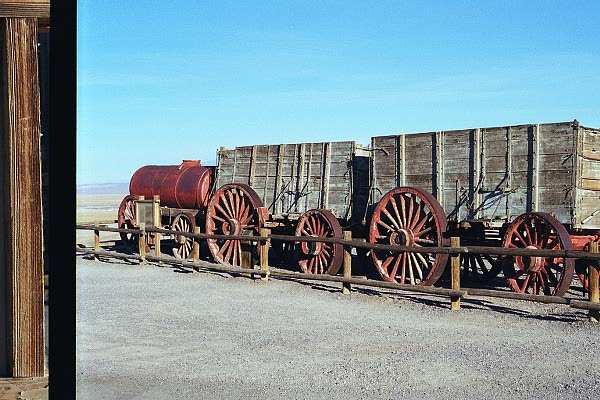
Wagon used with the "Twenty Mule Team"

c12.jpg (37480 bytes)

Another view of the site

c13.jpg (40525 bytes)

My car, riding low, with Harmony in the background

c14.jpg (45854 bytes)

View of the hills to the east of Harmony

c15.jpg (34105 bytes)

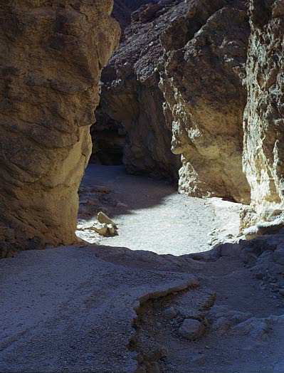
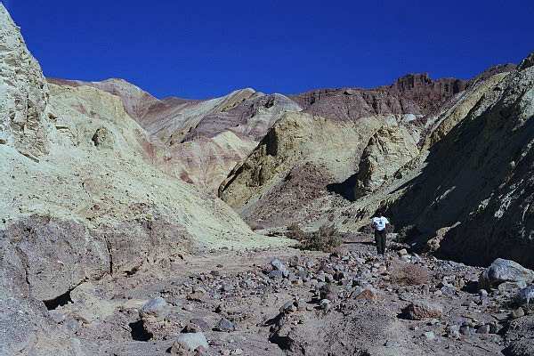
Golden Canyon, during my tour

c16.jpg (57515 bytes)

Golden Canyon

c17.jpg (37833 bytes)

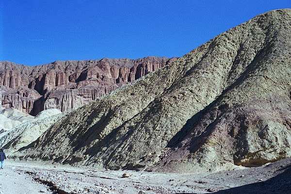
Golden Canyon, along what used to be a paved road!

c18.jpg (52049 bytes)

Golden Canyon

c19.jpg (64079 bytes)

Golden Canyon with a red rock background

c20.jpg (59973 bytes)

One more of Golden Canyon

c21.jpg (35837 bytes)

Looking South-Southwest towards the lowest land point in the western hemisphere, -282'

c22.jpg (31861 bytes)

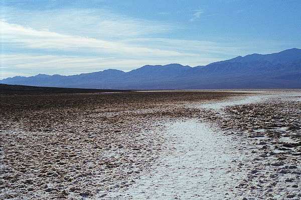
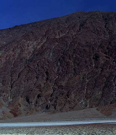
The salt lake Badwater, the salt flat contaning the lowest point.

c23.jpg (52897 bytes)

Trail on the salt flat

c24.jpg (65732 bytes)

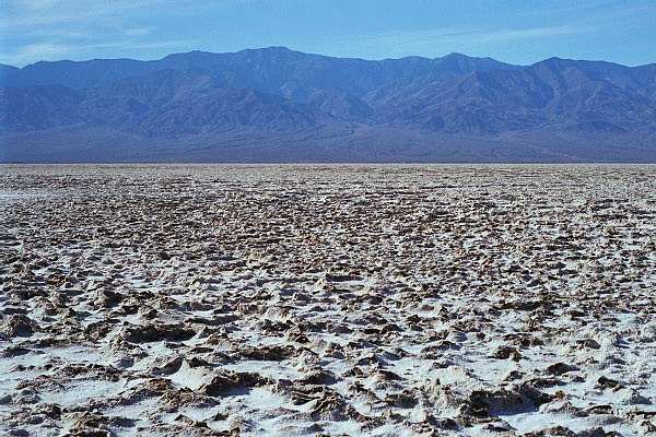
Looking at the salt covered ground at the lowest point.

c25.jpg (30014 bytes)

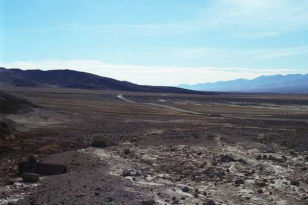
Looking East towards the parking area

d01.jpg (38542 bytes)

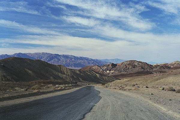
Route 190 North, the road to the Artist's Palette area

d02.jpg (59145 bytes)

Rock wall along the road

d03.jpg (32493 bytes)

Continuing North towards the Artist's Palette

d04.jpg (55356 bytes)

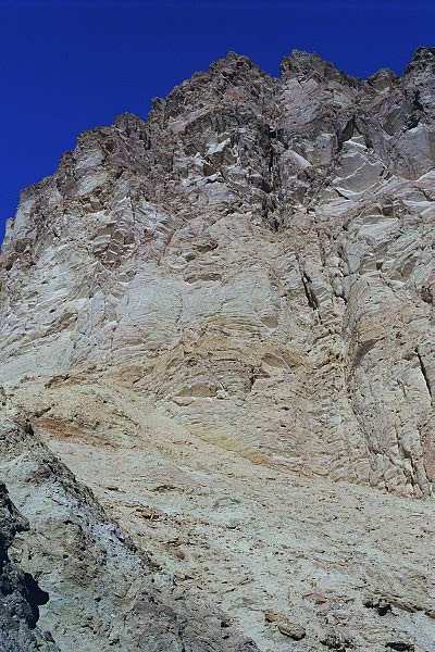
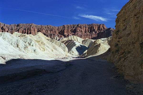
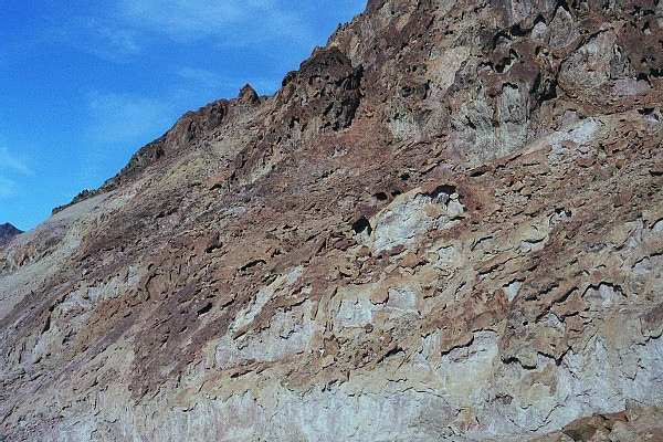
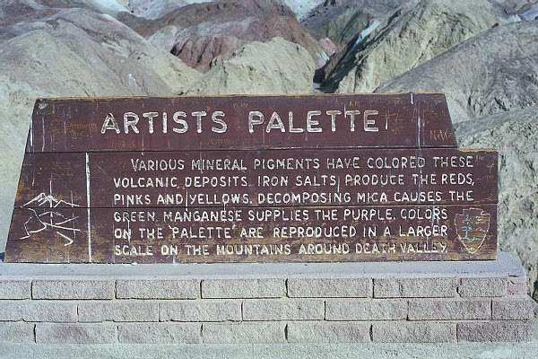
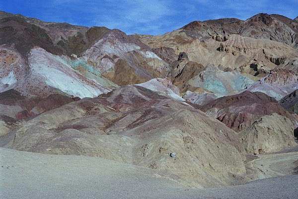
Entrance to the Artist's Palette, with some incredibly beautiful and colorful rock formations.
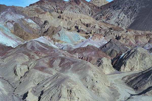
d05.jpg (41392 bytes)

Spectacular colors!

d06.jpg (38495 bytes)

A dry riverbed at the base of the hills.
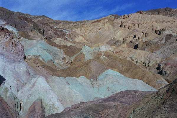
d07.jpg (52509 bytes)

Another view

d08.jpg (40837 bytes)

You can hike through the area and see the colors up close!

d09.jpg (52363 bytes)

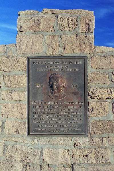
Padre Crowley Point Monument

d10.jpg (36180 bytes)

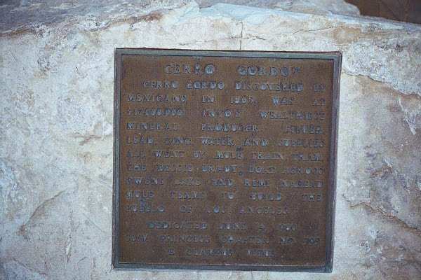
A memorial plaque designating the wealthiest mineral mine in Inyo County, along Route 190 West, on my return to Lone Pine.

d11.jpg (30723 bytes)

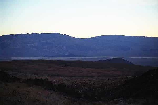
A view of the mine in the distance

d12.jpg (27637 bytes)

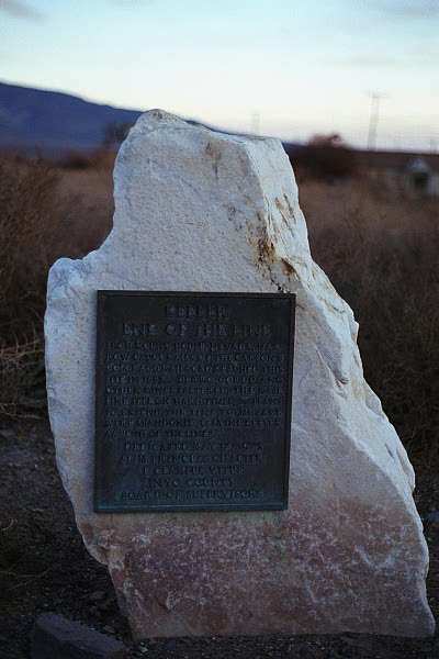
Marker indicating the end of the line for a narrow gauge railway that went through Owens Valley.

This page accessed  times since January 1, 2001.

Page created by: igorn@igorn.com


Copyright © 2001 Igor N. Nikishin

All Rights Reserved

Pictures may be used with permission.