Saturday, November 10, 2001
Hello from Grants Pass, Oregon!
Start time: 0730
Start odometer: 24578
Weather: Beautiful sunrise, mostly
clear skies, great driving and hiking weather. Temperature 26 degrees
F., up to a max of 70.
Spent the majority of the day at
Crater Lake National Monument. The weather was very cooperative, and the
scenery was stunning. Stopped this evening in Grants Pass to position
myself for a visit to Oregon Caves National Monument tomorrow. Grants Pass
is another Oregon community surrounded by a multitude of recreational
opportunities. Also, the Rogue River flows through the town, providing
water sport options in town.
I had another wonderful sunrise this
morning, and the drive to the north entrance of Crater Lake National Park
was nice. Once in the park, the views become more amazing. Though
the entrance road was open, the Ranger Station was not. A board posted
park information, indicating that all roads but the East Rim Road were
open. I decided to drive along the east rim as far as possible, until
stopped by a gate. No gates or chains were present at where I might expect
them, so I continued to drive. There were some snowy and icy spots, and
small rock falls had to be avoided. But the views were great, and the
sounds of the wind through the trees was soothing. It was also very
peaceful, and I did not see another car on the road. This kind of
concerned me, and rightfully so. When I finally got to the end of the East
Rim Road, where it meets with the West Rim Road. I found my locked gate!
This is not the first time this has happened to me! I pulled to the side
of the road and began walking to the visitor center, which was not far
away. As I walked, I noticed a Ranger vehicle approaching the gate, so I
met with him and he opened the gate for my exit. Ranger Ken was very
helpful and courteous, and his only concerns were that the gate at the north end
was not closed, and how severe were the rock falls on the road. He headed
north to close the gate and "sweep" the East Rim Road of any other
adventurers driving the closed road.
Click on picture for larger image,
hit back button to return to this page.
|
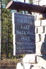
The winterized entrance sign to
Crater!
|
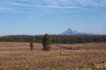
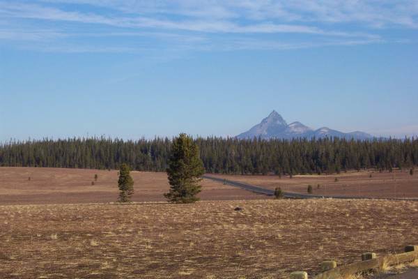
Pumice desert, from remains of
Mount Mazama, the mountain that collapsed to form Crater Lake.
|
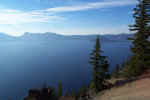
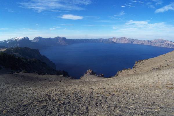
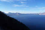
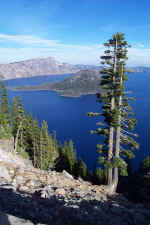
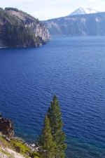
My first view of Crater
Lake! Spectacular!
|
|
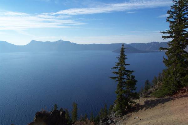
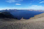
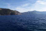
Continuing around the east rim of
the crater.
|
Beautiful views in all
directions.
|
I drove to a turnoff that had
this descriptive panel and the views in the following pictures.
|
|
My wide angle lens shows another magnificent
view!
|

Taking time out from my drive.
|

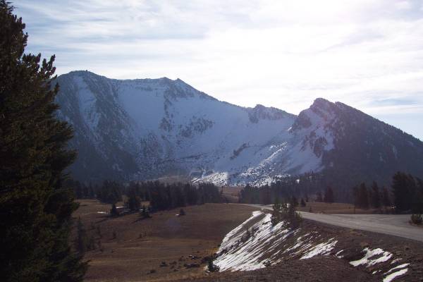
At 8926 feet, Mount Scott is to
the east of Crater Lake.
|
|
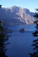
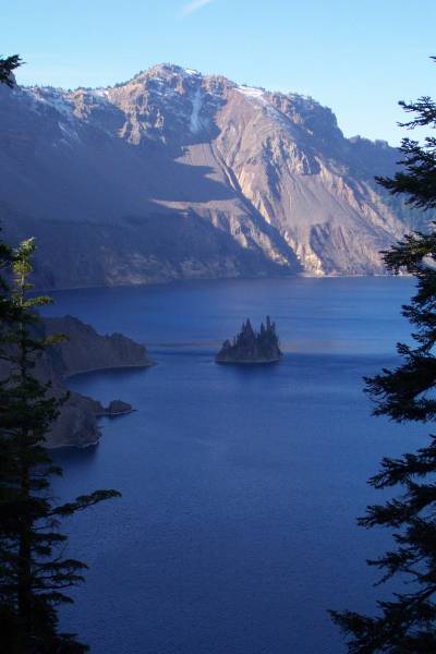
The cluster of dark, jagged rocks
is known as the Phantom Ship.
|
|
|
After getting through the gate, I drove to the
Visitor Center. I did my usual routine of talking with the Rangers, then
seeing the video of the park. A post office was also in the building, and
I spoke with Joe Harris working there. He was very informative, and had
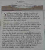
some very interesting pictures of snow scenes. The center gets an average
of over 44 feet of snow a year, but in 1998, received 56 feet! One winter
in the 1980s, they had a snow pack of 21 feet! Joe mentioned the location
of the park weather station behind the administrative building, which was next
door. I took a walk there to see their 21 foot tall snow measuring stick!
I continued my drive north on the West Rim Road,
stopping at many of the overlooks to see the beautiful lake!
|
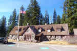
The Crater Lake National Park
Visitor Center. In winter, the snow pack often reaches to upper story
windows. Normally, they should already have nine inches of snow on the
ground for this date.
|
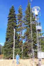
This is the weather station
located behind the administrative building. I am standing next to the
pole used to measure the snow pack. It is twenty-one feet tall!
|
Discovery Point, near where John
Wesley Hillman first saw Crater Lake in 1853.
|
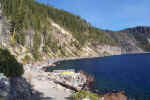
When I got to the intersection of the East Rim Road,
I decided to drive that road to the point where it should have been closed this
morning. This is the location of the Cleetwood Cove Trail that leads to
the shore of the lake. The trail is only a mile long, but the elevation
change is 700 feet. It was a great hike, and the water felt good and
cool!
After the hike, I drove back to the south entrance.
|
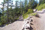
This is the entrance to the East
Rim Road, now closed! Not the way I found it this morning!
|
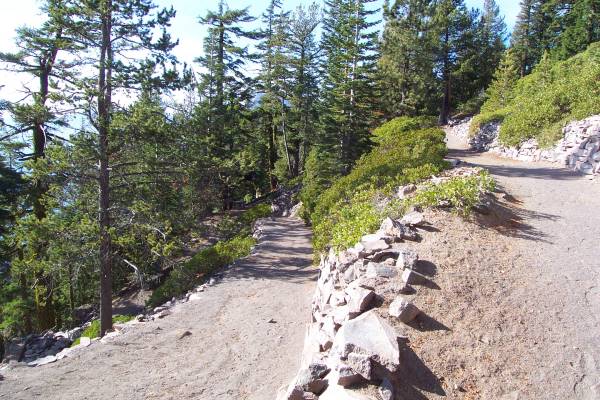
These are some of the switchbacks
along the Cleetwood Cove Trail, the only trail to the lakeshore. It
usually closes in early October, so I was fortunate to have access.
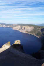
|

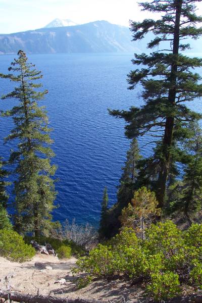
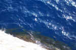
Approaching the lake, the water
colors are becoming more brilliant!
|
|
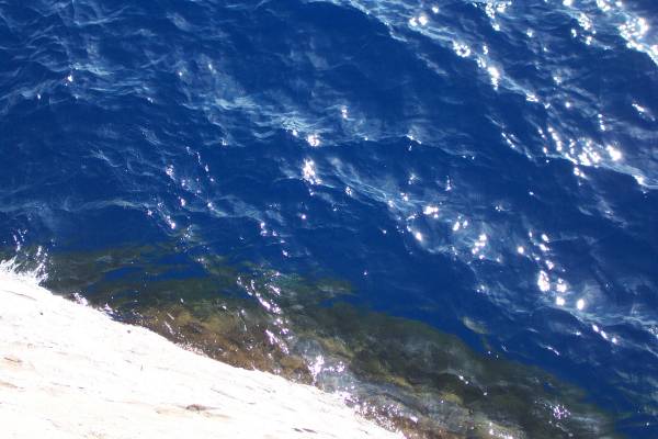
A beautiful shade of blue at this
section of the lake.
|
A boat dock at the base of the
trail. Interpretive boat tours are available during the summer season.
|
A view from the boat dock.
|
|
Heading back up the trail.
|
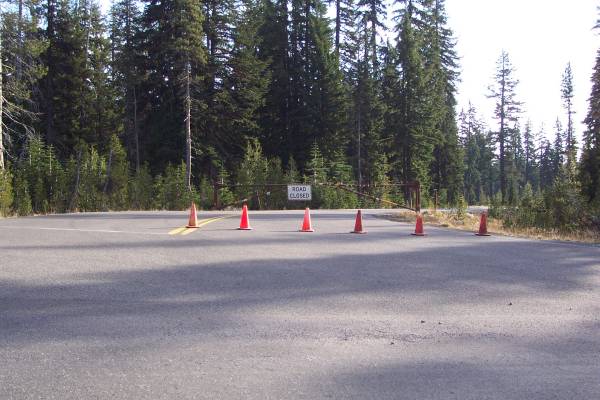
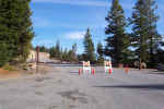
This is the closed gate at the
south end of the East Rim Road. This is where I had to park and walk
to find a Ranger to let me out!
|
|
My drive out of the park was on Oregon Route 62, and
this too was a nice drive. They must get a lot of snow, since the poles
used to mark the edge of the road were at least twenty feet tall! The road
also runs by several Forest Service recreation areas. I stopped for two
short hikes, as seen in the pictures below. I also stopped on a bridge
over two very large water pipes. They had many leaks, as the picture
indicates.
|
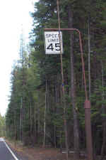
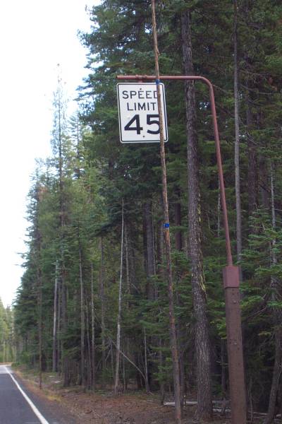
All signs on this section of road
were elevated as this one to allow viewing during the high snow pack!
|
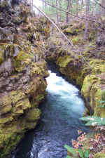
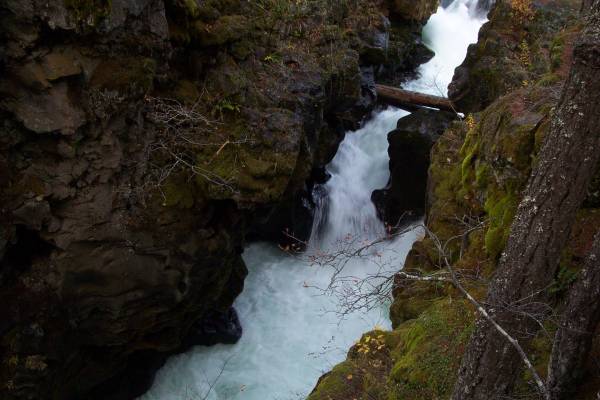
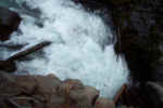
A view of Rogue Gorge.
|

The Rogue River passing trough
the narrowest portion of the gorge.
|
|
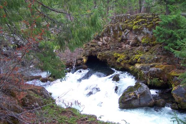
At Natural Bridge, though hard to
see, this is where the river water enters the cave...
|
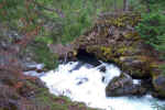
...And exits here, approximately
150 feet downstream.
|
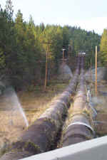
The leaking water pipes.
|
I may finally get to Oregon Caves in the morning. The monument is said to
be open all year except winter holidays. Afterwards, I will head to
California, and the Redwoods National Park or Lava Beds National Park. Not
sure which one I will go to first. Thank you for visiting!
Routes traveled today: Oregon 97 - Or 138 - Crater Lake Park Roads - Or 62 -
Or 234 - Or 99 - US 199
Lodging: Knights' Inn Motel

This page
accessed  times.
Page
created by: igorn@igorn.com
Copyright
© 2001 Igor N. Nikishin
All
Rights Reserved
Pictures
may be used with permission.