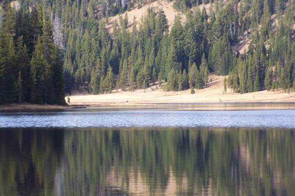
The west view from Pilot Butte.
Looking southwest, my motel from last night is circled in red.
Start time: 0730
Start odometer: 24440
Weather: Mostly clear skies allowing for a beautiful sunrise. Temperature 34 degrees F., up to a max of 59.
I did not get very far south today (nothing new,) but learned more and see some spectacular sights. After a museum visit and several hikes, I stopped in La Pine. The town supports varied outdoor recreational opportunities with its access to the Cascades and the many lakes that dot the region. And tonight, the high school was doing the stage production of It's a Wonderful Life, one of my favorite movies. Since I had never seen the stage version, I decided to see it. Very interesting adaptation!
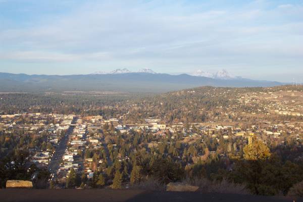
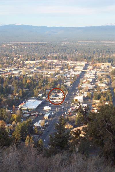
I started my day with a drive down the road from the motel in Bend to Pilot Butte, a hill that provides a beautiful 360 degree view of the area.
Click on picture for larger image, hit back button to return to this page.
|
The west view from Pilot Butte. |
Looking southwest, my motel from last night is circled in red. |
|
I decided to return to the High Desert Museum this morning, but since it did not open until 0900, I drove back into the Newberry National Volcanic Monument and hiked the Benham Falls Trail. It was a nice walk to take this morning.
|
Descriptive panel near the start of the Benham Falls Trail.
|
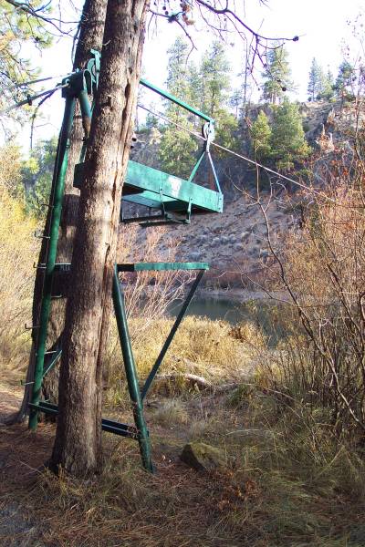
The cableway and basket described in previous panel. |
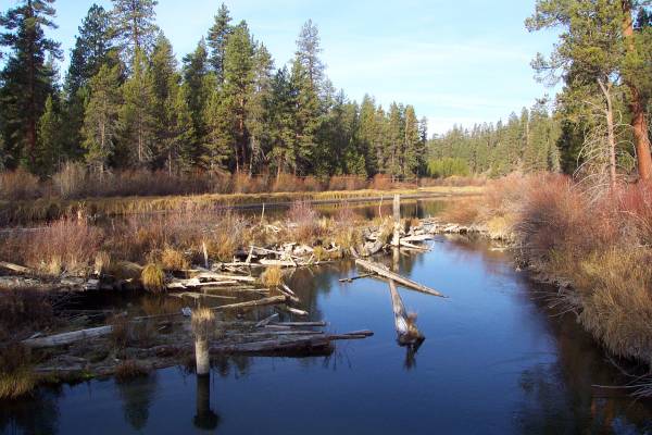
A pretty portion of the Deschutes River. |
|
Benham Falls. |
Another view of the falls with extended exposure. |
|
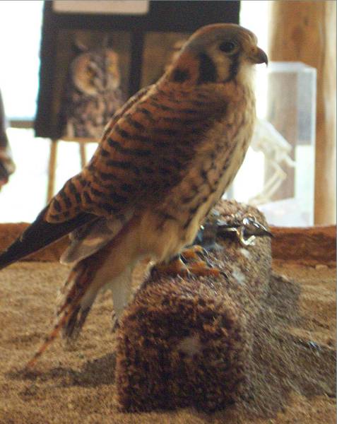
It was 0900 when I returned to the parking area. I drove back to the High Desert Museum and began to explore areas I was unable to visit yesterday. This is a great facility with outstanding displays and very informative exhibits. Throughout the facility, the staff was very knowledgeable and helpful. During the day, talks are scheduled at several areas of the museum. I went to the Birds of Prey exhibit to hear Sherry describe some very interesting facts. We had a great conversation afterwards about the exhibit, travel (she had been to Alaska) and other aspects of life. She had also lived in the East Bay, so we were able to compare notes since we both left the area.
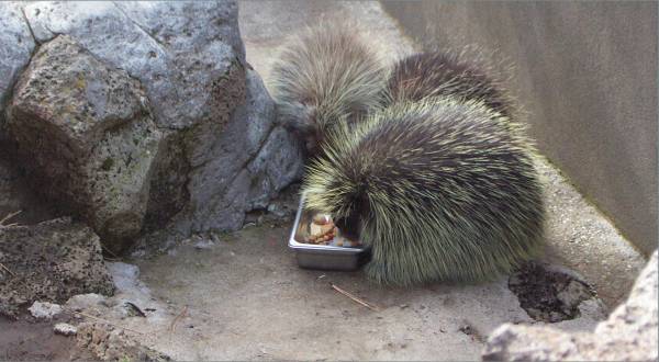
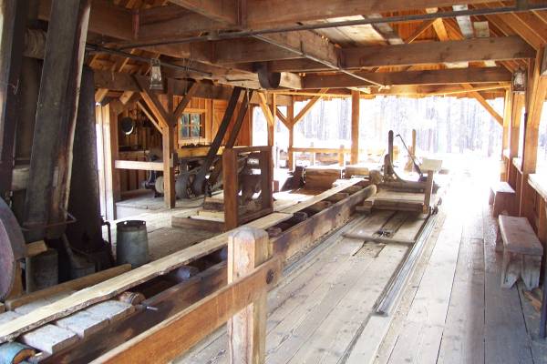
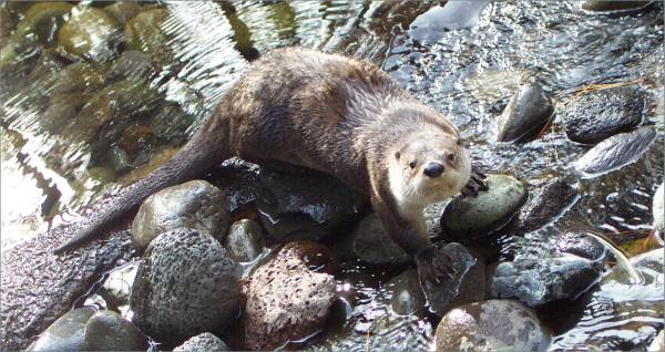
The museum had many features of the high desert, and took you through an interesting timeline of history. Outside, they had a pioneer homestead and an old sawmill on display. Upon revisiting some of the displays I saw yesterday, the porcupines were eating, and the river otter was having fun swimming around her environment.
|
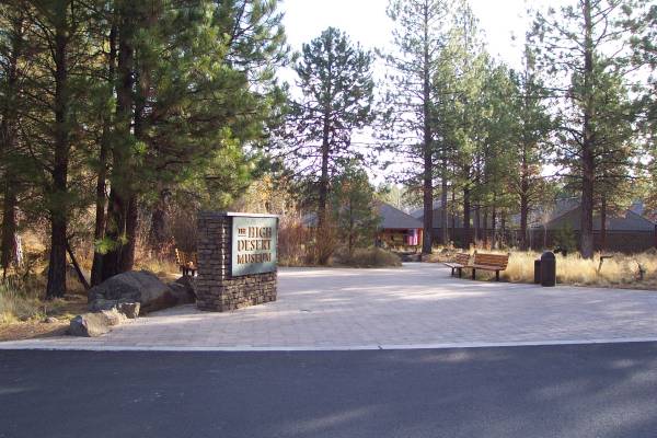
Entrance to the High Desert Museum. |
Sherry had a kestrel on display. |
Feeding time for the porcupines. |
|
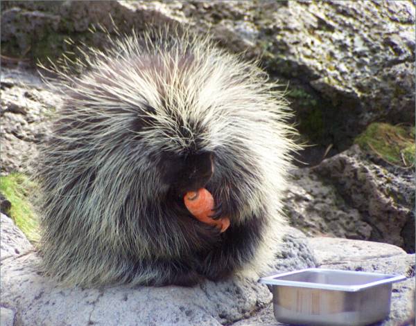
Enjoying a carrot. |
Log cabin at the settler's area. |
An old working sawmill. |
|
The river otter was up and watching me this morning! |
|
|
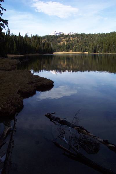
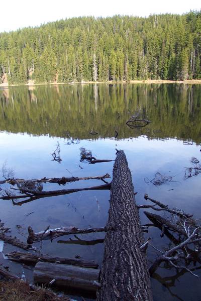
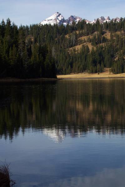
During our conversation, Sherry suggested a side trip to Mt. Bachelor and Todd Lake, mentioning the beauty of the locale. She was absolutely correct, as it was so quiet, peaceful, pretty, and serene. This was a great place to stop and take in the splendor.
|
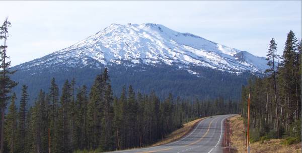
At 9065 feet, Mt. Bachelor is easily seen while driving along this road. |
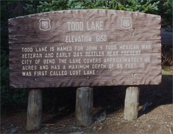
Information on Todd Lake. |
As Sherry described, this is a very peaceful and beautiful place. |
|
Another view of the lake. |
The reflective characteristics of the lake provided beautiful scenes. |
The little dot on the far shore is an elk feeding. |
|
A close up of Broken Top Mountain at 9175 feet. |
One more view of Broken Top. |
|
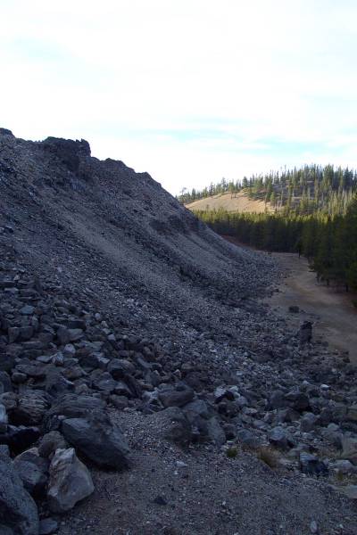
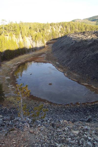
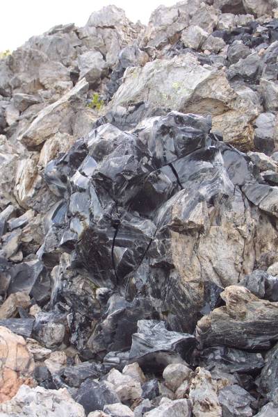
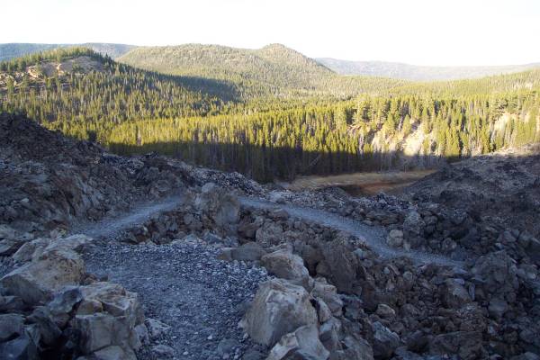
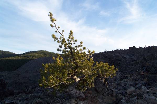
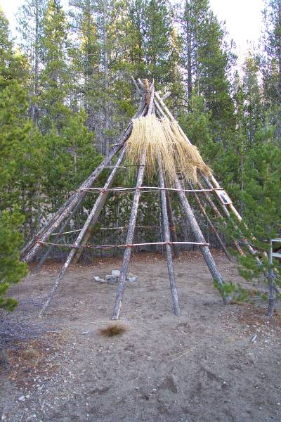
My final visit for the day was to the south section of Newberry Newberry Volcanic Monument and visit a large obsidian flow. I took a very interesting interpretive trail along the lava flow. Near the parking area was a structure built like a Teepee. A flyer on the frame indicated that in this area, an archeological dig located the oldest known structures in the country. I will try to find a link to the article for future reference.
|
The edge of the lava flow. |
A lake along side of the flow. |
A large piece of obsidian. |
|
A view of the trail through the flow. |
A lone tree, though dwarfed, growing at this spot. |
A model of the oldest "home" in the U. S. |
Tomorrow I will be visiting Crater National Park, and possibly a visit to Oregon Caves National Park. But as you know, with the way I travel, I could change these plans! Thank you for taking time to look at this page.
Routes traveled today: Oregon 97 - FS 46 - FS 45 - FS 40 - Or 97
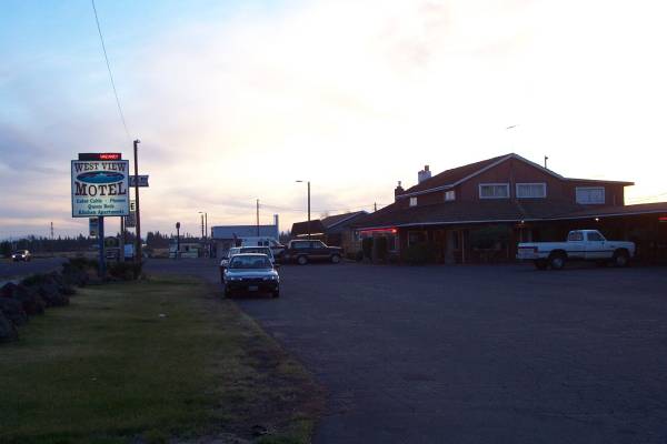
Lodging: West View Motel -

This page
accessed
times.
Page created by: igorn@igorn.com
Copyright © 2001 Igor N. Nikishin
All Rights Reserved
Pictures may be used with permission.