Tuesday, November 6, 2001
Hello from Tillamook, Oregon!
Start time: 0700
Start odometer: 23794
Weather: Cloudy with fog this
morning, clearing as the day continued, then rain! Temperature 41 degrees
F.
Did not see the sunrise, but the sun
came out later in the morning. It was an interesting day of seeing the
pacific coast, with a few stops to visit coastal cities and learn more about the
Lewis and Clark expedition. I had planned to continue south beyond
Tillamook, but saw the Air Museum, and that took me past sunset. I would
have stayed past closing time (1700) if I could! Tillamook used to harbor
many blimps at the local Naval Air Station.
I am still enjoying driving the
"Blue Highways" (a book by William "Least Heat" Moon)
because I get to see many things that small towns have to offer. Local
history can be very interesting and enlightening, and many times it correlates
to national historical events. It may even be something like the metal
sculptures in Raymond, Washington. I will need to research what they are
about later! The small town museums have so much to offer, too.
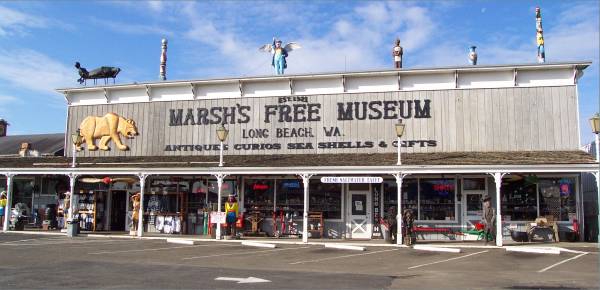
Marsh's Free Museum in Long Beach, Washington is a perfect example. Many
displays of unique and unusual items are throughout the building, numerous which
would not be found (or considered as museum pieces) anywhere else. I enjoy
these very much. Also, many of the towns display "The World's
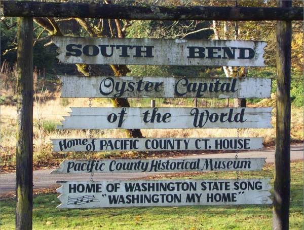
Largest" or "Smallest," or in the case of South Bend, Washington,
calling themselves "The Oyster Capitol of the World!"
Click on picture for larger image,
hit back button to return to this page.
|
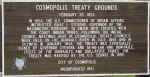
A historic marker in Cosmopolis,
Washington
|
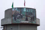
Painting on tank behind marker.
|
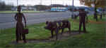
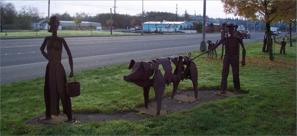
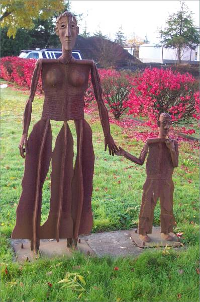
As I was driving through Raymond,
I noticed interesting metal sculptures throughout the town.
|
|
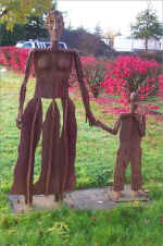
More sculptures.
|
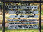
South Bend, Washington...Oyster
capitol of the world?
|
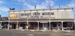
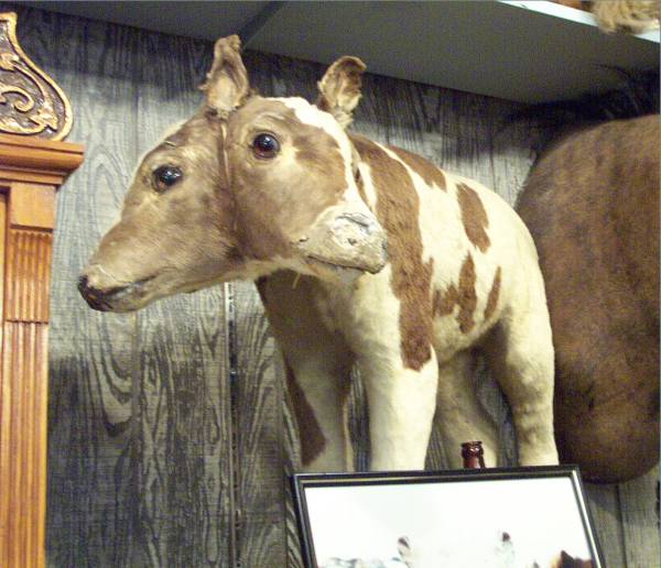
My visit to long beach began at
Marsh's Free Museum, which is also a souvenir store.
|
|
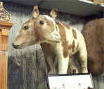
A two headed animal!
|
This is the half-alligator,
half-man being named Jake!
|
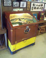
An old baseball game.
|
|
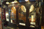
While this looked like a piano on
the outside, it also contained several instruments inside.
|
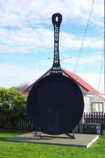
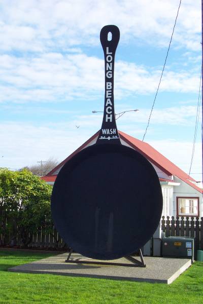
The world's largest frying pan.
|
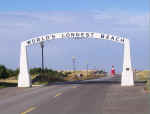
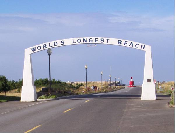
Access to Long Beach, Washington.
|
|
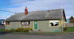
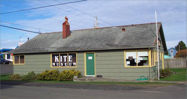
The kite museum, unfortunately
closed today.
|
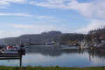
The wharf area at Cape Disappointment.
|
|
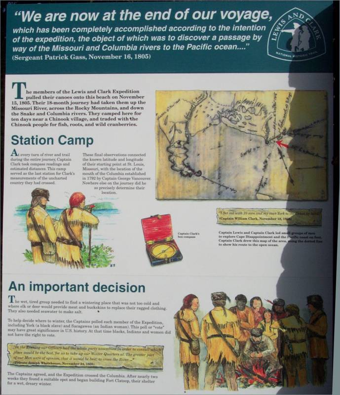
Continuing my drive south, a historical roadside
stop was located just before the bridge to Oregon. This is where
Washington claims was the final point of The Lewis and Clark expedition.
As you will see later, a display in a fort in Oregon claims the final spot of
the journey! More research for me!
|
Roadside historical stop
explained this as the location where Lewis and Clark completed there long
journey.
|
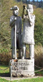
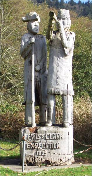
Carving of the explorers at the
historical site.
|

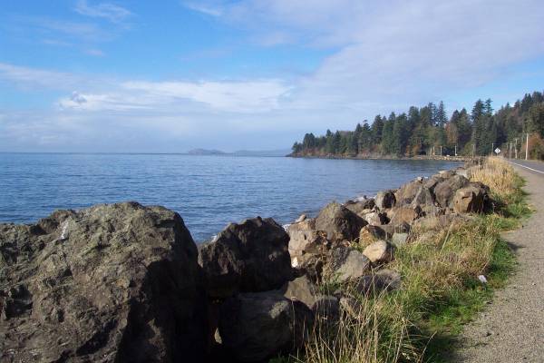
The waterfront across the road
from the roadside stop.
|
|
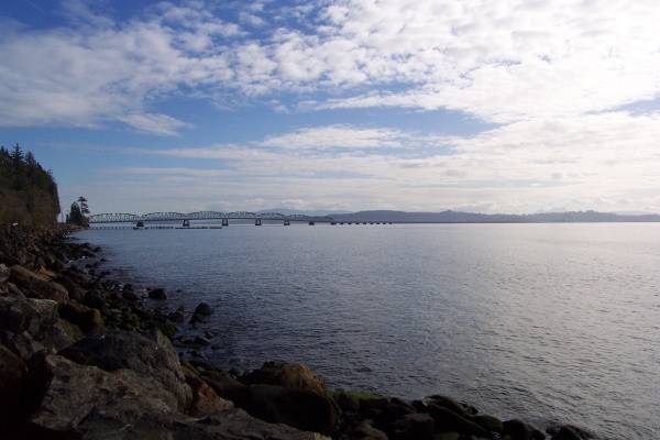
Looking south towards the
Columbia River, and the bridge that connects Washington and Oregon.
|
|
|
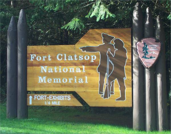
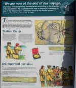
I crossed into Oregon over the Columbia River, into
Astoria. This is my first visit to Oregon, so I was anxious to see what
the state had to offer. Just south of Astoria is the Fort Clatsop National
Memorial. This is the location of the fort built by the Lewis and Clark
expedition to stay through the winter after their arrival to the Pacific
Ocean. Of interest to me was the models and maps showing their journey,
and I was able to see where my journey matched theirs! There were several
references to the previous winter, when they built Fort Mandan. I was able
to visit that fort several months ago.
|

Entrance to Fort Clatsop.
|
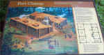
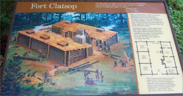
Diagram of the fort.
|
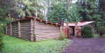
Exterior view towards the main
entrance.
|
|
Interior shot of the fort.
|
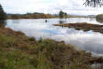
A trail leads to the
waterfront. This is believed to be the location where Lewis and Clark
originally landed and stepped ashore.
|
Canoes on display near the
landing.
|
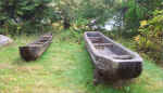
|
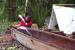
Canoe building is displayed, and
all canoes constructed are required to be usable.
|
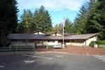
The Fort Clatsop Visitor Center.
|
|
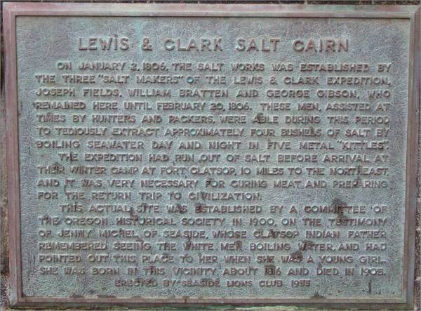
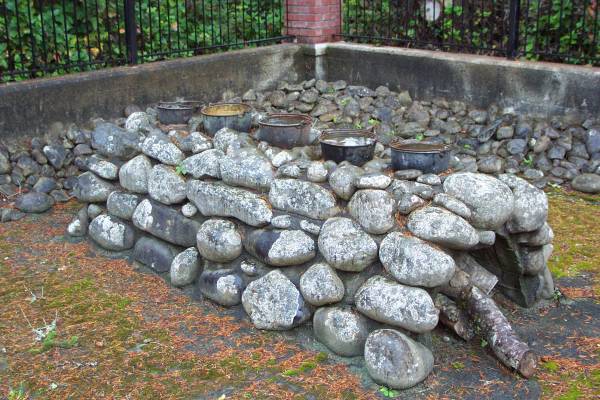
In Seaside Oregon, I found this historical site
where the salt works used by the expedition were located.
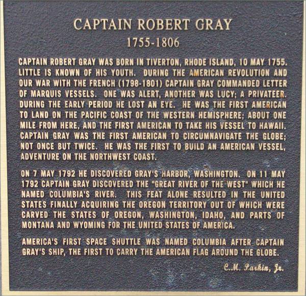
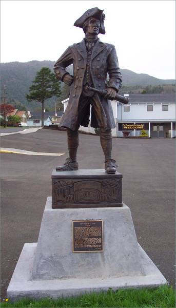
As stated before, there is ample opportunity to
learn history, as the statue and plaque of Captain Robert Gray demonstrates.
|
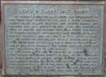
Panel describing the salt works.
|
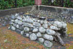
The salt works used by the
expedition.
|
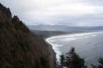
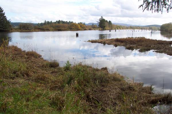
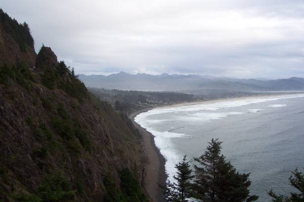
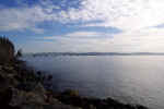
A view of the pacific
coast.
|
|
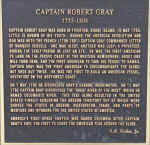
The story of Captain Robert Gray.
|
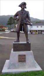
Statue of Captain Gray.
|
|
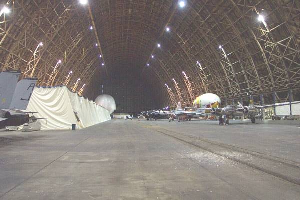
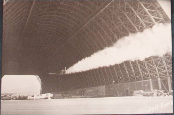
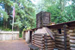
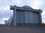
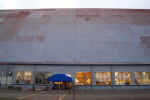
Just south of Tillamook is the Tillamook
Air Museum. You cannot miss it, as it is located in a blimp hangar
with extremely large letters on the side of the building! (Pictures of the
building side will be on tomorrow's page.) They have some great displays,
and many of the aircraft can still be flown. They also discuss the history
of blimps and the hangar.
|
The original entrance to the
blimp hangar.
|
The entrance to the museum.
|
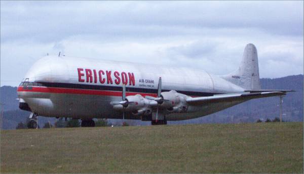
An interesting aircraft located
along the road to the museum.
|
|

One of the first two planes to
land at the North Pole.
|

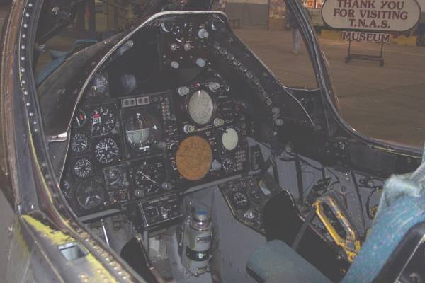
An F-14 fighter.
|
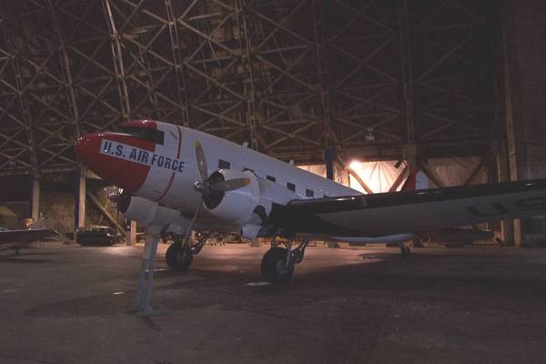
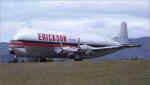
An old C-47.
|
|
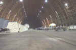
This hangar was HUGE! Years
ago, basketball hoops were hung on both ends of the hangar above the doors
at about 120 feet up! It was an interesting sight!
|
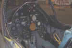
Inside the cockpit of the F-14.
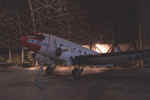
|
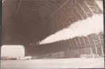
From a postcard, as a demonstration, an airplane was flown through the
hangar!
|
Tomorrow I head further south, and will be taking a left turn to head towards
several parks in the interior of Oregon. Thank you for visiting!
Routes traveled today: Wa 115 - Wa 109 - US 101 (Some side roads along the
coast)
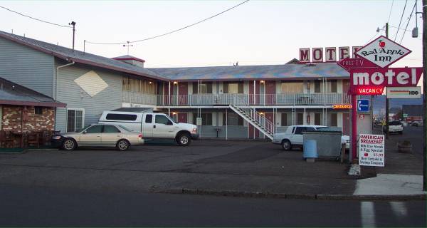
Lodging: Red Apple Inn -


This page
accessed  times.
Page
created by: igorn@igorn.com
Copyright
© 2001 Igor N. Nikishin
All
Rights Reserved
Pictures
may be used with permission.