Saturday, November 3, 2001

Hello from Shelton, Washington!

Start time: 0745

Start odometer: 23138

Weather: Cloudy and fog at the start near the Route 5 corridor, but clearing skies near the park, temperature 50 degrees F.


As you can see, I did not get to Neah Bay today!  But I did have a very interesting day at the Mount St. Helens National Volcanic Monument!  Stopping at several of the visitor centers, I also learned much about the mountain and the May 1980 eruption.  My stop tonight is in Shelton, another town thriving on the outdoor activity market here in northwest Washington with the Olympic mountain range nearby.


As stated before, I spent some time viewing, reading, and hiking about Mount St. Helens.  When first approaching the visitor center near Silver Lake, I was concerned with the fog that seemed persistent since I left my motel.  As I continued east towards the park entrance, the skies cleared and I had some extraordinary views!


After finishing my tour of the park, I headed north and west through some interesting towns, until reaching Shelton.  Along the way, I was able to see many beautiful views, and colors are still bright in many areas.


As I sit here preparing the page, I am watching a news report about tremors under the lava dome on Mount St. Helens!  Here is the web report:

From http://www.KING5.com

The U.S. Geological Survey reports that more than 200 small earthquakes have been recorded at Mount St. Helens within the past 24 hours. Geologists said quakes are common at Mount St. Helens, but such a swarm has not been recorded since 1998.

The earthquakes are occurring at shallow depths - less than 1.5 mile - mostly in or under the north flank of the lava dome. The cause of the earthquakes is uncertain, but geologists speculate ground-water levels with the recent autumn rainfall may have caused slippage or fractures in or below the lava dome and crater floor.

 
Geologists say the earthquakes increases the chance of small landslides and debris flows in the crater, which could affect areas several miles north of the crater. Geologists say there is also an increased chance of small steam explosions which could hurl rocks a few hundred meters.

Officials at the Gifford Pinchot National Forest are asking hikers and campers in the area to remain on alert for possible debris flows. Loud rumbling noises may indicate that a debris flow is approaching, at which point people are advised to get away from streams and on to higher ground.

Geologists are continuing to monitor the situation closely and will issue additional information if conditions change.


At this point, it is best to tell the story with pictures!

Click on picture for larger image, hit back button to return to this page.

110301.jpg (31157 bytes)

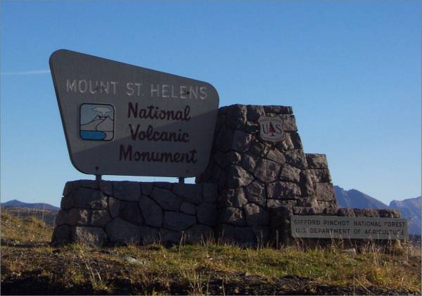
Entrance to the monument.

110302.jpg (26518 bytes)

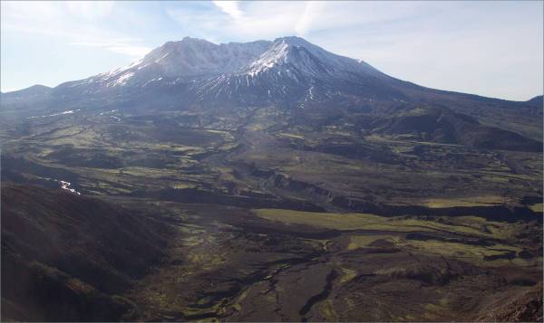
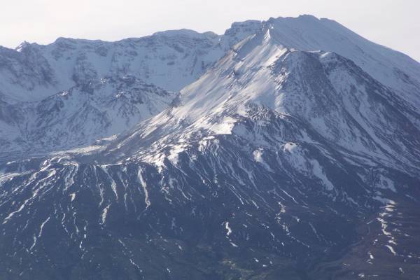
Mount St. Helens, north view.

110303.jpg (49124 bytes)

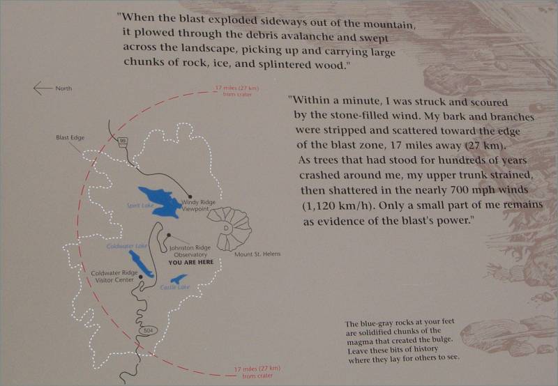
Panel describing the blast.

110304.jpg (37466 bytes)

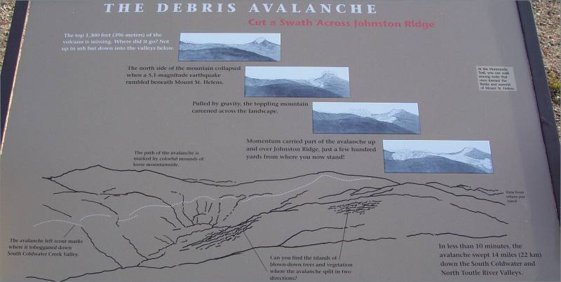
Debris avalanche information.

110305.jpg (24676 bytes)

Close look at the crater, with the lava dome visible in the middle.

110306.jpg (27131 bytes)

Looking east, the peak of Mount Adams is visible in the distance.

110307.jpg (69611 bytes)

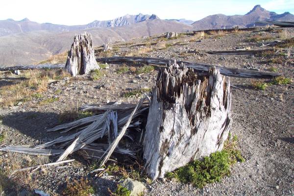
Trees were broken apart by the lateral blast!

110308.jpg (38304 bytes)

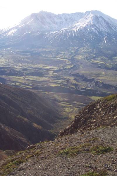
Johnston Ridge, visible in the foreground, had water and mud flow over it during the eruption.

110309.jpg (40775 bytes)

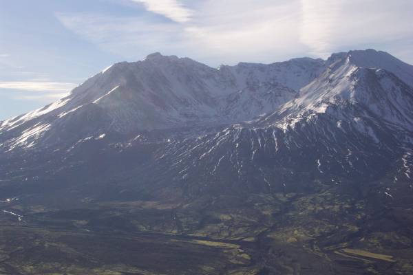
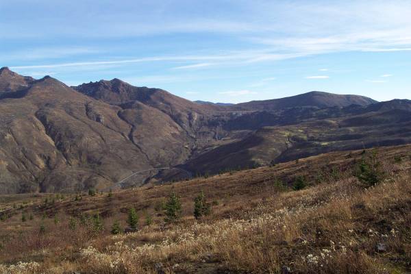
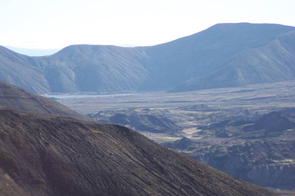
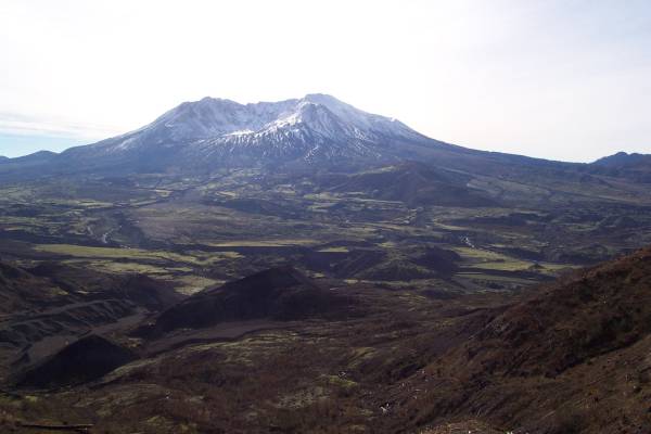
Another look at the mountain and valley where the landslide settled.

110310.jpg (35485 bytes)

Lava dome clearly visible in the top center of the picture.

110311.jpg (34035 bytes)

This view is slightly right of the previous one, showing the dome, as well as the west peak.

110312.jpg (31196 bytes)

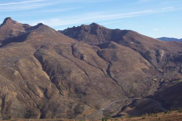
Looking northwest from the Johnston Ridge area, the access road can bee seen running along the area cleared by the blast.

110313.jpg (38112 bytes)

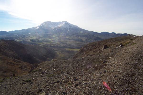
From Johnston Ridge.  It is difficult to capture in pictures the incredibly huge area affected by the eruption.

110314.jpg (21882 bytes)

This memorial is dedicated to those who lost their lives in May 1980.  Sixty people were killed by the mountain's eruption.

110315.jpg (28825 bytes)

Me in front of the mountain.  This is the area where volcanologist David Johnston was doing research in March 1980 when the volcano erupted.  He was killed, and the ridge, as well as the observatory built here, was named for him.

110316.jpg (37369 bytes)

Another view with the access road visible.

110318.jpg (29426 bytes)

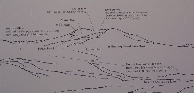
This panel describes landmarks of the mountain.  The picture in the next frame shows the items marked on this panel.

110319.jpg (25070 bytes)

See previous description.

110317.jpg (40218 bytes)

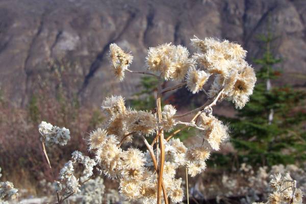
Plant life returning to the area.

110320.jpg (25173 bytes)

Spirit Lake is visible in the left center of the picture.  The ridge seen in the upper right is the location of the Windy Ridge Overlook, where I stood yesterday.

110321.jpg (21869 bytes)

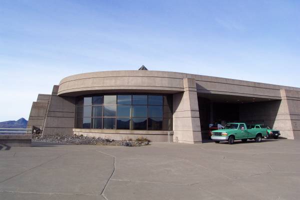
The observatory at Johnston Ridge.

110322.jpg (26340 bytes)

One final look before heading out.

110323.jpg (25875 bytes)

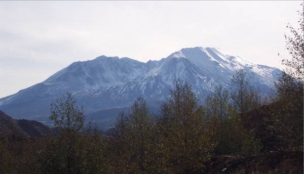
A different angle from the west.

110324.jpg (62488 bytes)

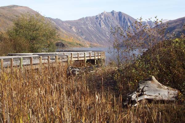
Coldwater Lake, created when the landslide block drainage in this area.

110325.jpg (32344 bytes)

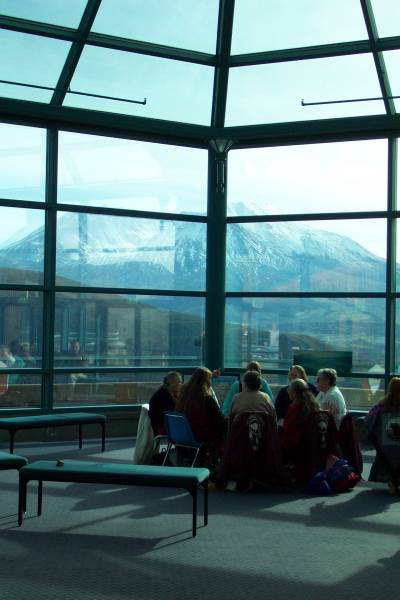
The park was celebrating Native American month.  At the Coldwater Ridge Visitor Center, a drum circle was making a presentation, with Mount St. Helens in the background.

110326.jpg (57067 bytes)

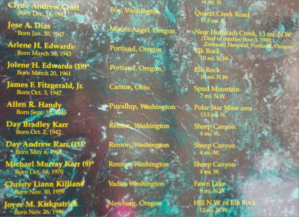
At the visitor center, a plaque listed those that died during the eruption, and where they were at the time.  I took this picture to show how they displayed the information, and also that someone from Canton Ohio, my original hometown, was listed here.

110327.jpg (38790 bytes)

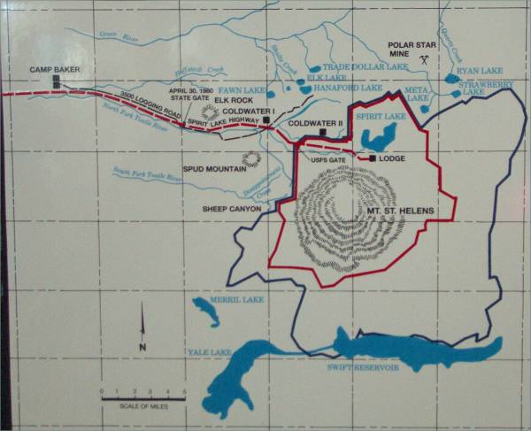
This map was included with the list in the picture to the left.  It was amazing to see the distances that the death blow was able to reach.

110328.jpg (31022 bytes)

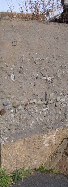
A trail at Coldwater Ridge had this display of a cut in the ground to show the layers of the soil deposits.

110329.jpg (65119 bytes)

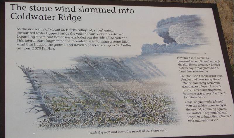
Another descriptive panel on the devastation on Coldwater Ridge.

110330.jpg (25327 bytes)

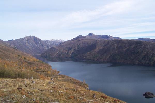
Another view of Coldwater Lake.

110331.jpg (26287 bytes)

The Coldwater Ridge Visitor Center.

110332.jpg (40148 bytes)

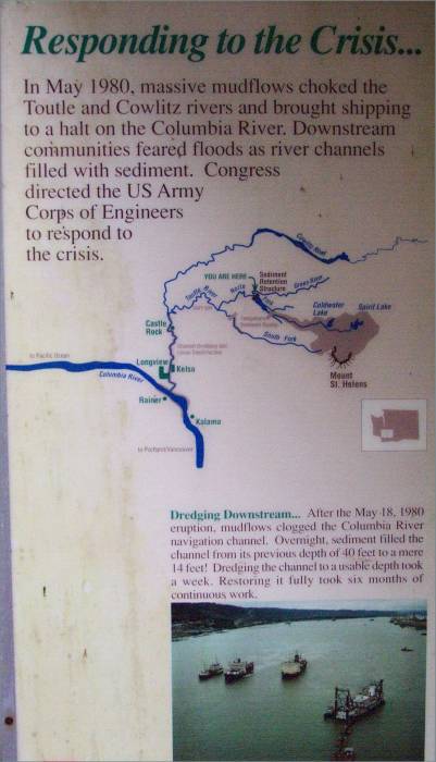
Further west, a turnoff is available to view the sediment dam.
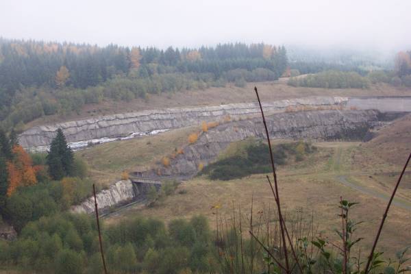
110333.jpg (29762 bytes)

 A view of the dam.

110334.jpg (41133 bytes)

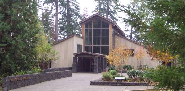
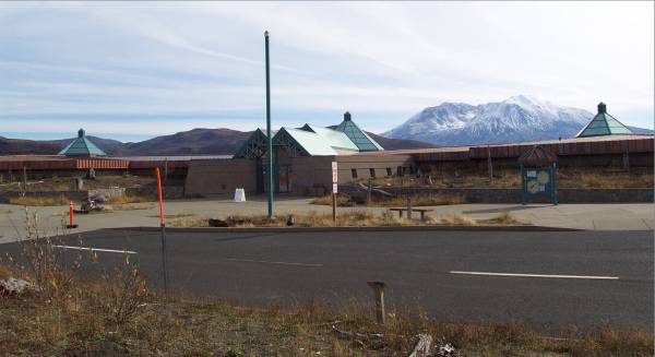
The Mount St. Helens Visitor Center.  Great displays were available here, as well as coldwater.

110335.jpg (53022 bytes)

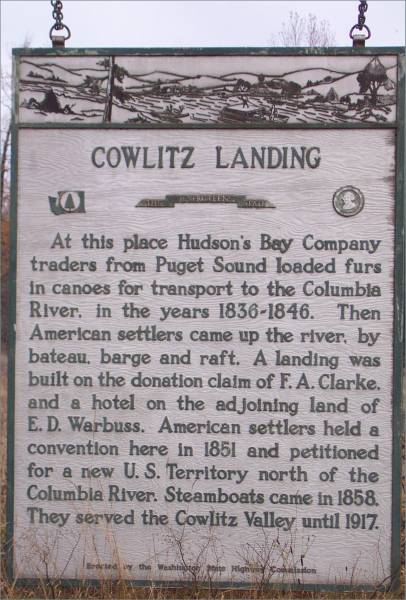
As I continued my drive towards the northwest, I passed by this area and stopped to read this informational sign.

110336.jpg (32992 bytes)

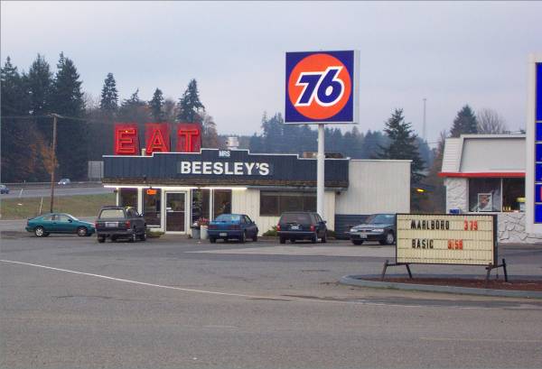
To the north of Cowlitz Landing was Mrs. Beesley's Restaurant!

110337.jpg (49121 bytes)

In Winlock, not only did this little park display the world's largest egg...

110338.jpg (39582 bytes)

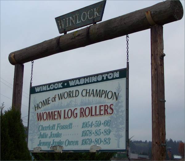
...But also informed the public about the world champion women log rollers.

110339.jpg (67123 bytes)

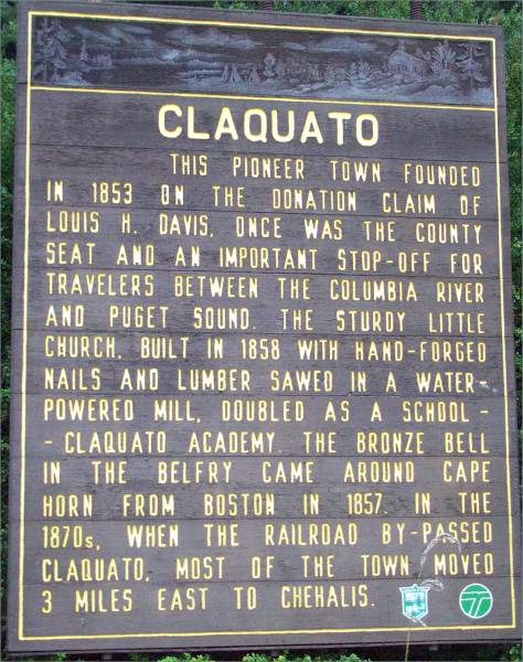
One final town descriptive panel.

I hope to reach the Pacific tomorrow, and hike near Neah Bay.  Then I head south along the coast.  Thanks for looking at the page!


Routes traveled today: US 5 - Wa 504 - Mount St. Helens Park roads - Wa 504 - US 5 - Wa 506 - Winlock-Vader Road - Wa 603 - US 5 - US 101

Lodging: Super 8 -

This page accessed  times.

Page created by: igorn@igorn.com


Copyright © 2001 Igor N. Nikishin

All Rights Reserved

Pictures may be used with permission.