Thursday, October 25, 2001
Hello from Deer Lodge, Montana!
Start time: 0745
Start odometer: 21194
Weather: Cloudy skies, with some
breaks in the clouds later in the afternoon,
temperature 23 degrees F., peaking
at 43.
I did a lot of touring today, seeing
two parks, then two museums in one facility. After the last one, it was
late in the afternoon, so I decided to stay in Deer Lodge for the evening.
This town is known as the "Museum Capitol of Southwestern Montana,"
and has a population of 6620. From an informational
web site:
"Deer Lodge earned it's name
from a thermal spring that gave off large amounts of vapor and built up a cone
almost 40 feet high. From a distance the cone and vapor resembled an Indian
lodge with smoke rising from it. Many Deer often frequented the area to feed;
thus, the name Deer Lodge."
It was a cold morning, and not much
of a sunrise due to the clouds. But even though the weather was not great,
I still had some very scenic views and interesting and historical sites to see.
At the advice of Barb and Wayne from the motel last night, I went to Bannack State Park. It is located about forty miles southeast of Wisdom,
and was an interesting drive past ranches, through a mountain pass, and through
the town of Jackson. Bannack, Montana, was the location of the first
territorial capitol of Montana. The town was the former site of gold
mining, but was abandoned in the 1960s. Several years later, there was
much interest in preserving the buildings and the history of the town.
After much work, the town became a state park. Upon entering the park, a
self-guided tour is available with a very informative pamphlet. This was a
very interesting ghost town!
Click on picture for larger image,
hit back button to return to this page.
|
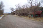
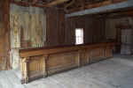
Main Street, Bannack!
|
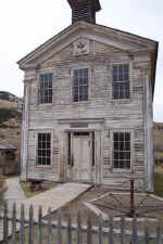
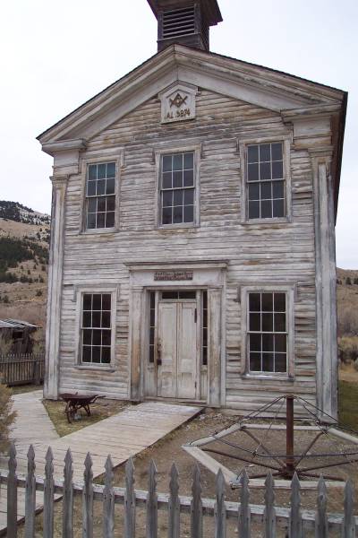
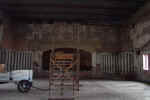
Upstairs, the Mason Hall.
Downstairs, the one room school.
|
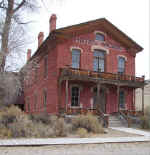
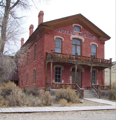
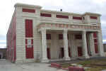
Originally the county
courthouse when Bannack was the county seat, it was later converted into a
hotel. |
|
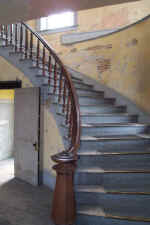
Inside Hotel Meade, the main
staircase off the side of the main lobby. |
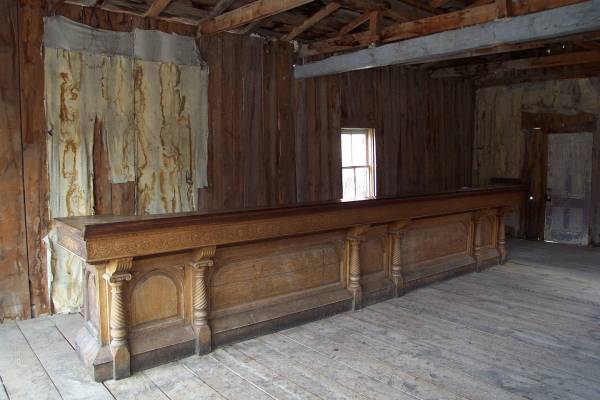
The saloon!
|
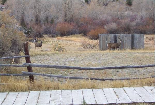
Some mule deer visiting the
park. Actually, I probably saw about twenty this morning. |
|
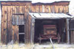
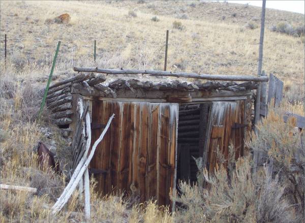
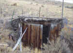
A garage and wagon. |
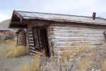
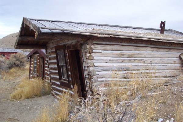
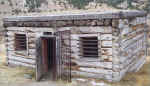
One of the miner houses!
|
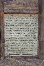
The town nearly experienced a
visit from the Nez Perce Indians.
|
|
A mine shaft that is blocked
about twenty feet beyond the entrance.
|
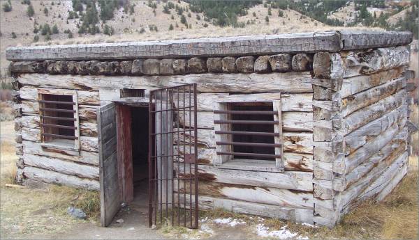
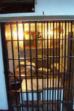
The jail built in the late 1800s.
|
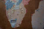
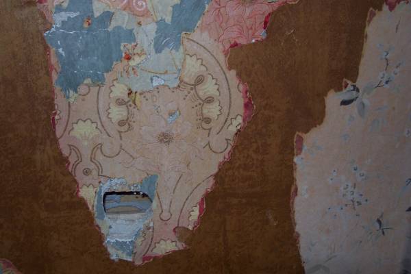
Inside one of the houses, I took
this picture of several layers of wallpaper.
|
|
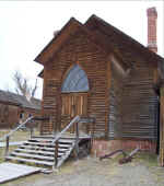
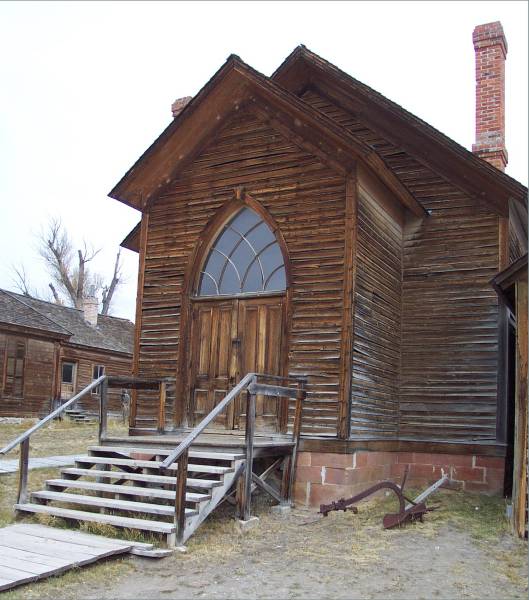
The first church built in
Bannack. |
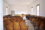
The interior of the church.
|
The hanging platform on its
side. |
After visiting the park, I drove
back towards the northwest, through Jackson and Wisdom, then to the Big Hole
National Battlefield. Along the route, I stopped for the following two
pictures.
|
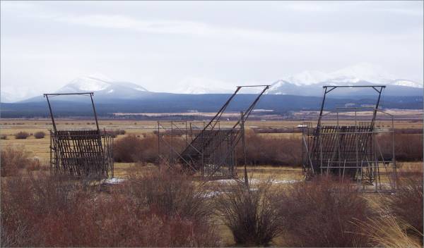
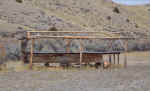
These are called Beaverslides,
and were invented in the Big Hole Valley, patented in 1910 as a Sunny
Slope Slide Stacker. This device is used to create the twenty ton
haystacks that are thirty feet tall seen throughout the valley. This
much hay is needed to feed the livestock through the long winters. |
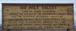
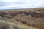
A description of the Big Hole
Valley.
|
|
Big Hole National Battlefield was my
next destination. This is one of several battle locations where the U.S.
fought the Nez Perce Indians in 1877. To save space here, please see this
site for the history of what became to be known as the Nez Perce War.
The Visitor Center has some interesting exhibits and pictures. They are
working on a new video to show visitors, and had a video that describe the Nez
Perce Indians and some of their battles, but was not specific to this
park. A very helpful and knowledgeable staff provided further information.
|
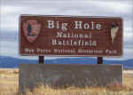
The entrance sign...
|
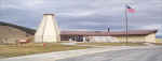
...To the Visitor Center.
|
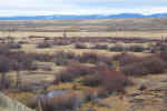
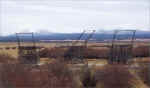
There are several trails in the
park near the siege area. This is a view of a section of the
battlefield, where the park service has set up fifty-five teepee
frames. At the actual battle, approximately eighty-three teepees
were erected. |
|
A wide angle view of the
battlefield. |
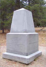
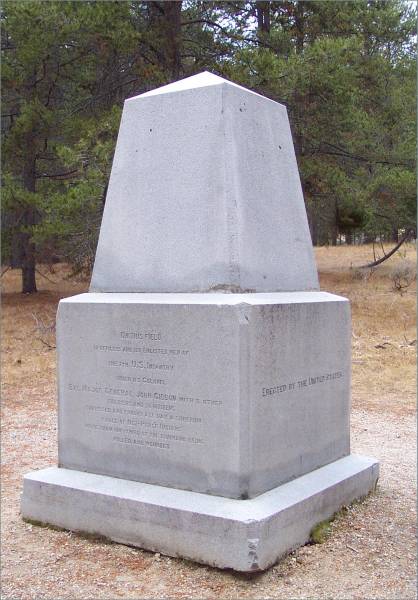
This monument was placed in
honor of the lost soldiers and volunteers.
|
|
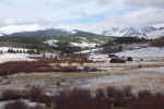
Back on the road, I drove northeast
towards Deer Lodge. I stopped a couple of times enroute, including a state
recreation area and the town of Anaconda, Montana.
|
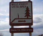
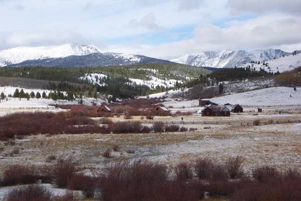
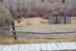
Mule Ranch Vista area. |
Mule ranch
|

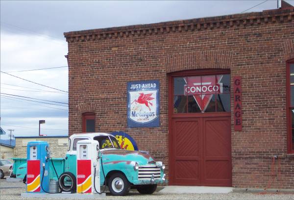
In Anaconda, I thought this was
an interesting sight!
|
|
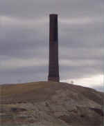
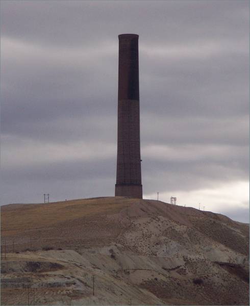
Anaconda is also known for the
"Big Stack!" According to The New Roadside America,
this was part of the Washoe Smelter Complex that shut down in the
1980's. It is over 585 feet tall, and is the largest free-standing
brick structure on earth! Plans are to save the structure for some use
in the future, but currently, according to the DEP, it leaks arsenic.
|
|
|
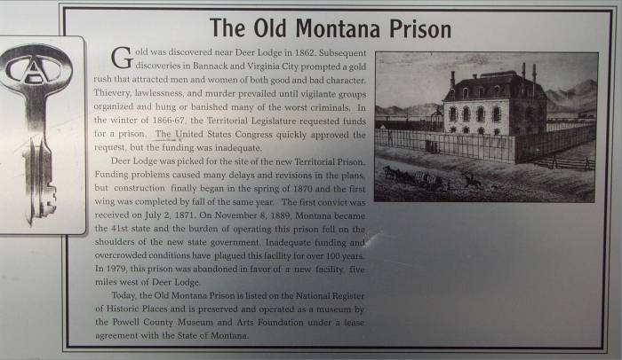
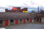
For my final stop of the day, I
arrived in Deer Lodge. This is the location of the Territorial Prison
Museum, suggested by my friend Carla, who was here during this past
summer. A self guided tour is provided with a very informative
pamphlet. It was very interesting to learn about the history of the
complex, the people involved, and the changes made over time.
|
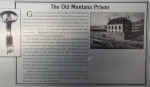
Informative sign at the
entrance. |
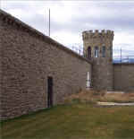
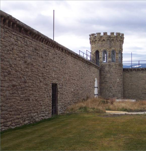
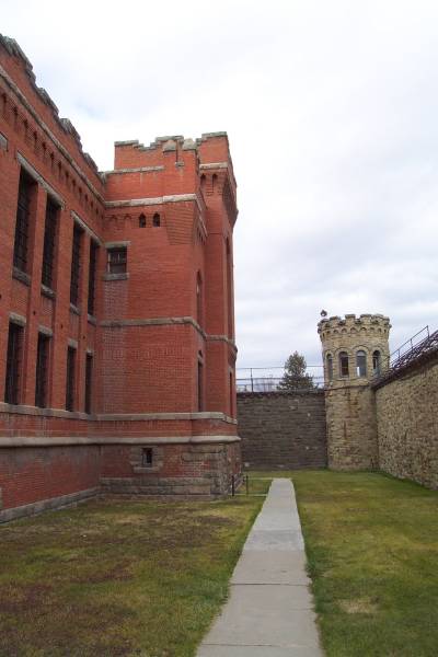
One of the corners of the
complex.
|

Looking northeast, the main
cellblock to the left.
|
|
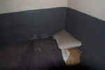
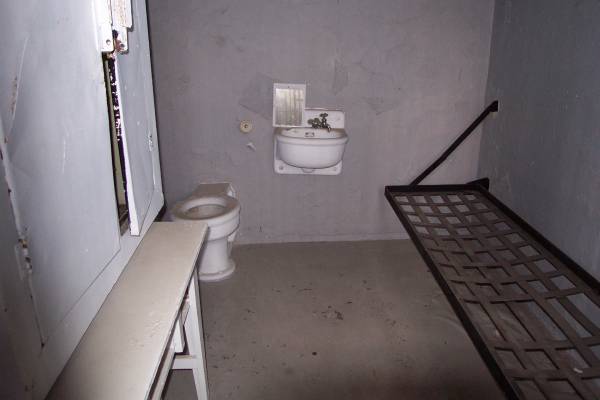
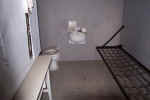
Inside one of the cells in East
Siberia, a location with cells more remote than the cellblock.
|
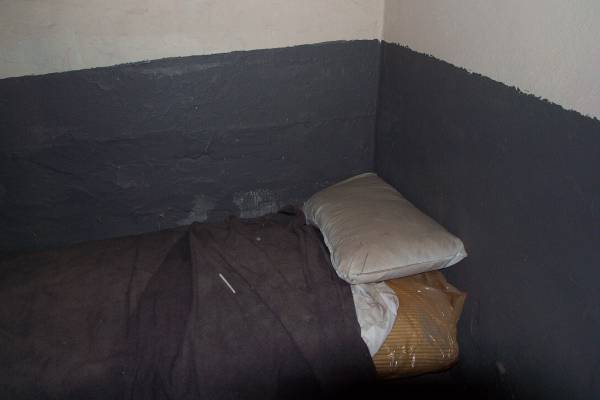
The cell of one of the lifelong prisoners.
|
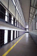
The west cellblock section.
It is four levels tall.
|
|
Inside another cell. At one point, the state added second bunks
to many of the cells, raising complaints of overcrowding. |
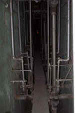
Between the sections are
pathways that provide access to plumbing and ventilation. Guards
were asked to walk these areas to listen in on the prisoner conversations.
|

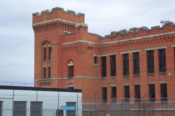
Notice the damage to bricks in
the top right window under the turrets. This is where a shell was
fired in a riot that occurred in the late 1950s. |
|
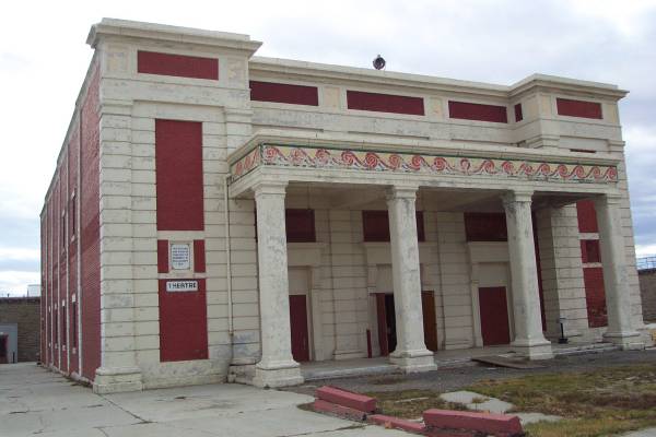
A theater was built in the
early 1900s for entertainment not only for the prisoners, but for the
townspeople in the evenings after the prisoners had been locked in for the
night. |
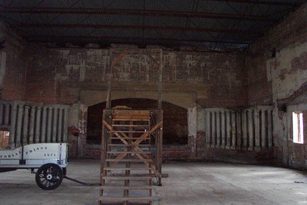
Inside the theater, where fire
had gutted the interior in the 1970s. In the picture is the gallows
used throughout this area of the state. Yes, there are thirteen
stairs leading to the top!
|

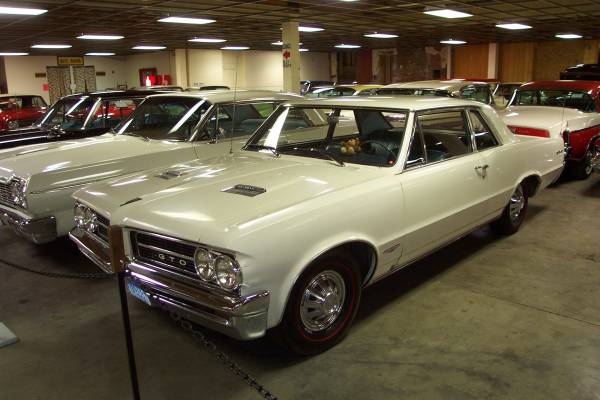
After visiting the Prison Museum,
I went to the car museum, in the same complex. This was another well
designed museum with cars from the 1900s to 1970s.
|
|
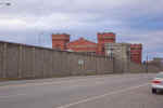
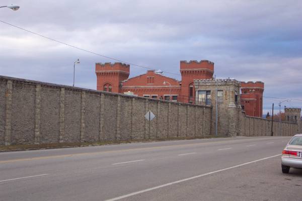
One more exterior shot of the
prison.
|
|
|
Tomorrow I head west into Idaho, to
travel along Route 12. Eventually, probably Saturday, I will be in
Washington, Thank you for stopping by!
Routes traveled today: Montana 43 - Mt 278 - Mt 43 - Mt 274 - Mt 1 - Mt 48 -
Mt 273
Lodging: Ima Scharfs Motor Inn -

This page
accessed  times.
Page
created by: igorn@igorn.com
Copyright
© 2001 Igor N. Nikishin
All
Rights Reserved
Pictures
may be used with permission.