Wednesday, October 24, 2001
Hello from Wisdom, Montana!
Start time: 0730
Start odometer: 20894
Weather: Thin overcast sky, cleared
as day progressed,
temperature 19 degrees F., peaking
at 52.
I had a good day of sightseeing and
driving, and decided to get into position to see the Big Hole National
Battlefield tomorrow. In a Fodor's guide to America's National Parks, it
was mentioned that lodging was available in this town. I stopped at the
Nez Perce Motel and met a very nice couple, Barb and Wayne Challoner, the
owners. They are originally from Wisconsin, and after a few years in
Alaska, they bought a motel and settled in Wisdom. They enjoy the peace
and lifestyle present here.
After spending time talking and
meeting some of the people here, it looks like I found another great town!
Wisdom, Montana, with a population of 120, is located in southwestern Montana in
the Big Hole Valley, Beaverhead County, at the junction of Routes 43 and
278. According to Barb and Wayne, with an altitude of 6050 feet, it can
get pretty cold here, and can snow every month of the year! In fact, they
had a real good snow in June, which help much due to the recent drought.
The town supports local ranchers, tourists, and hunters. Numerous outdoor
activities are available here. At the suggestion of the motel owners, I
had dinner at Letty's, a local bar and cafe. I had the
"special," an excellent home style pork chop dinner with fried apples,
baked potato, mushrooms, freshly made chicken noodle soup, and soda. Total
cost: $9.00 (no tax in Montana!) and it was delicious!
The day started with a partial view
of the sun as it rose above the horizon, through breaks in the overcast
sky. I drove back to the Craters of the Moon National Monument this
morning to hike some of the trails. It was a bit cool, and the wind, while
much less than yesterday, was still strong enough to enhance the chilly
temperature. I hiked several trails, including an interpretive trail, a path
up to the top of Inferno Cone to see a 360 degree view of the landscape, and out
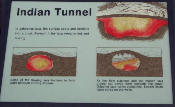
to a tunnel and several caves. As I said yesterday, this is a very unique
and unusual landscape. As with much of this trip, it was also educational.
Click on picture for larger image,
hit back button to return to this page.
|
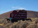
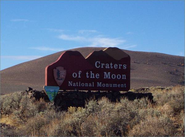
Entrance sign.
|
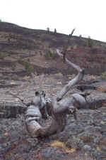
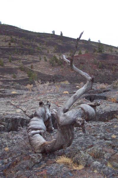
An interesting tree along the
trail.
|
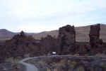
Remnants of the volcano that
broke off and traveled in the lava flows. |
|
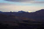
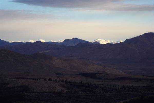
From the top of Inferno Cone,
snow capped mountains can be seen in the distance. |
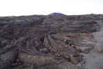
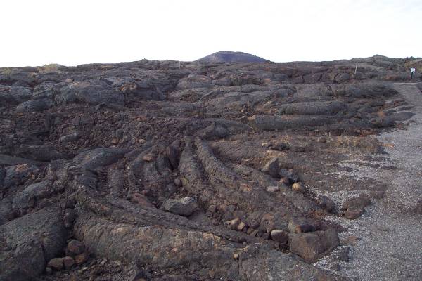
I found the lava flows had
created many remarkable shapes and forms.
|
 The
first tunnel I visited. |
|
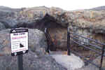
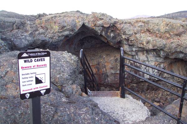
A warning sign at the entrance. |

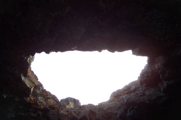
From inside looking out.
I traveled about one hundred feet inside the tunnel.
|
Two entrances were available to
travel separate directions.
|
|
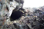
This cave was longer, but due to
some frost loosened rocks on the ceiling, there was a restriction to the
distance permitted to travel.
|
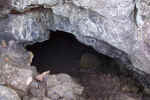
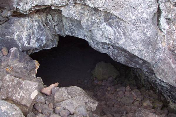
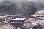
Another look at the entrance to
Beauty Cave.
|
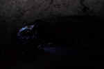
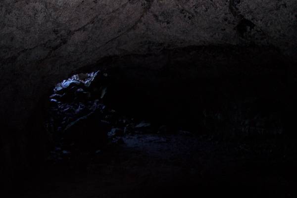
From the inside looking
out. I had my flashlight, but these caves, formed from lava tubes,
absorbed much of the light, making it difficult to see far in the cave.
|
|
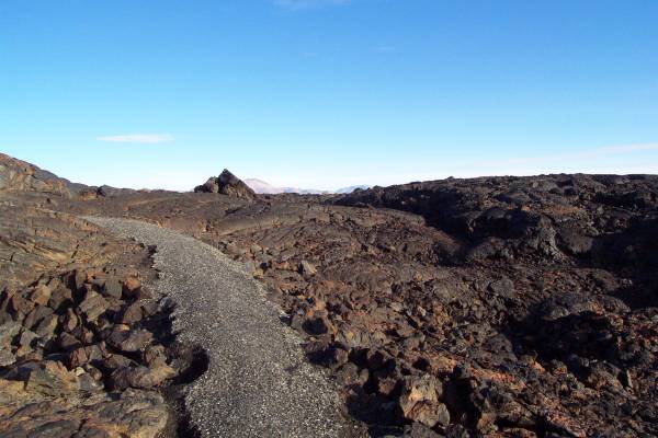
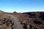 The
path through the flows. This was a similar view on several of the
paths. |
|
|
After a few hours in the park, I
returned to Arco. I was interested in following up on some of the items I
learned yesterday. But first, I washed the car! I was driving with
mud collected from my drive through the City of Rocks. I then drove to the
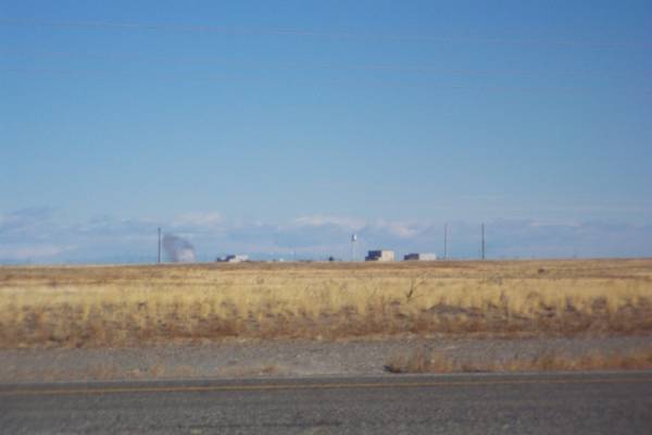
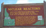
Nuclear Power Testing area southeast of town. As you look out over the
level land, you see many facilities, all belonging to The Department of Energy's
Idaho National Engineering and Environmental Laboratory. The tract of land
used is more than three quarters the of Rhode Island, and is home to more
nuclear reactors, and more different kinds of reactors, than anywhere else in
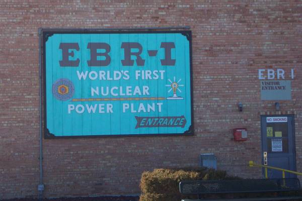
the world! In the summer, they offer tours of the first nuclear reactor to
provide power to a town (Arco.) I drove to the site and took a few
pictures, as shown below. Afterwards, I headed back to town and stopped at
the Idaho Science Center. This is the location where the town plans to set
up displays and artifacts concerning items related to the scientific discoveries
and technical highlights in which Arco was involved. This is the current
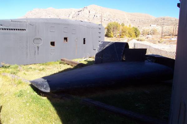
location of the "sail" of the USS Hawkbill, a nuclear submarine.
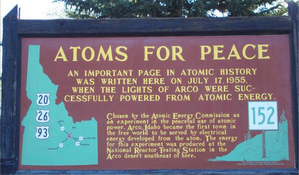
|
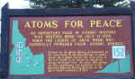
Description of Arco's place in
history. |
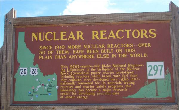
Explanation of the laboratory..
|
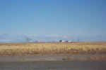
This is one of the facilities set
back from the road.
|
|
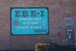
This building is now a registered historical landmark.
|
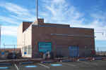
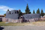
Using the parking spaces for
perspective, you can see the building is not large.
|
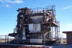
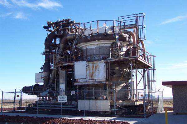
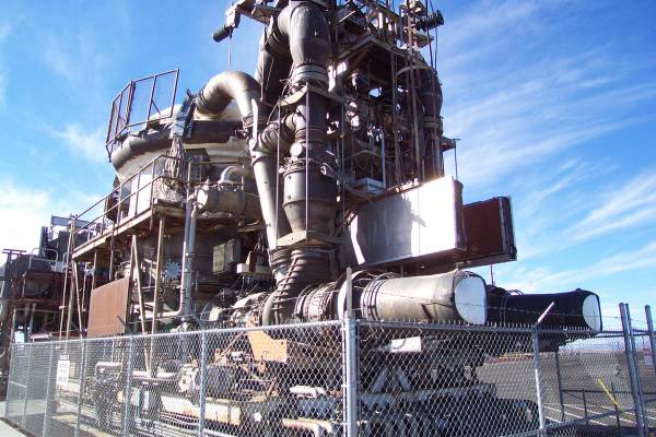
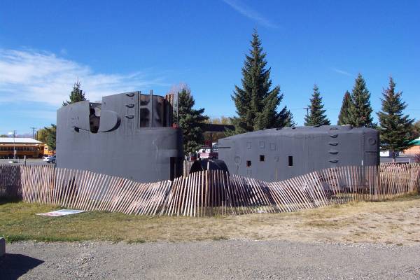
In the fifties, this organization
was given the challenge to develop a nuclear propulsion system that would
allow extended flight or travel across land/water. This is one
prototype.
|
|
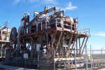
This was a second
prototype. In 1961, President Kennedy cancelled the project. It
was almost complete at that time, as they were awaiting the construction of
a runway on which to test.
|

A side view of the first
prototype. Note the thrust exhausts at the lower right of the picture
(covered with metal disks.)
|
Back in Arco, here are parts of
the "sail" of the USS Hawksbill.
|
|

Other pieces of the submarine.
|
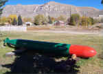
A missile, though I am unsure if
it was on the Hawksbill.
|
|
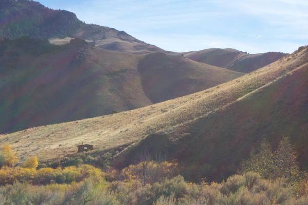
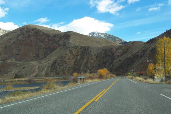
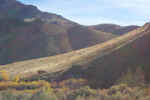
I departed Arco to the north,
following US 93. This is a very scenic drive that takes you though nice
small towns, along the Salmon River, through beautiful canyons like the Grand
View Canyon, and into the Bitterroot range. Many roadside displays are
provided along the route discussing the history of the region. At certain
elevations, the fall colors were still present on the trees, and on several
occasions, the rocks were imbedded with remarkable colors.
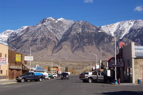
|
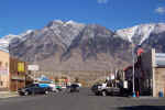
The town of Mackay with a pretty
backdrop!
|
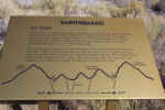
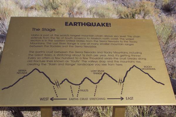
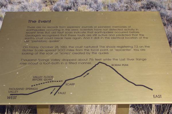
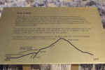
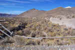
An earthquake display is just two
miles off the road. This, as well as the following two panels,
provides some information about the quake.
|
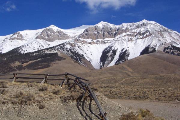
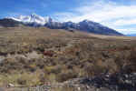
Borah Peak is the highest point
in Idaho. |
|
The results of the quake. |
In this picture, you can see
part of the scarp that extends for twenty one miles.
|
Looking the opposite direction
of the previous picture. |
|
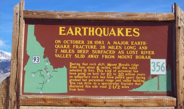
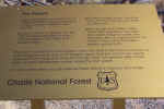
 Back
on Route 93, another panel discusses the earthquake of 1983. |
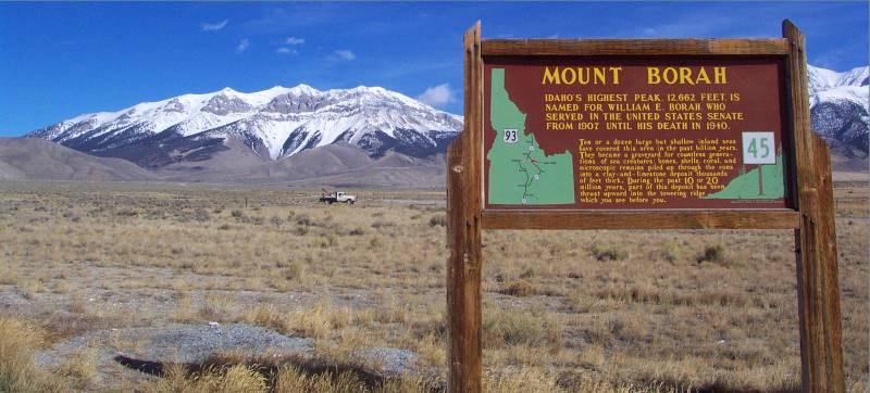
Borah Peak, from the earthquake
display area.
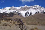
|
Borah Peak from Highway 93, with
a descriptive panel.
|
|
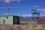
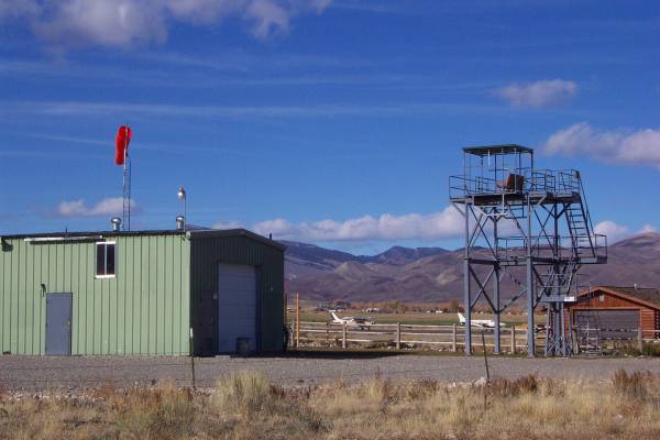
I found the Challis airport
"tower!" Or is this the observation deck? Look at the
bench seat on the top!
When leaving Challis, a sign was
draped above the road which read "We are still what America once
was."
|
A view along Route 93.
|

Another view from the road.
|
|
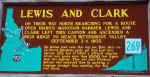
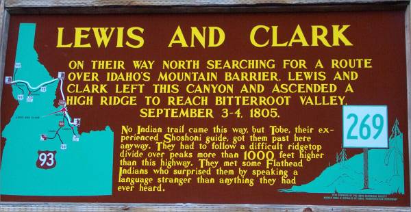
Descriptive panel along the
road. |
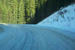
Towards the top of Lost Trail
Pass, the temperature dropped to the mid twenties, allowing the snow to
remain on the road.
|
|
Thursday morning will take me to the
Big Hole National Battlefield. It will be a good day of learning American
History. I then plan to head north towards Missoula, where I will pick up
Route 12 west. Still looking at Deer Lodge as another possible stopover
for a museum visit. Thanks for viewing the page.
Routes traveled today: US 20 - US 93 - Montana 43
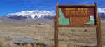
Lodging: Nez Perce Motel -


This page
accessed  times.
Page
created by: igorn@igorn.com
Copyright
© 2001 Igor N. Nikishin
All
Rights Reserved
Pictures
may be used with permission.