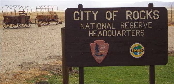
Entrance to the Visitor Center.
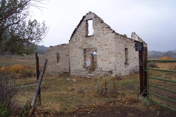
The only remaining building owned by an original homesteader.
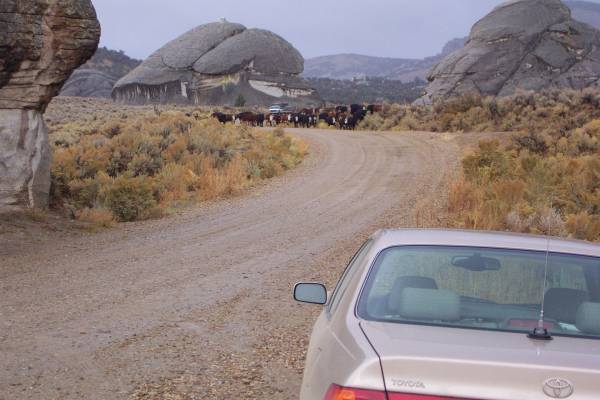
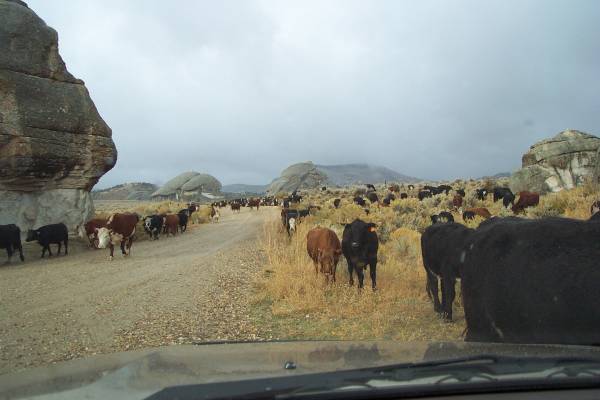
Here come the cattle!
Start time: 0830
Start odometer: 20676
Weather: Beautiful sunrise, temperature 39 degrees F., peaking at 58.
A town in southeast Idaho, Arco supports local agriculture, as well as providing tourist services for visitors to the Craters of the Moon National Monument. This is also a very friendly town, as witnessed by how people greeted me while I walked around during my short time here! This is also the location of the Idaho National Engineering Laboratory, a facility that occupies over eight hundred square miles east of town. This laboratory built experimental nuclear generating plants. I was told by the proprietor of the hotel that there is no more activity, but the test sites can be seen. I will take a look tomorrow and get pictures if possible.
Here are some other interesting facts about Arco.
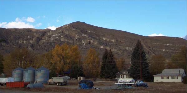
They have a mountain east of town with many flat surfaces. Since 1920, the high school students have painted their graduating year (two digit) on these rocks. I have included a picture below. Locally, there are some disputes if this should continue, and currently the students will be permitted to add their graduating year until 2019. Then they will decide what to do about the repeating years!
Historically, Arco was the first town in the world to be lit by nuclear power! In July of 1950, power was sent from an experimental nuclear plant to this town for two hours. It was mentioned the main purpose of the two hour event was to beat our competition in the USSR for the rights to say we were first!
The town is in the county of Butte, the high school being Butte High School. Interestingly for a landlocked county, the team mascot is a Pirate!
Finally, across the street from the hotel is a park with parts of a submarine that was recently decommissioned. I will try to research more about the sub..
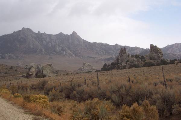
It was a cold morning, and the wind was reportedly gusting to sixty miles an hour! I also had some snow, and later, clearing to a beautiful sky. Quite an interesting variety of conditions. The drive took me to higher elevations, and I began to see some snow sticking on the vegetation. The cold and snow became more apparent at my first stop, the City of Rocks National Reserve. The California Trail went through this area, and these rocks were used as landmarks for the journey. The land in the reserve is a combination of public and private lands. Cattle often roam through the vicinity, including the road I was on this morning! The scenery is spectacular, and with the strong winds, the sound of moans was generated as the air rushed through the cracks in the rocks. While I was visiting, the temperature had dropped to 30 degrees, and as stated before, snow was sticking to the ground better here. After spending the morning in the park, I exited out the back way towards the town of Oakley, Idaho. The majority of the drive is on gravel roads, and takes you to some interesting hidden places.
Click on picture for larger image, hit back button to return to this page.
|
Entrance to the Visitor Center.
|
The only remaining building owned by an original homesteader. |
Here come the cattle! |
|
From inside the car. I spoke to the rancher driving the herd and he said there were about a couple hundred head! |
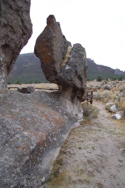
One of many interesting rock formations. |
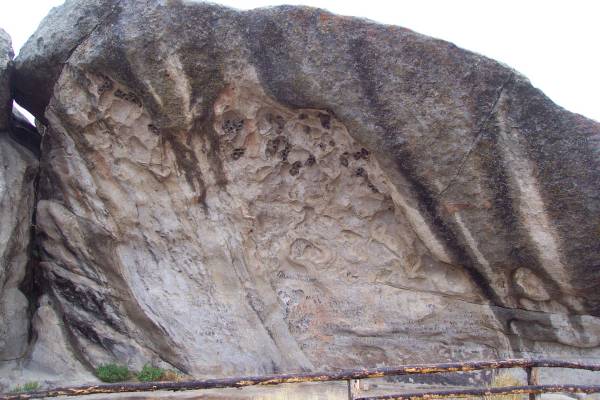
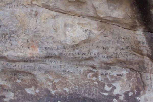
Camp Rock, where many of the people that traveled the California Trail left their names, as seen in the next picture. |
|
Camp Rock up close, with 1880 as the oldest visible date. |
An interesting plant next to Camp Rock. |
These are known as the Twin Sisters, even though one is over a hundred times older than the other! |
|
Another interesting rock. |
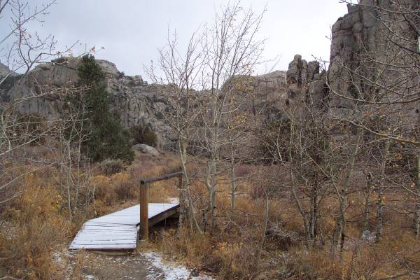
Wonderful scenery throughout the park. |
A snow covered trail bridge. |
|
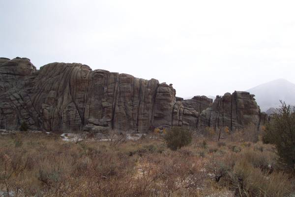
This formation is known as the Bread Loaves. |
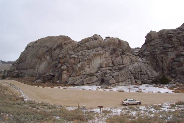
My car is in the lot below the trail I walked. There are some great camping sites available. |
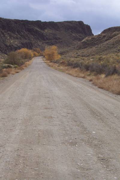
A view along the road leading out of the west side of the reserve. |
|
Another view of the road. |
As I approached Oakley, the clouds began to break. |
|
I stopped at the Oakley Post Office to send my sister and nephew post cards, and to purchase more stamps. I began talking with the postmaster, Tom Masino, who was originally from Brooklyn, New York. He previously worked for U. S. Customs, and is currently trying to change jobs from Postmaster to Immigration Officer. He may get a chance to work next summer at Chief Mountain, outside of Glacier National Park, where I passed through in August! I mentioned the wonderful views from the drive near the border. Another great conversation with someone on the road, the real way to learn about people and their towns.
|
The Oakley Post Office. |
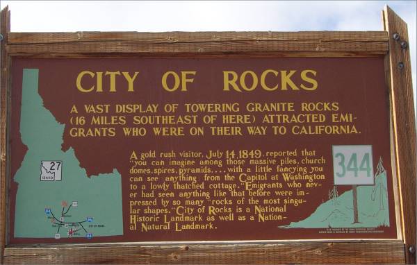
Heading north out of Oakley, this sign describes City of Rocks. |
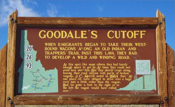
Another roadside sign. |
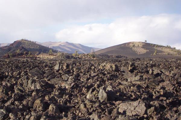
I drove the next few hours towards the north, seeing much level land with ranches, potatoes, and cattle. To the north, the Rockies began to come into view. Finally I arrived at the Craters of the Moon National Monument. The change in landscape was incredible! For many miles the view is of sagebrush and dirt, then all of a sudden, you see basalt lava flows, a moon-like landscape. It was amazing how suddenly it changed. Once at the Visitor Center, I retrieved information on the park and viewed the exhibits about the land. It was 1630 and the center was closing, so I took the park loop road to get a better view. I also took a drive through the campground, and with the surrounding lava formations, this could be an interesting place to stay. However, at 6000 feet, the temperature drops at night. Possibly another visit will allow me to camp here. The loop drive was very interesting, and I plan to return tomorrow morning to take a few trails.
|
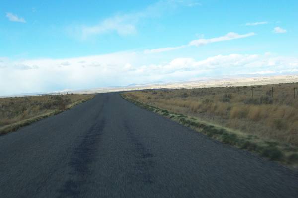
The long and non-winding road! |
Craters of the Moon National Monument Visitor Center. |
One of many interesting formations. |
|
Another view from the road. |
I took one short trail up a formation, then took this picture showing another trail. |
Another view of the "lunar" landscape. |
|
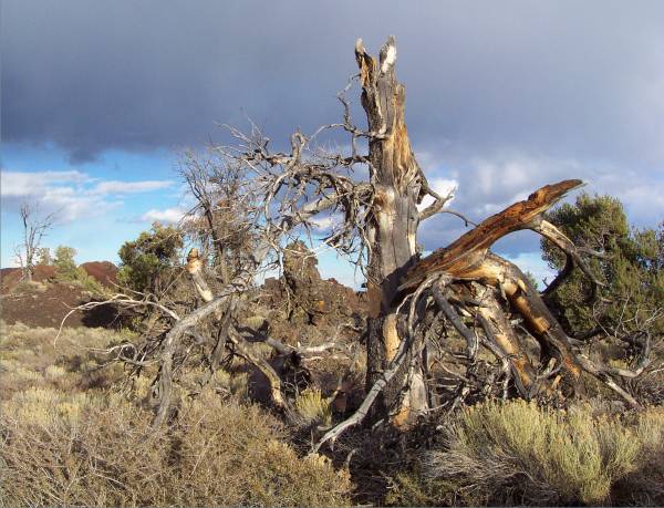
A tree off the side of the road. |
|
|
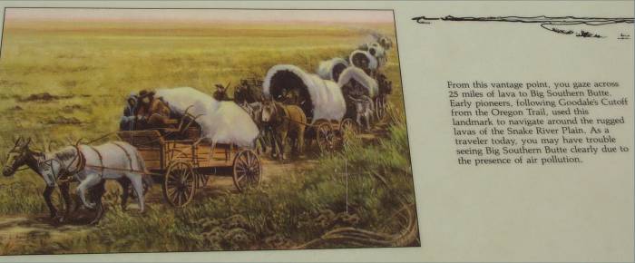
Arco is an eighteen mile drive from the Craters of the Moon. The scenery along this drive is memorable, and the clouds enhanced the views.
|
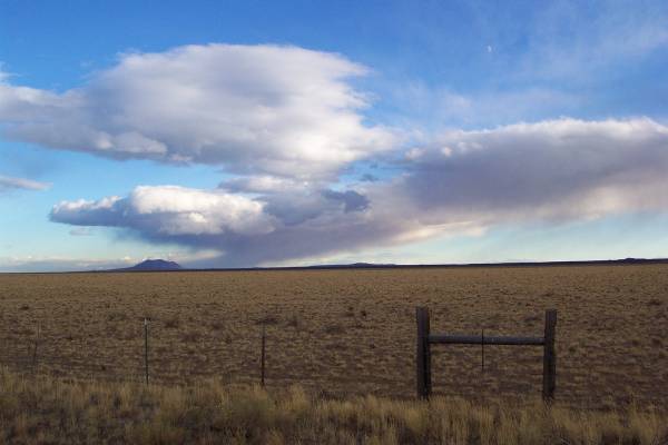
A tablet discussing the landmarks used for the trail. |
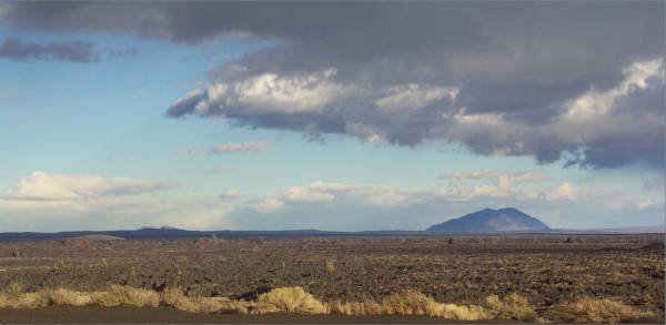
Big Southern Butte, the landmark mentioned on the previous photo. |
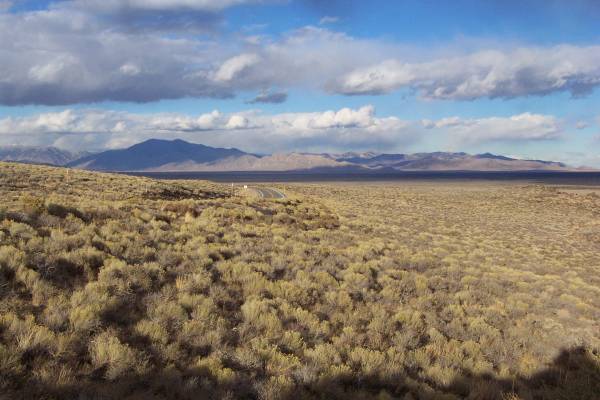
This view appears as you head down a hill. It reminded me of the drive east from the Bristlecone Pine Forest in Inyo County, California, towards Nevada. The difference; more vegetation here, and the views to either side of this picture are quite unlike those in California. |
|
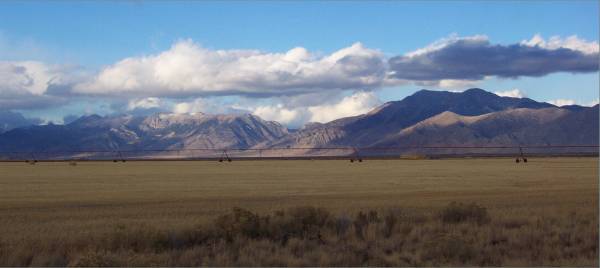
Looking northeast, a beautiful view of a ranch, the watering system, and the mountains. |
From the same stop, looking southeast. |
The hill in Arco with the years painted on the face. |
Tomorrow I return to the Craters of the Moon National Monument to go on a few hikes, then head north to position myself to get on Highway 12. This road was suggested by someone I met a few months back as a nice drive to take. Thank you for visiting!
Routes traveled today: Idaho 17 - City of Rocks Park Roads - Id 27 - 600 West Road - ID 24 - 750 East Road - US 93 - Craters of the Moon Park Road - US 93
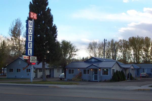
Lodging: D-K Motel -

This page
accessed
times.
Page created by: igorn@igorn.com
Copyright © 2001 Igor N. Nikishin
All Rights Reserved
Pictures may be used with permission.