Sidney Airport (SDY)
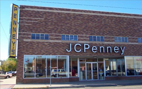
An old stand-alone J. C. Penney in downtown Sidney! Note the old vertical sign on the left.
Start time: 0745
Start odometer: 17830
Weather: Another beautiful morning with clear skies and bright sun with a cool temperature of 38o F.
Click on picture for larger image, hit back button to return to this page.
It was a good day for driving, sightseeing, and hiking. Most of the day was spent in the Theodore Roosevelt National Park. The park is located central part of western North Dakota, and is divided in two units, north and south. I toured the northern unit today, and will visit the southern unit tomorrow. A suggestion from Ranger Kay at the North Unit Visitor Center led me to a back road drive to Medora, where I decided to stay for the evening. The town was named after the bride of a French nobleman when he founded the town in 1883. This was an old western town, and in the early 1960s, was modernized. However, restoration allowed it to keep the old western look. It has a great look and feel to it as I walked around a bit this evening.
I drove south for most of the morning, going through the towns of Plentywood, Froid, Culbertson (which I visited on August 11,) and Sidney Montana. Sidney was the largest one, and appeared to be a nice, typical small town. And it has an airport!
|
Sidney Airport (SDY) |
An old stand-alone J. C. Penney in downtown Sidney! Note the old vertical sign on the left. |
After stopping at the Post Office, I headed east towards North Dakota. The scenery along the road was interesting as I headed into the Badlands region.
|
Another state, another time zone! (Mountain time to Central time) This makes the my twenty-third time zone change! |
View along the road. |
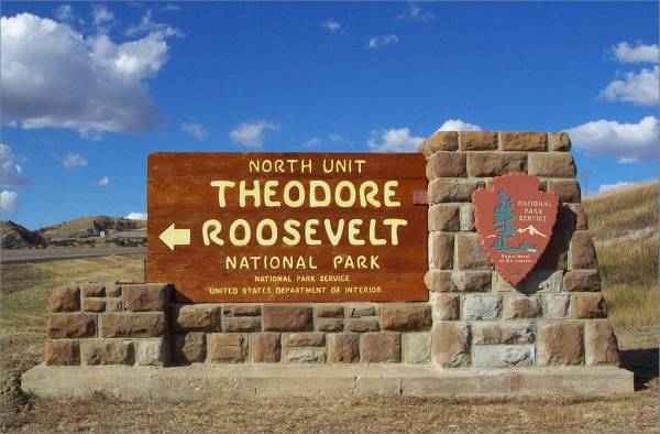
The is the entrance sign to the North Unit of the Theodore Roosevelt National Park. Dorothy, the park staff member who I met when I visited the Knife River Indian Village Historical Site just east of here, suggested I visit this unit first. |
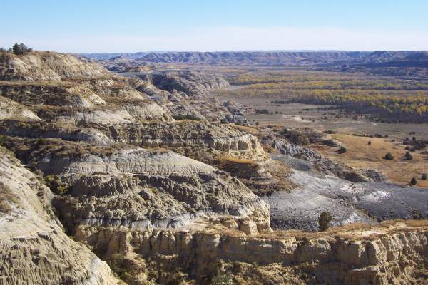
After a short drive, I turned south on Route 85 which led me to the entrance of the Theodore Roosevelt National Park. After stopping by the Visitor Center and getting information from Ranger Kay, I drove along the fourteen mile park road. I stopped at the overlooks and interpretive panels.
|
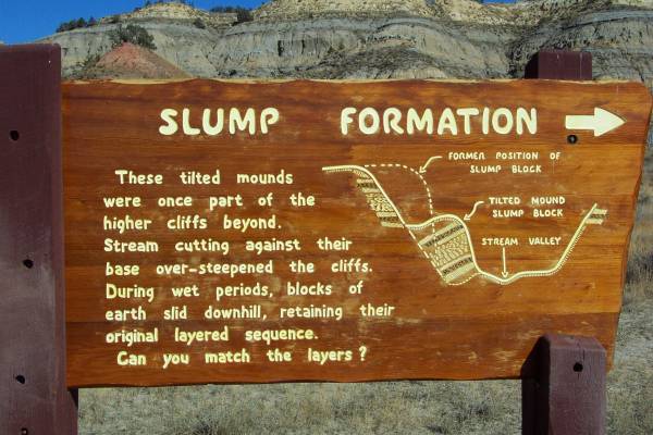
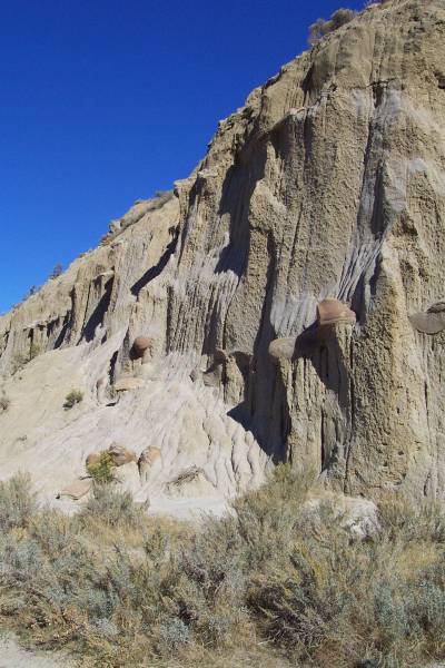
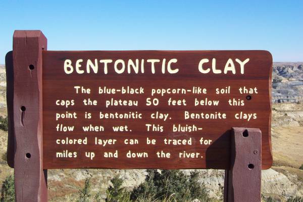
Information about some of the formations seen in the park. |
An example of a slump block. |
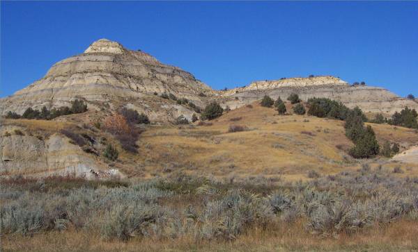
A picture of the road and landscape in this area. |
|
|
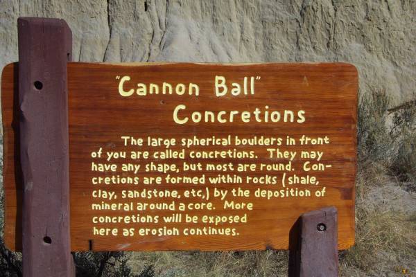
Interesting shapes in the rock. |
|
|
|
|
|
|
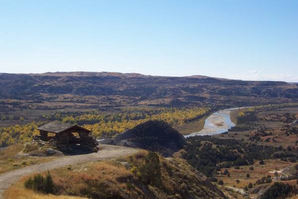
This shelter, overlooking the Little Missouri River to the southwest, was built by the CCC in the 1930s. |
Another view from the previous overlook, southeastward. |
Mule deer on the road. |
|
|
Another tourist at the Visitor Center mentioned that while there is some similarity to the Badlands National Park, more color is visible in these formations. |
|
|
|
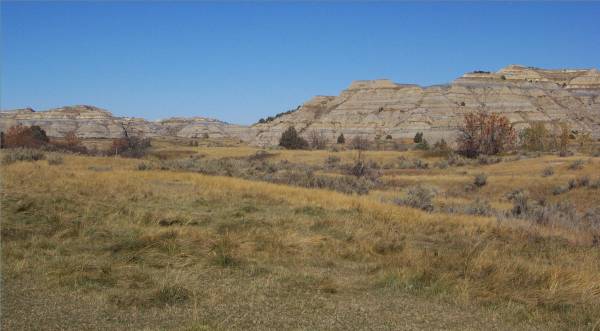
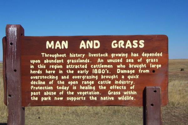
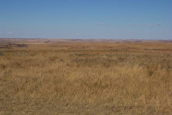
This region of North Dakota also contains the Little Missouri National Grasslands. |
|
|
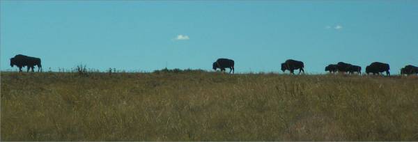
Along the road, I met a pack of thirty Bison! |
This one did not look both ways before crossing the road! |
On my return to the entrance, another larger pack was preparing to cross the road! |
|
Another view of the landscape. |
The first cloud of the day! |
Later, more clouds moved in, but it made for a very pretty sky, with the sun just outside the frame. |
|
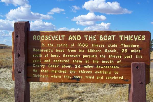
This panel tells a story about Theodore Roosevelt, who had lived in the area. It is said that some of his inspiration for conservation of land and wildlife was generated while he lived here. |
|
I took several hikes while in the park, and fortunately did not run into any Bison on the trails! It was fascinating to see these formations up close, and to learn about some of the plant life in the park. It was also wonderful to be in such a peaceful place.
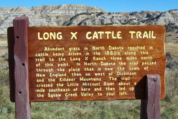
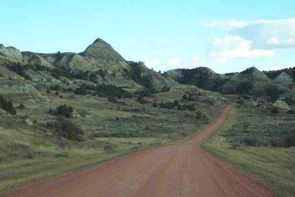
I departed the park later in the afternoon, but just south of the entrance, after crossing the Little Missouri river, I changed time zones again! I was now back in Mountain Daylight Savings Time, getting back the hour I lost earlier in the day. Soon, a roadside turnout had a sign detailing the Badland scenery. Twenty miles further south I turned west on Blacktail Road, which Ranger Kay said was a much prettier drive to Medora. I spent the next 45 miles on gravel roads (again,) and as usual, it was well worth it for the scenery.
|
Another time zone, my twenty-forth! |
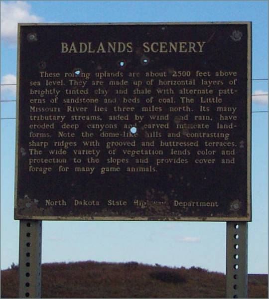
The descriptive panel along Route 85. |
The back road to Medora. |
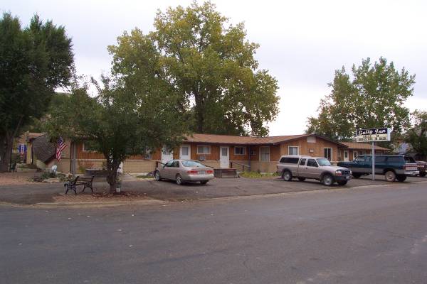
After checking into my motel, I had a great dinner at the Iron Horse Saloon, and listened to some interesting stories being told by the ranchers at the bar. As I said before, I walked around town afterwards, enjoying the visual atmosphere of the old west.
Tomorrow I plan on visiting the south unit of the Roosevelt National Park, then head to Rapid City, where I hope to pick up my mail that has been forwarded to me. I may also get to see the geographical center of the United States in Castle Rock, South Dakota! Thank you for taking the time to look at the page!
Routes traveled today: Montana 16 - Mt 200 - Mt 23 - North Dakota 68 - US 85 - Roosevelt National Park North Unit Road - US 85 - Blacktail Road - Forest Service Road 702 - Roosevelt National Park South Unit Road - East River Road
Hotel: Sully Inn -

This page
accessed
times.
Page created by: igorn@igorn.com
Copyright © 2001 Igor N. Nikishin
All Rights Reserved
Pictures may be used with permission.