Sunday, September 30, 2001
Hello from Johnson's Crossing, Yukon Territory!
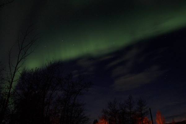
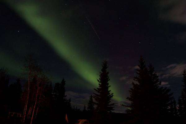
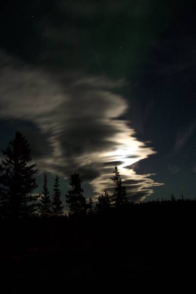
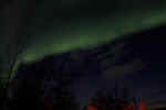
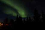
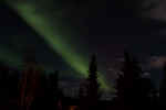
Also, another Aurora Borealis sighting!!! See below...
Start time: 0930
Start odometer: 15216
Weather: The day started cloudy and windy, with a temperature of 49 degrees
F. It had rained overnight, making for a damp morning.
Click on picture for larger image,
hit back button to return to this page.
Highlights:
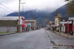
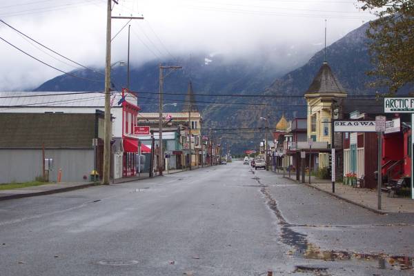
- I decided to start the day with a drive and walk around town. It was
pretty deserted, as stated yesterday, since the cruise ship season is over
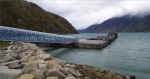
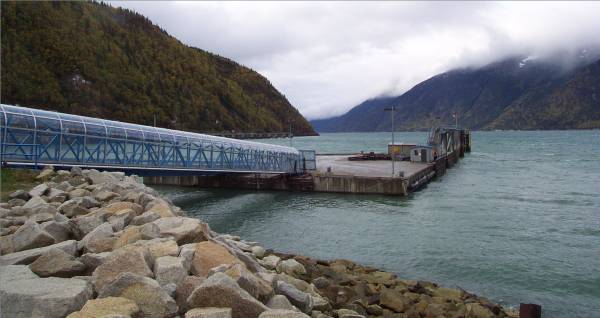
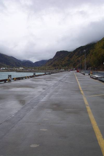
and most of the businesses were closed. I did walk along the dock for
the cruise ships. It is incredibly long (total docking length of the
pier is just under 2000 feet,) and can probably accommodate
two or three large ships at one time. Afterwards, I walked to the
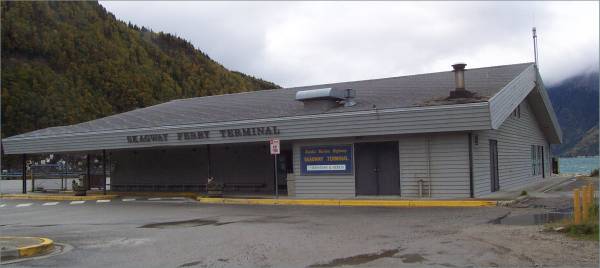
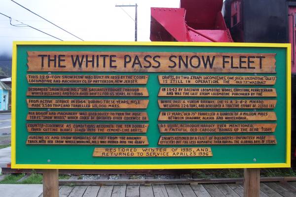
White Pass and Yukon Route Railroad terminal to look at some of the displays
available outside the closed building.
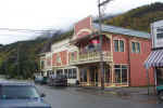
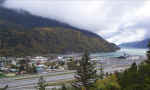
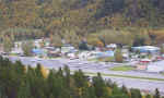
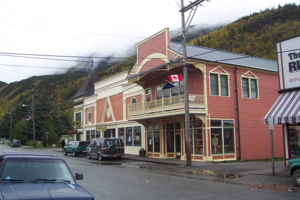
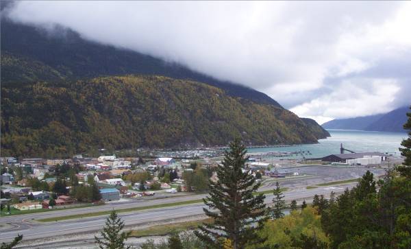
- Views of downtown Skagway -
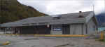
- Alaska Marine Highway Ferry terminal and dock -
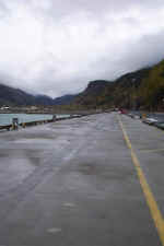
- From the end of the cruise ship dock looking towards town. -
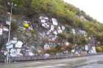
- This is a rock wall beside the dock that has insignia and logos of many
ships. -
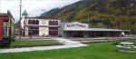
- WP & YR Railroad info and terminal -
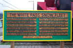
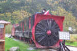
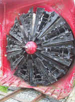
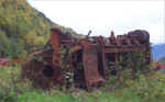
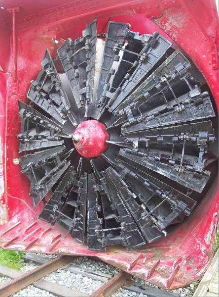
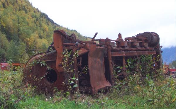
- An old snow clearing machine on display -
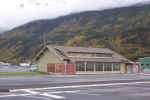
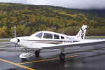
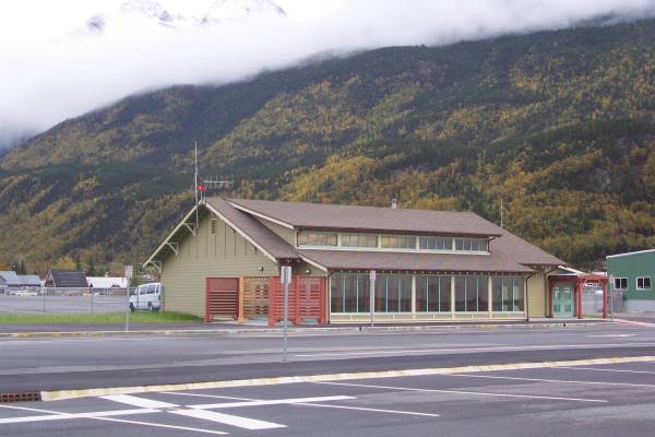
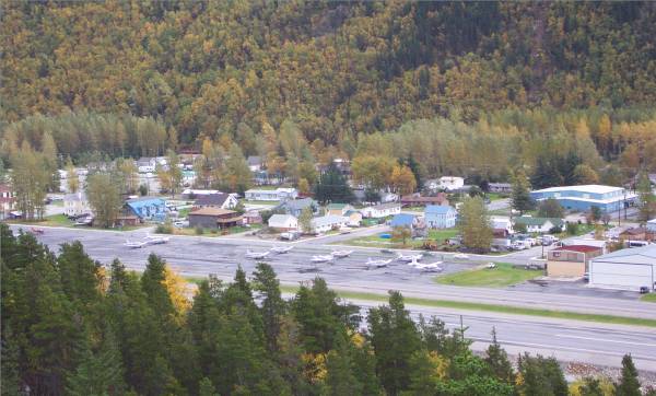
- I got back into my car and drove to the Skagway Airport (SGY) for a picture (of
course!)
- I called my sister and brother-in-law while parked here and we brought
each other up to date. It is always good to hear their voices.
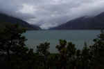
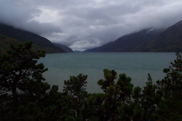
- I then took a little hike out to see the Talya Inlet that connects Skagway
to the Inside Passage. This trail provides some beautiful views of the
channel.-
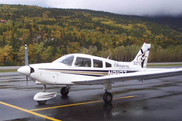
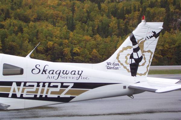
- I continued my drive near the airport and noticed a parking area for
Skagway Air Service, Inc. I noticed they had quite a unique logo.
-
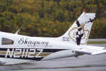
- A pilot was walking by at the time and I learned that the owner came up
with it! They are a scheduled airline service to some of the smaller
airports in the region and islands. They also provide flight-seeing
and charter service. I remembered something Ed, the gentleman I met a
couple of days ago from Vermont, told me about a mountain pass out of
Anchorage that has eaten many small aircraft. Usually it is a pilot
from the lower 48 that is not acclimated to the type of conditions
experienced in Alaska. I mentioned this to the pilot from Skagway Air,
and he knew immediately which pass I was referring to. He also told me
of some of his other flight experiences in narrow mountain passes, and that
the way they must fly in Alaska would not be acceptable in the lower 48.
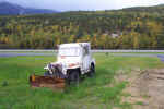
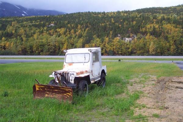
- Near the aircraft was a piece of ground support equipment.
This picture is for you, David Z.!!! -
- After a visit to the grocery store and helping a local push a stalled van
out of the way of traffic, I finished my drive around town and headed back
to the Klondike Highway.
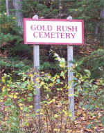
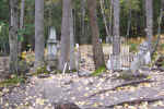
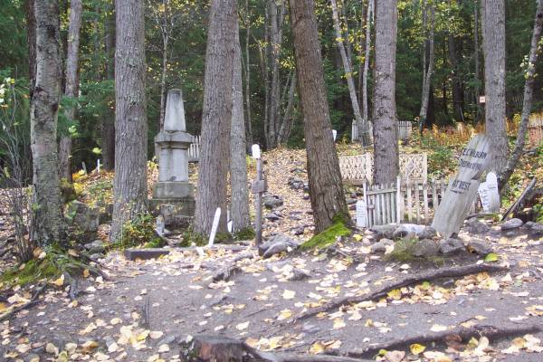
- At the town line is a storage a maintenance facility for the WP & YR
Railroad. The road into the area also leads further back into a gold rush
cemetery. Many of the graves have up to date headstones which provide
info, but you lose the feeling of the site. There were some sites with
old markers, which are interesting to view.
-
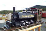
- Leaving the cemetery area, I noticed some old locomotives, and took this
picture. -
- A short distance out of town is a road to
Dyea, which was part of the
famous
Chilkoot Trail used by the miners headed for the Klondike gold
fields. I drove the road to an overlook that provides a great view of
Skagway. -
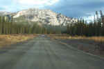
- Back on the Klondike Highway, I found low ceilings, clouds, and also rain
on portions of the drive. I still had some nice views as I drove up to
White Pass, and into Canada. -
 By
the way, this in the seventeenth time zone change for me!
By
the way, this in the seventeenth time zone change for me!
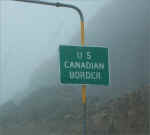
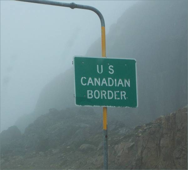
- My stop at Canadian Customs was fast. I was asked for my passport
again, and had it ready by my side. A few extra questions and I was on
my way.
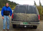
- As I was driving, I remembered that Ed, whom I referred to earlier, was
possibly heading to Skagway today. I kept looking at oncoming traffic
for a Vermont license plate, and just a few minutes past Customs, I saw
him! He noticed the Maine plates on my car, and we both stopped and
turned around to meet again. Amazing how timing works sometimes.
When I was in Whitehorse two days ago, I tried to call him at his hotel, but
he was out. I left a message at the desk to let him know my
lodging. I found out today that the hotel clerk gave him the message
today! Thinking I might still be around, he called my hotel, and the
clerk there said I had checked out this morning (when I had actually left
yesterday!) Lets us see how confusing we can make it for Ed! We
had another interesting conversation, and shared more travel advice.
He will be in Skagway tonight, then take the Ferry down to Bellingham,
Washington tomorrow. I let him know of some of the places I visited in
town. He mentioned that the Yellowknife area is seeing Polar
Bears. A little out of my way for this trip, it will be part of my
future travel plans. Hopefully, we will be able to meet again in Tahoe
if and when I get there!
- Ed and the Vermont truck -
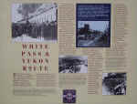
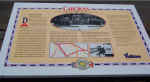
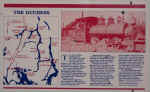
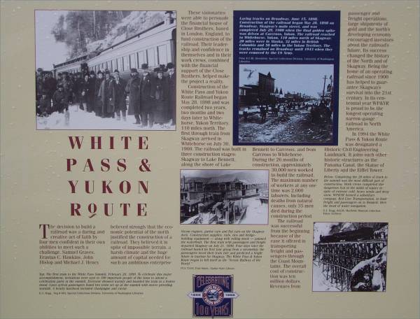
- He also mentioned a couple of places along the Klondike Highway to
see. The first was a park just up the road with very informative
panels discussing the history of the Klondike gold rush and the Chilkoot and
White Pass Trails. There was also a very nice rainbow!
- Continuing north, the weather began to improve as I entered the Yukon
Territory. Unfortunately, British Columbia did not have a sign
indicating their border. -
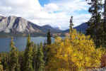
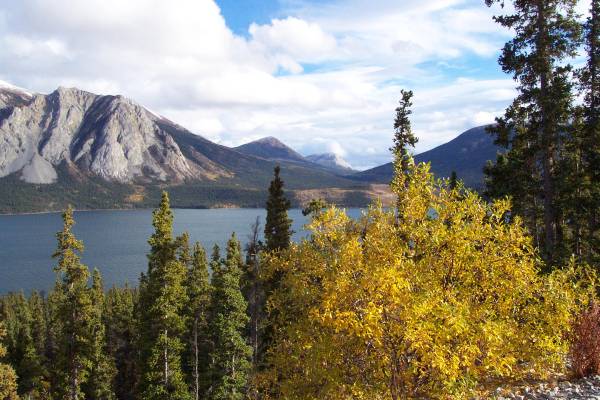
- A picture of
Tagish Lake -
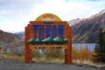
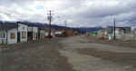
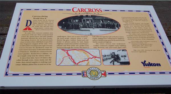
- The second place Ed suggested to see was
Carcross, just off of the
Klondike Highway. Carcross played an integral part of the gold rush,
as well as transportation. This is where the ceremonial golden spike
was placed during the original construction of the WP & YR Railroad.
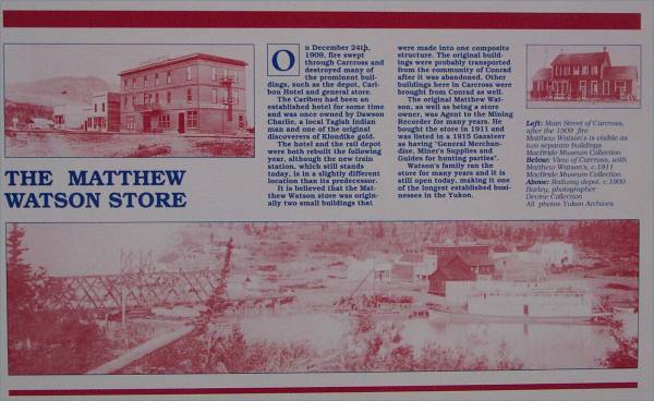
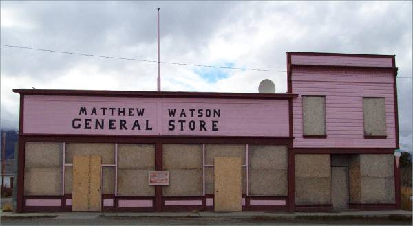
- Interpretive panel about Carcross -
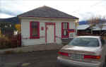
- A street in town -
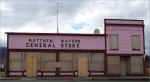
- Information about the General Store -
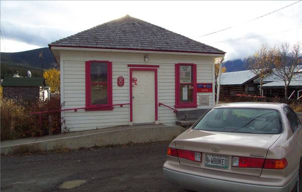
- My car in front of the Post Office -
 (Yes Nina and David, you will get a postmarked card from here.)
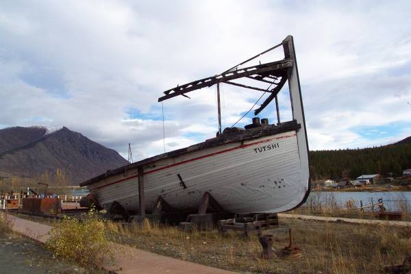
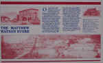
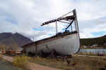
- They also had a display of a burned paddlewheel boat. They laid out
remnants of the boat in the positions where they were originally
placed. In the second picture, you can see where the paddlewheels were
mounted.
-
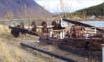
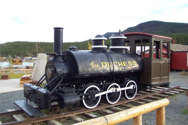
- They also had an old locomotive display.
-
- Returning to the Klondike Highway, I drove just north of town to the
Tagish road turnoff. This road will take me back to the Alaska
Highway. This drive provides more wonderful views of the mountains, as
well as the Tagish River.
- Following a car on the Tagish. While the majority of the road is
ship-sealed, this portion is gravel. -
- Upon arriving at the Alaska Highway, I turned east, driving until I
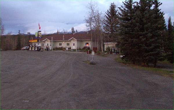
arrived at my lodging for the evening. It was the right time to stop and rest.
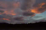
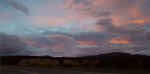
- After a good dinner, I decided to take a walk over the bridge that crosses
the Teslin River. This is the third longest bridge span on the Alaska
Highway, and was fairly high above the river. The sky and clouds
provided for some interesting views, and they were enhanced by the
reflection of the water in the river.
-
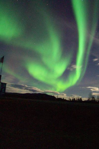
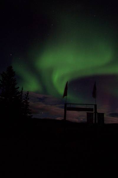
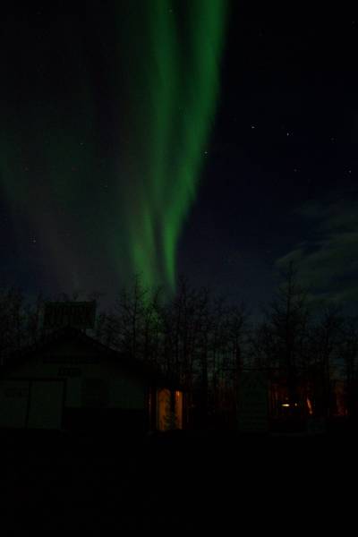
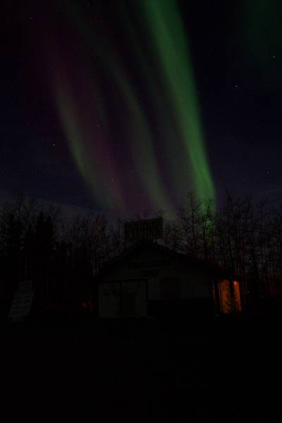
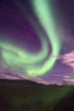
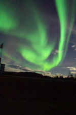
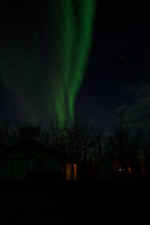
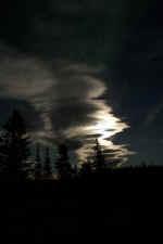
- As I was typing up this page, I took a break and walked outside. I
looked up, and there was the Aurora Borealis! What a spectacular
sight, even with the lights of the surrounding buildings, and a waxing
moon! I really love this stuff!!!!!!
|
 |
 |
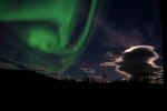
The Northern Lights with moonlit
clouds. |
|

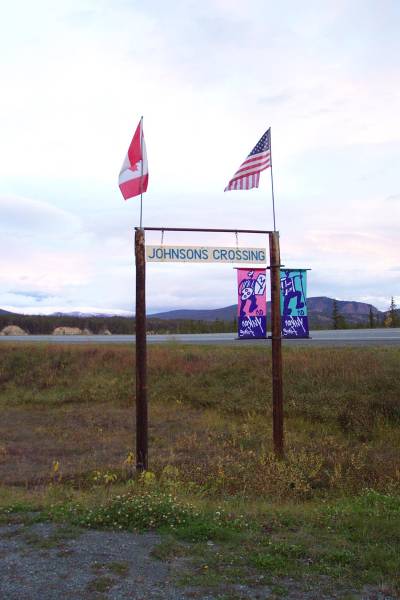
Daylight view of the sign. |
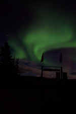
The same sign backlit by the
aurora borealis. |
 |
|
 |
You can see the Big Dipper behind the lights! |
 |
|
The streak of light is a
commercial jet at high altitude. |
This is the moon behind clouds. It looked pretty nice, too! |
|
Tomorrow I continue my quest along the Alaska Highway, then after a short
visit to Watson Lake, I will turn south onto the Stewart-Cassiar
Highway! Thank you for stopping by and viewing my page, and
pictures! Please let me know what you think! Thanks!
Routes traveled today: Ak 98 - BC 2 - YT 2 - YT 8 - YT 1
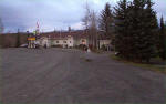
Hotel: Johnson's Crossing Campground Services Motel -

This page
accessed  times.
Page
created by: igorn@igorn.com
Copyright
© 2001 Igor N. Nikishin
All
Rights Reserved
Pictures
may be used with permission.


 By
the way, this in the seventeenth time zone change for me!
By
the way, this in the seventeenth time zone change for me!


 (Yes Nina and David, you will get a postmarked card from here.)