 Click on picture for larger image...Hit the back button to return.
Start time: 0830
Start odometer: 10641
Click on picture for larger image...Hit the back button to return.
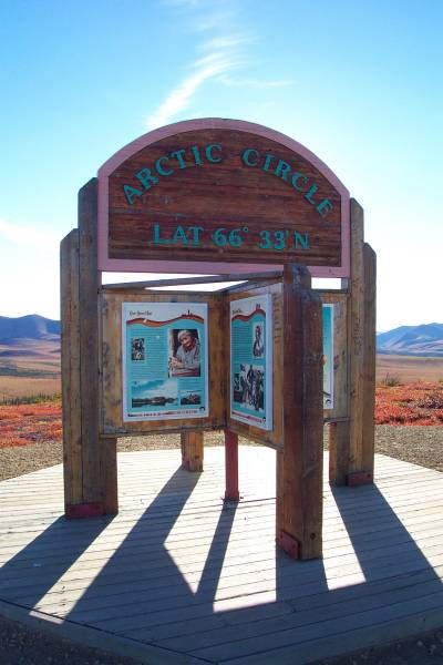
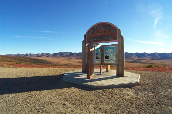
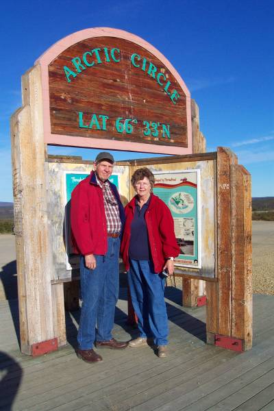
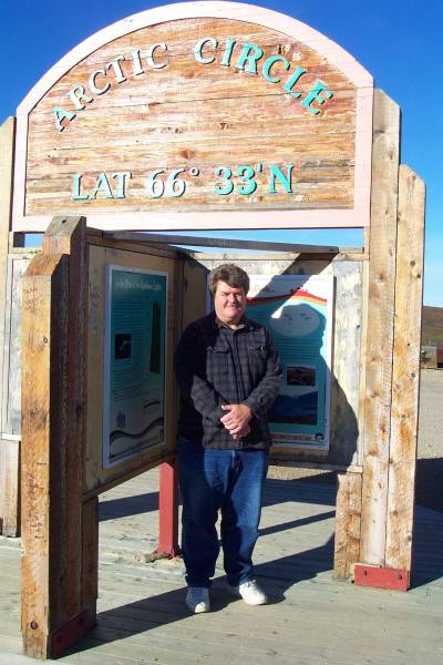
I made it north of the Arctic Circle! A nice display was set up at the location of the Arctic Circle by the Yukon territory. Nell and Dave, who I met yesterday, wanted to get to the Arctic Circle before returning to Dawson, so we met at this location after breakfast. Dave kindly took this picture of me to show everyone back in the States that I crossed the line. Now I sit in Inuvik, Northwest Territory, seeing another very late but beautiful sunset. This town is at the end of the mostly gravel Dempster Highway, and I arrived safe and somewhat sound after 457 miles of gravel, dirt, dust, shale, and who knows what else I drove on to get here! Oh, and there were two ferry crossings required, which were interesting. Inuvik, with the emphasis on the "U", sits on top of permafrost. Most of the buildings and homes are built on stilts above the ground, and many covered square boxes run from building to building like above ground tunnels. These are used for the water supply and sewage removal, since they cannot be buried underground. This town, located on the MacKenzie River delta, is said to have been created to replace another town that appeared to be sinking a short distance to the west. This town was also part of the U. S. defense shield during the cold war. There is a large radar dome at the highest point above town , and I noticed several large antenna arrays while driving into town.
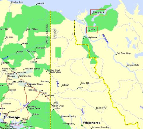
Below is a map of the location on Inuvik. For reference, Anchorage is on the lower left.
 Click on picture for larger image...Hit the back button to return.
Today started as another beautiful day, and the sun was shining bright after a wonderful sunrise, with a temperature of 51 degrees. I decided to stay for breakfast, and found Nell and Dave at the restaurant, and was invited to have breakfast with them. They mentioned there intentions to go to the Arctic Circle before heading south, so we planned to meet there.
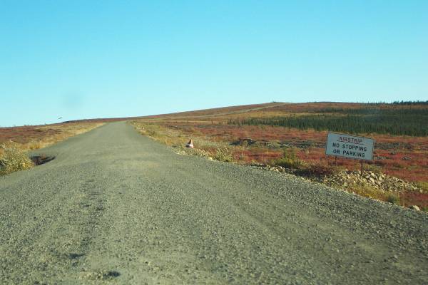
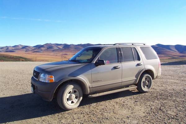
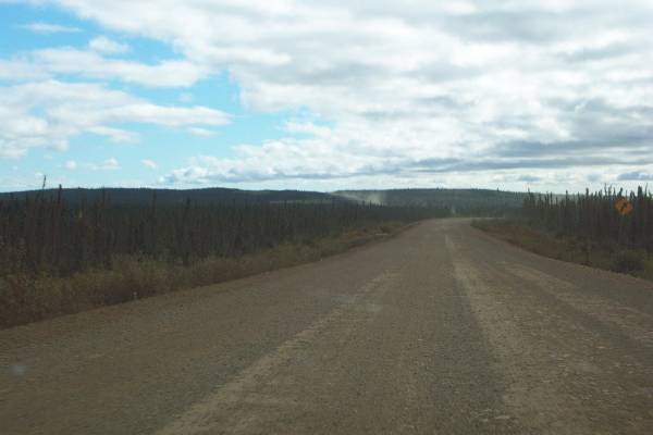
After packing the car, I headed north on the Dempster Highway. The views were again magnificent, with a beautiful clear sky. While watching the scenery, I also paid attention to the road. Last night it was mentioned that shale in use in the area, and I needed to slow down to prevent tire damage. An interesting sign appeared after twenty miles that warned of an emergency airstrip. When approaching it, I realized they meant the road, which was widened and very straight for several thousand feet. There were also cone markers along the edge. This was the first of two I found today. I understand that this first one is used fairly regularly to bring supplies into the town of Old Crow many miles to the west of the landing strip.
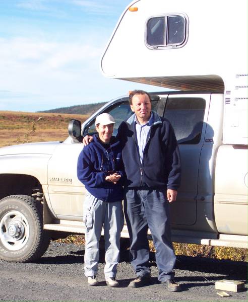
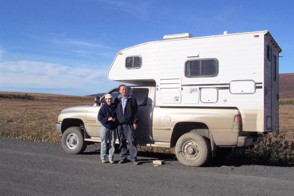
My first stop today was at the Arctic Circle. As mentioned above, I met Nell and Dave one last time, and we were able to get pictures before we departed. We both returned to the road, they to the south, and me to the north. It was not but a few minutes before I stopped again when I noticed a camper on the side of the road with two flat tires! They found the shale! The couple with the camper, Pia and Fritz, were from Germany on tour in the Yukon and NWT. They had been traveling south when their left rear tire had a quick deflation. They were able to replace the bad tire with a spare, but when they lowered the vehicle, the spare was also flat. Fortunately, I carry an air pump that works off of the cigarette lighter, so I dug it out of my trunk and began filling the spare tire. I was really hoping that the spare was only flat due to a very slow leak, and not like the blowout of the original tire. The pump is not quick, so we had some time to talk about our travels, and Fritz carried a very powerful scope. We viewed the landscape, but were unable to see any animals. Finally, the tire was filled, and after checking the pressure several times to learn it was not leaking fast, Pia and Fritz departed. They planned to stop at the Eagle Plains service station to fix the original tire and to re-check the spare. I offered to follow, but they felt that since the station was close, they were fine. I watched them for several minutes after they left, as you can see the dust trails for a very long time and distance. Also, a highway truck going south went by soon after I headed north, so if they had any more problem, they would be able to get more assistance.
An interesting note...While driving, I was listening to Jon Luc Ponte and Sting. I was passing by this huge field of brilliant yellow-gold plants, the song "Fields of Gold" played. Good timing!
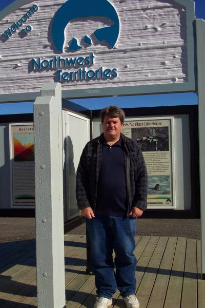
I continued north, and made a few stops for pictures, as well as lunch along the way. The shale section only lasted fifteen miles, which was good. A few hours later, I crossed into the Northwest Territory!
As you can partially see in the picture, I had a beautiful sky. This lasted for a short while, until I approached and drove over a ridge covered in fog. The fog lasted for quite some time, but the effect of it blowing over the many subdued colors of the tundra was wonderful! It was not too thick, so I could see some distance. It was still present when I reached my first ferry crossing at the Peel River. Canada provides ferry transportation free of charge at points where there is no other way to cross a river or body of water. I first heard of this long ago on Campobello Island. This particular ferry used a motor for power, but a cable running across the river was passed through the boat for guidance. The cable is long enough that when the ferry is on either side, the cable is low enough in the water for ships to pass over it. Worthy of note at the ferry crossing was the stillness in the air and how it was quiet. There were several crows near me, and you could hear the wind coming off their wings as they flew by and away from me.
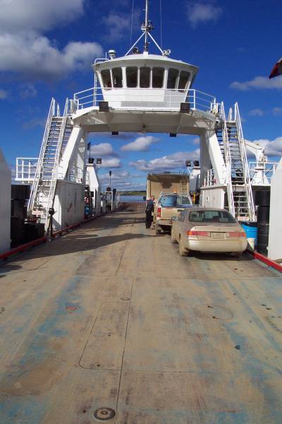
Once off the ferry, the drive continued on a smoother gravel surface, and though dusty, higher speeds were obtainable. Also, the fog cleared, and the sun began warming the air. In the fog, the temperature dropped to 49, but in the sun, it bumped up to 66 by the time I reached my second ferry crossing at the Mackenzie River. This is the second longest river in North America! This ferry visits three ports, so it navigates without a cable. But as with the first one, they just drop ramps from the boat onto the dirt road, and you drive on or off. No special docks are needed for these boats on this road!
NOTE: One of the advantages of having this site is the many people who have written me about it! Your comments are greatly appreciated! I have change the contents of the previous two paragraphs thanks to Craig from Gilliam, Missouri. He wrote a wonderful letter comparing my trip with one he took in 2002. We met some of the same people and enjoyed many of the same sites. He also was able to correct some misinformation I had originally written. Thank you Craig for helping the site be more accurate. You are correct when stating it is difficult to keep all the names of places and rivers in order. Your corrections are greatly appreciated! Enjoy your travels!
After departing the ferry, I actually passed a camper going slower than me! Most of the time, I get passed, since I am taking my time on this trip, so you can imagine my surprise when someone pulls to the side for me! The road was in very good shape at this point, still gravel, but smooth with fewer potholes than the rest of the road. The sky was blue with puffy white clouds, and the yellows of the willows(?) were their brightest.
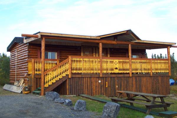
About ten kilometers out of Inuvik, the road became paved! It was nice to get off of the gravel, but the new challenge was frost heaves and sinking spots, which made for an interesting finale. I stopped by the Visitor Center just outside of the downtown area and got information on lodging. After finding the Arctic Chalet Bed and Breakfast, I was given a very nice cabin with a phone. I will try to upload the last few entries tonight.
After checking in and getting the cabin, I was standing on the main patio with several people and met Gordon and Arlene, other guests at the Inn. They invited me to join them for dinner at the best restaurant in town, in the MacKenzie Hotel. Dinner was delicious, and the conversation was very interesting. Gordon happens to be a Beech 1900 pilot for an Air Canada feeder. Arlene and Gordon were spending a couple of days here to see the area, as well as taking a tour of Tuktoyaktuk to see the Arctic Ocean. This is the tour I plan to take tomorrow, so it was good to get information on what to expect. Unfortunately, Arlene and Gordon fly back home to Toronto tomorrow, but it was nice to meet them. By the way, this will be Gordon's last week at Air Georgian(?) as next week he will be working as a corporate pilot after training to fly a Lear.
Click on picture for larger image, hit back button to return to this page.
|
This picture shows the road condition at the exit of Eagle Plains. |
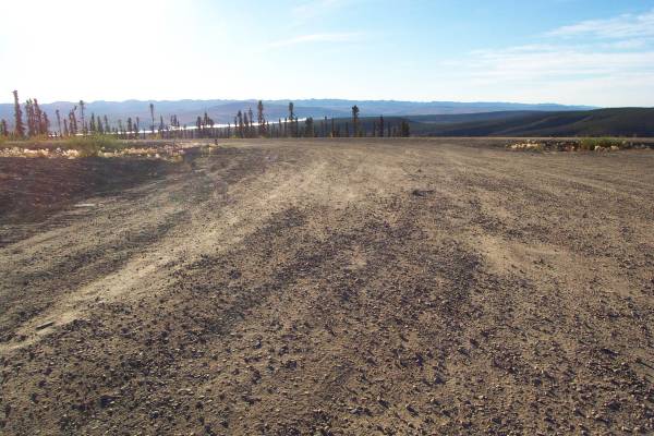
One of the airstrips that are part of the highway. |
The Arctic Circle! |
|
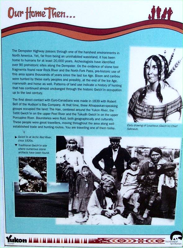
As seen in the previous picture, many informative panels are presented. "Our Home Then..." |
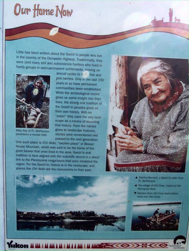
"Our Home Now" |
"The Arctic Circle" |
|
"Threshold of the Invisible World" |
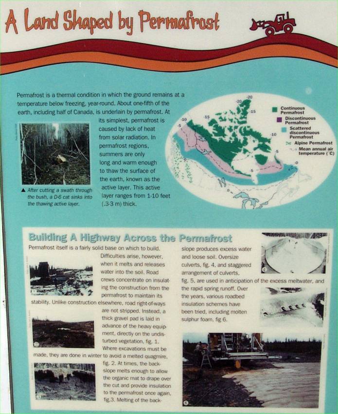
"A Land Shaped by Permafrost" |
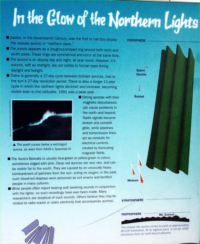
In the Glow of the Northern Lights" |
|
More pretty scenery surrounds the parking area for the Arctic Circle. |
Dave and Nell, it was wonderful to meet you! |
And thanks for taking my picture! |
|
Nell and Dave as they begin their trek south. |
Pia and Fritz, as we await their tire to be inflated. |
Filling the spare with air! |
|
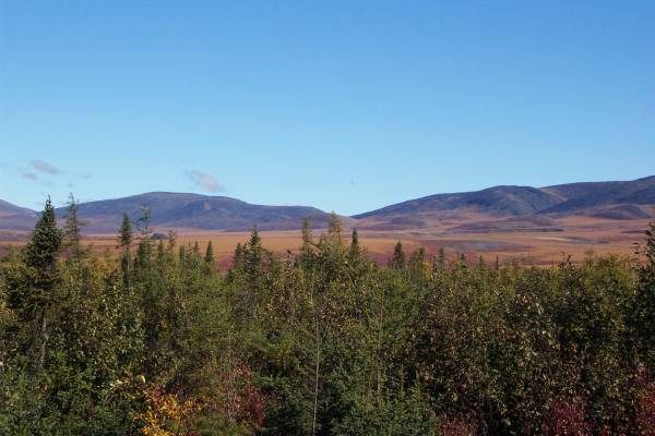
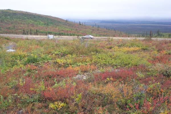
The tundra colors beyond the trees enhanced this shot. |
This was a wonderful art of the drive. It was amazing how far of a distance could be viewed. |
The road can be seen off in the distance to the upper left. |
|
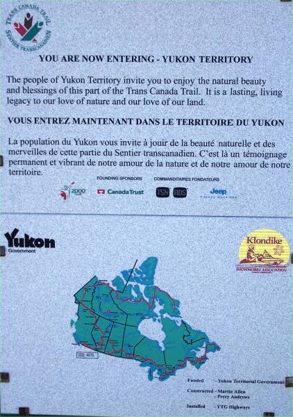
Entering the Yukon Territories, my eighth province! |
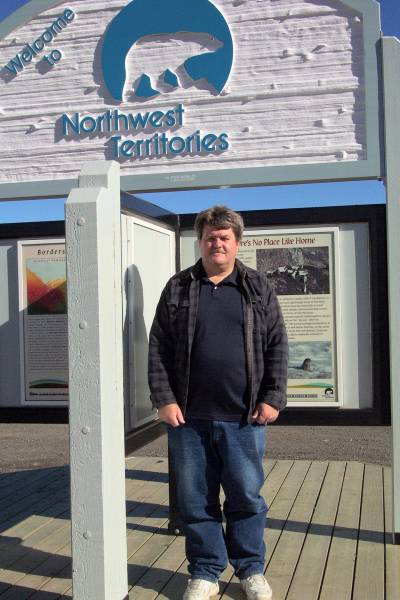
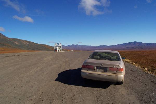
A tripod shot of me at the Northwest Territories sign. |
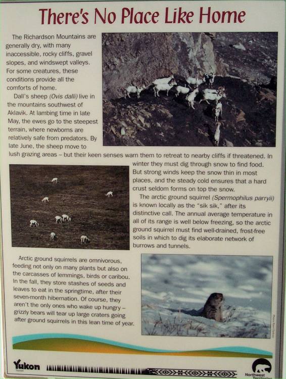
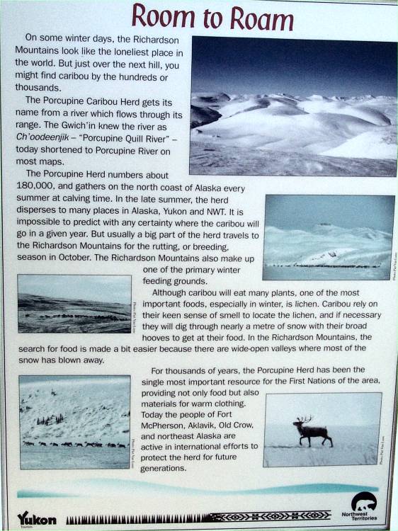
I took a picture of a few of the panels on display. "There's No Place Like Home" |
|
"Fall Colours Beyond the Treeline" |
"Room to Roam" |
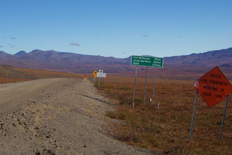
The road signs just north of the border. |
|
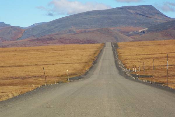
The roadside area at the border is a pretty, but barren place. The surrounding scenery is spectacular. |
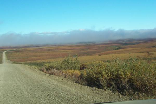
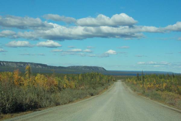
The road was interesting to drive in this area. |
A fog bank looms ahead. |
|
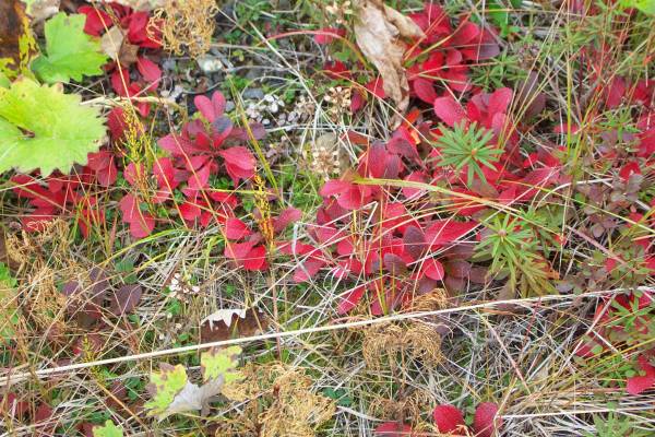
Nice colours of the tundra. |
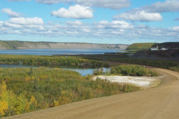
Near the first ferry, a short trail led to this view overlooking the Mackenzie River valley.
|
Looking back at the car during my return, I enjoyed the colours and smell of the tundra. |
|
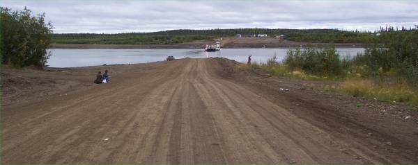
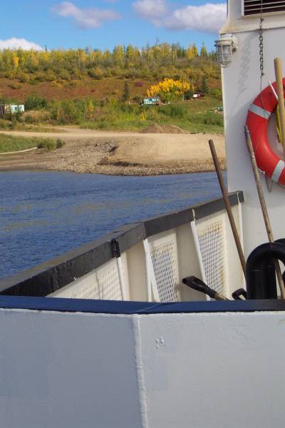
The entrance to the ferry. The people on the left were looking for a ride south to Dawson City. |
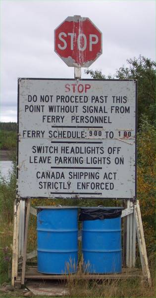
Ferry information |
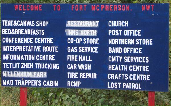
Businesses in Fort McPherson |
|
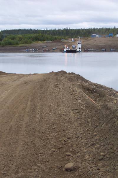
As seen in this picture, the road heads directly into the river. The cable to the center-right of the picture crosses the river to guide the ferry. |
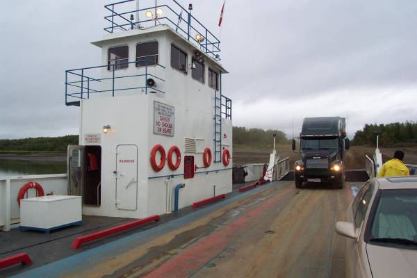
Onboard the ferry. The truck seen boarding was as long as the ferry. |
The road northeast of the ferry. |
|
The sky was clearing as I approached the Mackenzie River. I also found the geography interesting. |
Another ferry crossing, this time, the Mackenzie River. |
The entrance ramp. |
|
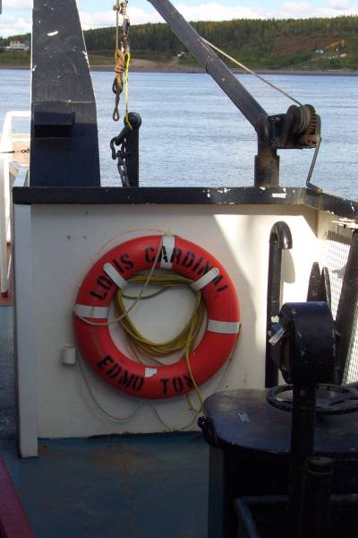
The Louis Cardinal of Edmonton. |
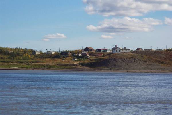
Nice community perched above the river. |
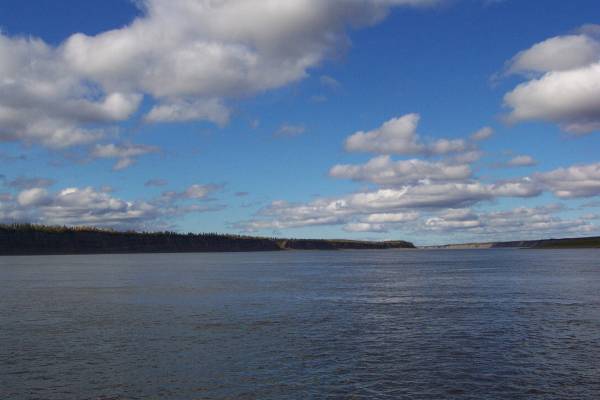
The Mackenzie River, looking north. |
|
Approaching the east bank. |
The road was in slightly better condition east of the river heading into Inuvik. |
This bridge was closed due to construction. A detour was available on a temporary bridge. |
Thank you for visiting my page. I was hoping to talk about the night sky, but I just went outside and it is still twilight to the west, so there is a lot of light in the sky. I am still impressed with the way daylight works up here, and am anxious to come back at the end of June. Tomorrow, I plan to tour Inuvik for the morning, then fly to Tuktoyaktuk on a tour of that town. This, of course, includes a touch of the Arctic Ocean. Talk with you soon.
Routes traveled today: YT 5 - NWT 8
Hotel: Arctic Chalet Bed and Breakfast -

This page
accessed
times.
Page created by: igorn@igorn.com
Copyright © 2001 Igor N. Nikishin
All Rights Reserved
Pictures may be used with permission.