 Click on picture for larger image. Hit "Back" button to
return to this page.
Click on picture for larger image. Hit "Back" button to
return to this page.Start time: 0710
Start odometer: 9460
I thought another night in a hotel similar to last night would be nice, so I found a place just over an hour west of Watson Lake, YT. The lodging has no phone, but it does have electric power from a utility, and there is actually a television! It only receives one station, and it has been off but for a few minutes to see what THE channel was (public broadcasting!) This place has a very long history of its involvement with the Alaska Highway. It was one of the first lodges on the highway, though many of the original buildings had burned years ago. The location has always been a stop on the road, and today it is, as it was all these years, open 24 hours, 365 days a year.
It was another cloudy day, with rain beginning to fall as I departed Coal Creek. The temperature dropped to 43 degrees (F) so the windows and sunroof were closed. In my report yesterday, I forgot to mention that for dinner last night I wore jeans. I also wore them today which was the first time I wore jeans, or any long pants, since before I left July 12! It would have been a good idea to wear long pants around Lake Superior to fight the flies, but it was very hot then. But back to today, while the weather was not cooperative in a blue sky way, having the wet, cloudy weather adds its own certain effect to the day, and I was able to enjoy it.
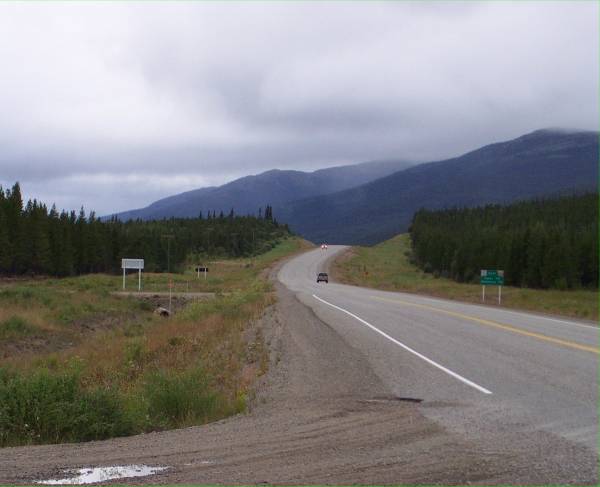
The road provided many wonderful views. It is amazing to see what appears as you round a corner or drive over a hill. There were many beautiful landscapes, including one view of a hillside where the trees created an interesting effect looking like a bumpy carpet. (Like I said, not a writer, so descriptions will be weak!)
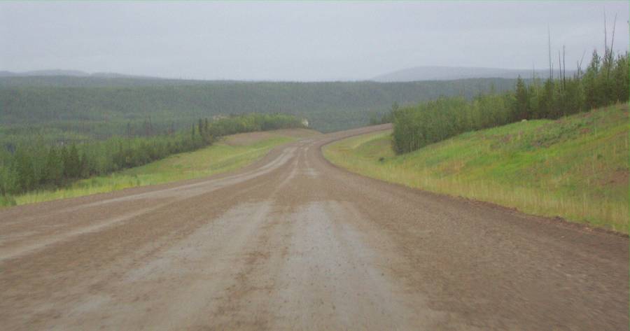
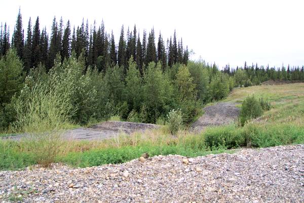
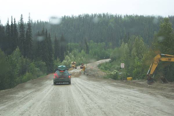
As I neared the Yukon border, the road narrowed and became surfaced with gravel. It was slow going, but was expected along the way. It also appeared that much realignment had been done on this section. The original road could be seen along side, wandering off in one direction, crossing the current path, and dead ending at a stream. It would be neat to drive the old road, but I believe it would have to be done in the winter on a snowmobile, since many of the stream crossings are gone, and pavement, if it still exists, is very broken up.
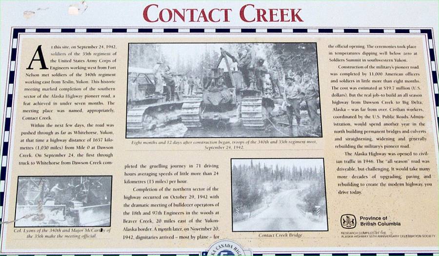
One of my stops today was at a roadside rest with an interpretive display at Contact Creek. This is the location where the builders of the southern section of the road met the builders from the center section of the road. The original bridge had been replaced by a culvert, but the road is still visible.
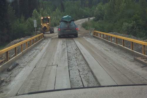
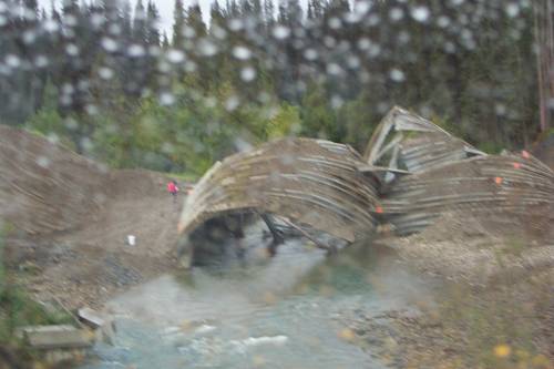
Speaking of culverts, in 1998. the world's largest culvert was constructed on this road south of Watson Lake. It was 25 feet high, 135 feet long, and 62 feet wide. Here is the story of why I use the past tense. At the end of June this year, road workers noted that there was a dip in the road at the location of the culvert. They kept the road open, but decided to keep someone onsite at all times to monitor the situation. A few days later, they started hearing noises, so they decided to close the road. The noises were followed by the sound of popping rivets, and finally, the culvert collapsed. It is now being claimed as the world's largest pothole! It is an interesting site to see, as a temporary road and bridge have been built around it. The first picture is the temporary bridge, and the second is the culvert. I was not permitted to stop the car, understandably, so the shots are not great. But they should give you an idea of what I am writing.
Click on picture for larger image. Hit "Back" button to
return to this page.
The second picture is a bit out of focus, but you can see a guy wearing a red coat to the left of the metal wreckage. That should give you an idea of the size of the culvert! By the way, do you like the bridge in the first photo?
After getting through this, with only a five minute wait, I drove into the town of Watson Lake. This is another community that grew due to the road. Initially, it had an airport that was part of a series of fields to provide a staging system into the Yukon. These airports were the main reason the road took the path it did, since there was some access to these areas. The town is called the "Gateway to the Yukon" and has a large standing in the forest industry. Tourism is now big here, and many options can be had for those who wish to hire someone for further exploration of the Yukon.
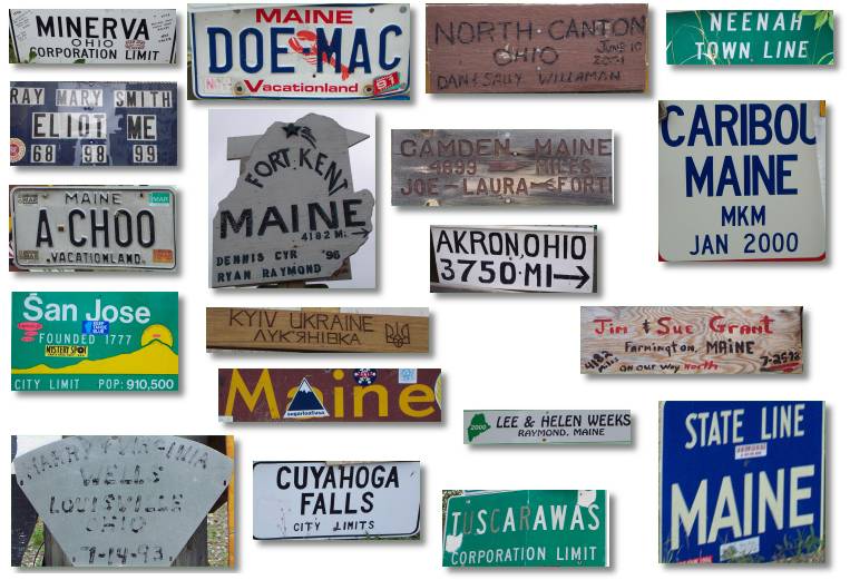
I stopped by the Visitor Center, which is right next to the Signpost Forest. You may have seen a picture of this "forest" as it is widely known. In the early 1940s, during the construction of the highway, a worker got in an accident and was recuperating in Watson Lake. He was homesick, so he made a sign of his home town and nailed it to a post. As time passed, others began doing the same thing. In the 1970s, when the road was being widened, the workers were tearing down the posts, when some local people thought it might be fun to keep them and promote it. They were moved to the current location, and the rest is history! Most of the old signs are gone, since old unreadable signs are removed. They count all the signs every fall, and as of the year 2000, they had 44335 signs! Button, the lady at the visitor center said they have at least 2000 more this year, and will have the new total this fall. Anybody have a sign they want to send for me to post when I pass through on my return? I got some pictures of places I recognized or towns where I lived, and of course, got several Maine signs. I know there are more posted than I saw. The problem is that there are so many signs, there is no way to see all of them, it is just that overwhelming!
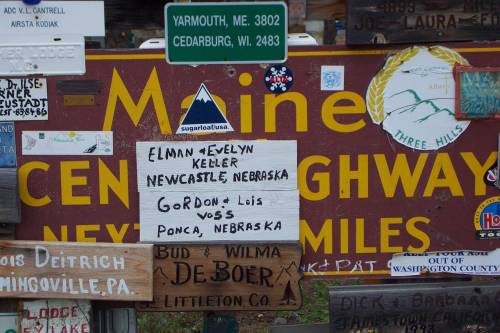 Note the Yarmouth on top, and the Sugarloaf Ski Area sticker over the
"A" in Maine!
Note the Yarmouth on top, and the Sugarloaf Ski Area sticker over the
"A" in Maine!
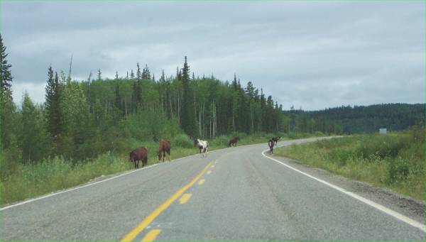
After taking a drive by the airport, I continued on my way westward. At this point, the Alaska Highway travels somewhat westerly, crossing in and out of B. C. seven times before finally heading northwest deeper in the Yukon. This part of the drive had me slow down at one point for about six pretty horses on the road.
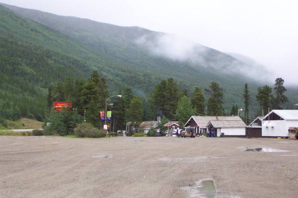
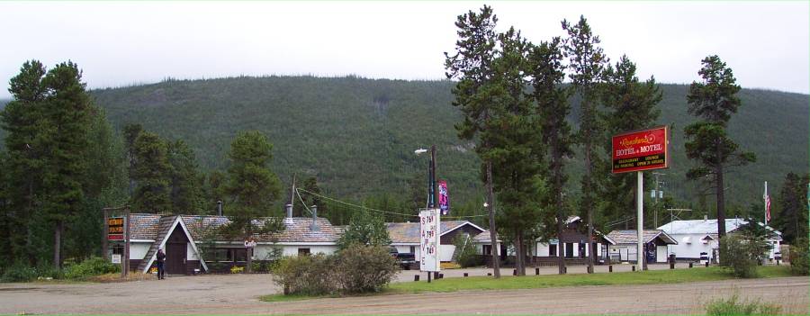
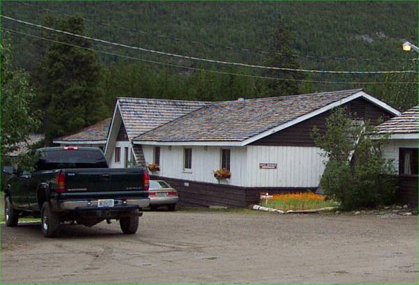
I finally got to Rancheria, and turned left into their parking lot. Working here for the summer is Steve, a twenty year old student from Prince George, B.C. Like Donna at the hotel last night, he checks people in for lodging at the hotel or campground, pumps gas, is the waiter of the restaurant and the lounge, gets drinks for the patrons, and does several other jobs around the place. He is a hard worker, very good with customers, and seems to be enjoying his summer here. He mentioned that this place is for sale, and for a price lower than its value! It seems the owner Beverly, who I got to meet, is really ready to retire. Steve said they could do more than their current business if they just advertised, but Beverly is not interested in any more business. Looks like an interesting place, but hard work.
Click on picture for larger image, hit back button to return to this page.
|
A bend in the river near the highway. |
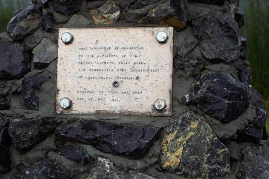
A monument was built and dedicated to the surveyors who worked the Alaska Highway. |
A close up of the plaque on the monument. |
|
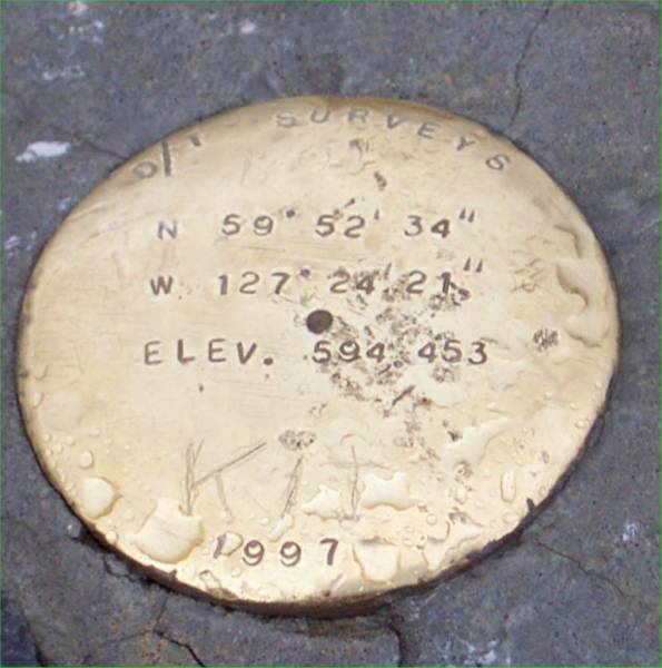
This marker was atop the monument. |
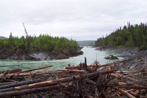
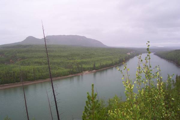
The Liard river was just off the highway. Even with the weather, the views were pretty. |
This picture is looking is the opposite direction. |
|
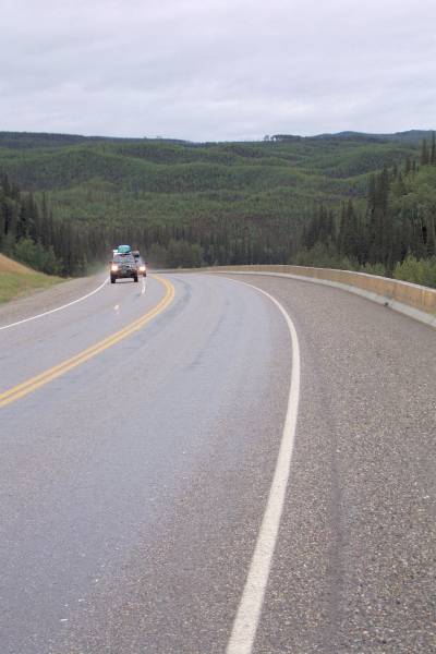
A view of a gravel portion of the highway. |
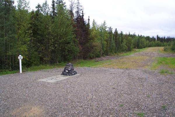
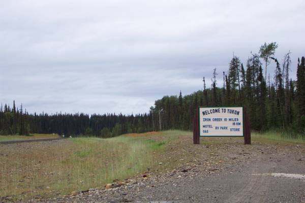
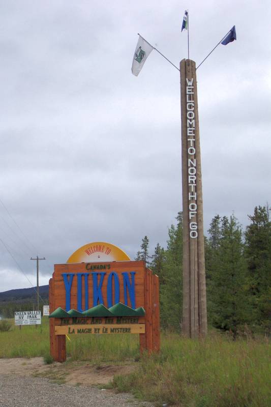
I have reached the Yukon Territory! This is the seventh province I have visited on this trip! In the background, an original section of the highway can bee seen. |
A close up of the border marker. This is one of the Yukon Territory - British Columbia border crossings, which the highway crosses several times. I am only counting this once! |
|
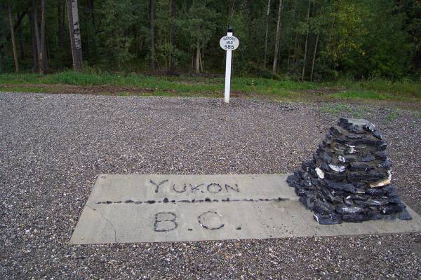
The sign was on the opposite end of the parking area where the province marker was located. The right side of the photo is the previous location of the Alaska Highway before improvements. |
An interesting hillside along the highway. |
The story of Contact Creek, where the road builders from the south and north met. |
|
This is the location of the original meeting point. The old road can be seen along the tree line. |
These next two pictures are a follow-up to the ones in the article. This is where the large culvert collapsed. The normal closed highway is straight ahead, while the makeshift bridge is off to the left. |
I followed another vehicle over the temporary bridge. |
|
Horses along the road. |
This marks one of the last times the Alaska Highway crosses into the Yukon Territory. |
The entrance sign to the Watson Lake Signpost Forest. This tells the "history" of the signposts. |
|
A wide angle view of the signpost forest. |
The Watson Lake Visitor Center. They had excellent displays available to learn about the area and the highway.
|
A collage of some of the signs to which I could relate. |
|
The Watson Lake Airport (YQH) main terminal and tower. |
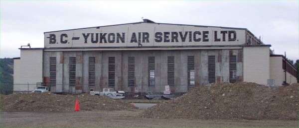
An air service hangar locates at the Watson Lake airport. |
This is a propeller from a plane that crashed into the waters of Watson Lake. |
|
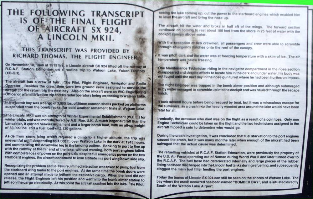
This display, on the cairn in the previous picture, describes the aircraft accident. |
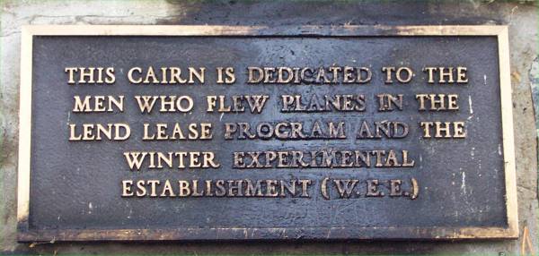
This is a close up of the plaque on the cairn. |
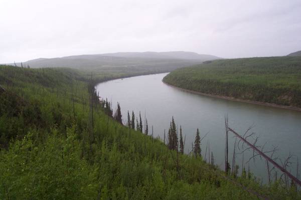
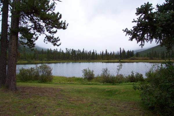
A pretty lake along the highway. |
|
After stopping at Rancheria, I took this picture looking northwest along the highway. |
The Rancheria complex. Camping, lodging, dining and gas were available here. As of 2002, it was for sale! |
The story of Rancheria. |
|
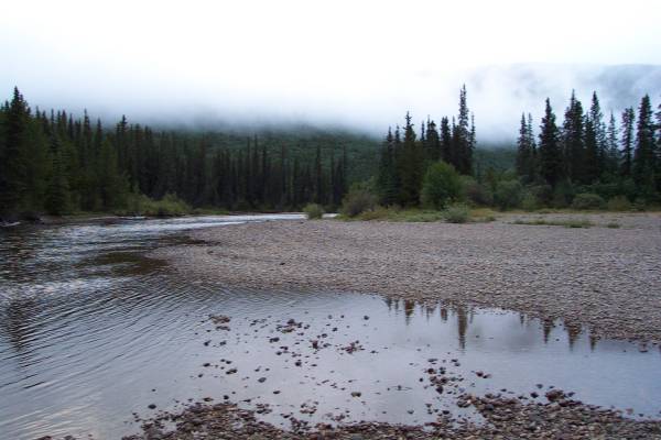
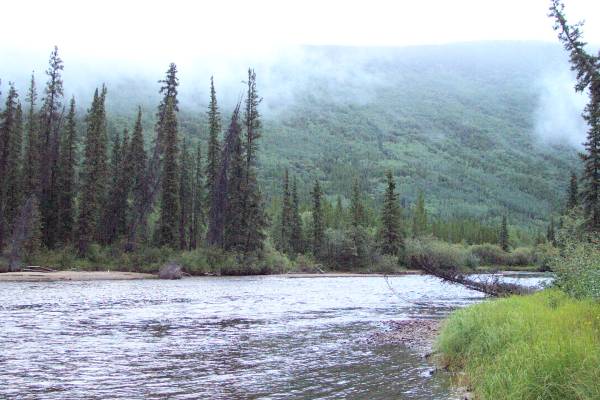
There was a trail out of the back of Rancheria that led to the Rancheria River. |
Another view of Rancheria River. |
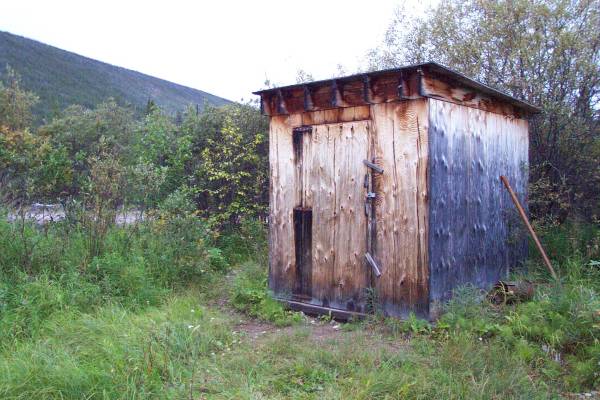
This shack was near the river. |
Tomorrow I continue up the Alaska Highway to Whitehorse, the capitol of the Yukon Territory. From there, I will be heading north on the Klondike Road, on my way to Dawson City. The part of the Alaska Highway I miss by taking this side route will be part of my return to the lower 48.
Thank you for stopping by!!!
Routes traveled today: B. C. 97, Yukon Territory 1
Hotel: Rancheria Hotel -

This page
accessed
times.
Page created by: igorn@igorn.com
Copyright © 2001 Igor N. Nikishin
All Rights Reserved
Pictures may be used with permission.