Sunday, August 19, 2001
Hello from Fort St. John, BC!
Start time: 0740
Start odometer: 8748
For the first day of my Alaska Highway drive, I was curious to learn what to
expect as I continued my journey. I found that for today, the distance
traveled was not far up the road, and a few side trips brought some interesting
learning experiences.
Today began cool and cloudy, with temperatures in the upper forties. As
soon as I departed the motel, it began to sprinkle. I drove around town
one more time for a few more pictures, then drove on towards Alaska.
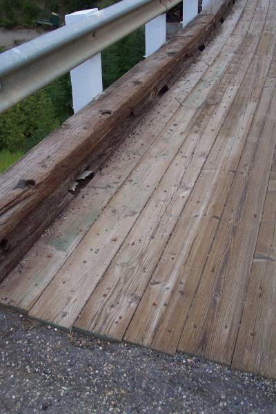
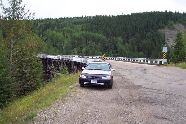
Reading "The Milepost," I learned of a side road that led to the only
remaining wooden bridge built during the original construction. This
particular bridge over the Kiskatinaw River had weight restrictions, so many of
the heavy trucks using the highway needed to take a side road to ford the river,
which they did not like to do. In the 1970s, a new portion of the road was
constructed, and a new bridge that could handle the weight was built. This
new section replaced 10 kilometers of the highway, but it is still possible to
take the old section to see the bridge. It was an interesting bridge to
see.
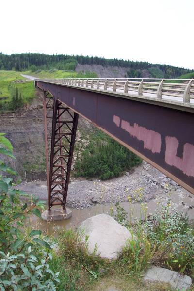
I connected back with the highway and decided to return to the first turnoff, so
that I could see the missed portion. The new replacement bridge is of interesting
design, with a single v-support in the center.
During the morning, rain was becoming more prevalent. However, whenever
I wanted to get out of the car for a look or to take pictures, the rain
ceased. It was interesting!
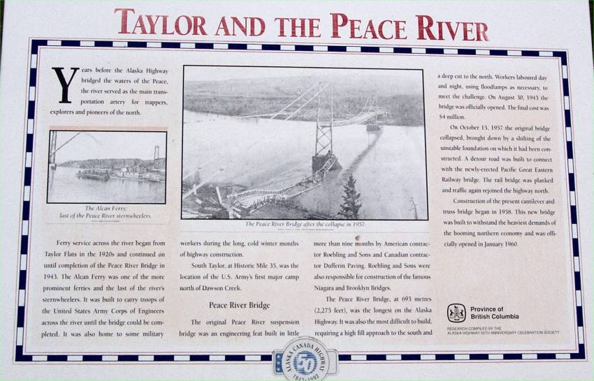
Continuing the drive, I arrived in Taylor, a small town along the Peace
River. A suspension bridge used to cross the river, but part of it
collapsed in 1957, so a new cantilever and truss-type bridge was built in its
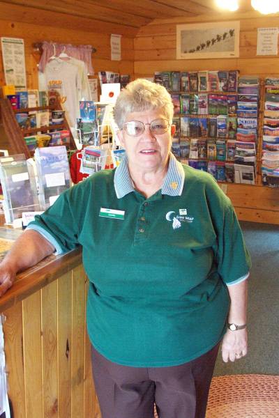
place. Also in Taylor is another visitor center. Juanita was working
at the center today, and she provided me with more information about the drive,
and was also extremely informative and helpful. I received more pamphlets
and updated current condition handouts, which will be very useful. Before
I left, she mentioned a tour I might find interesting at a local hydro-electric
plant outside of Hudson's Hope, BC. That was to be my next destination.
I arrived in Fort St. John, the next city along the highway. After
picking up some fuel, ice, and travel tips from a woman running the gas station,
I went a bit north of town to Route 29 and turned west. The drive to
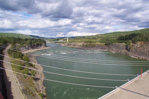
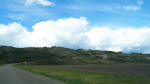
Hudson's Hope is just over an hour, but the scenery is incredible! The
road travels along the Peace River valley, and many outlooks are provided.
On this leg, I saw a few deer, but no other game.
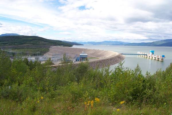
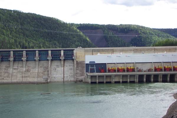
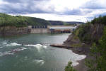
The Bennet Dam is located approximately ten minutes beyond Hudson's Hope, and
is an impressive site. It was built in the 1960s by B. C. Hydro, has ten
available generators, and provides power for much of western Canada, and has
also been used for power in the U. S. I arrived at their visitor center
just in time to board a bus that takes groups inside the dam for a tour.
Our guide Travous Quibell gave an excellent tour of the facilities, and we were
able to see many interesting areas of the plant, including the area after water
departs the generators. I was very impressed with his knowledge, as were
other members in my tour group. This tour, as well as the many displays in
the visitor center, showed the intriguing engineering design of the plant and
dam. After the tour, I spoke with Travous, asking more questions and
getting more information. I think I might be driving some of these tour
guides to reconsider there jobs! Travous is a computer geek, so we had
even more to talk about! He is a student at a university in BC, and works
in the summer at the dam. Also, he is a resident of Hudson's Hope.
Travous suggested a drive over the dam for another view, followed by a drive
to the other BC Hydro dam on the other side of town. I took a few pictures
of the dam after I drove to the other side of the dam, then went to the Peace
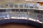
Canyon Dam. Unfortunately, they were getting ready to close, but
offered to stay a few minutes for me to look at their center and the control
room. Fortunately, I was not the only one there, so I took a quick look
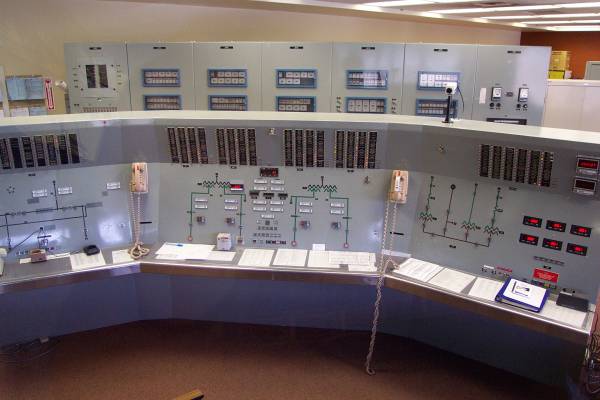
around. The plant and dam are smaller than the Bennet Dam, but the control
room was very interesting. I left a few minutes later, so they did not
have to stay for me.
It was after 1600, so I decided to drive back to Fort St. John and stay for
the night. The return drive was over the same road, but this time it was
sunny for most of the drive, as the rains stopped around noon. Again, the
scenery was quite impressive. Plus, I finally got to see more
wildlife. Halfway to Fort St. John, a black bear crossed the road in front
of me. I slowed down to avoid getting close to it, and in case another was
near. As soon as I passed the first bear, another walked across the road
behind me. Cute animals, but I kept my distance away from them.
Click on picture for larger image,
hit back button to return to this page.
|
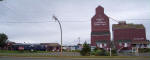
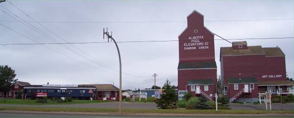
One last look at the visitor center before heading out on the
highway. |
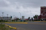
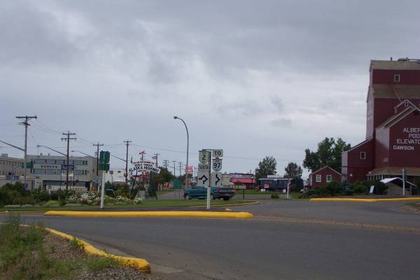
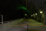
I drove around a traffic circle to get started. |
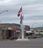
This is a symbolic zero milepost marker in Dawson Creek. |
|
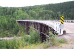
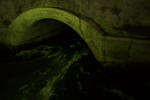
One of the older wooden bridges over the Kiskatinaw River on part of the
Alaska Highway that has been replaced with a new section. |
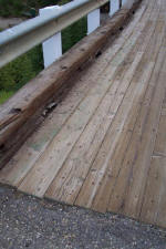
A closer look at the wooden Kiskatinaw River bridge. |
A final look at the bridge. |
|
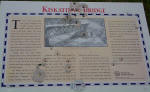
A slightly damaged panel
describing the Kiskatinaw River bridge |
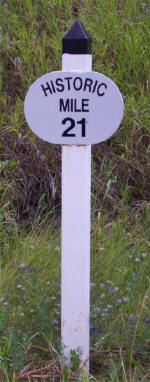
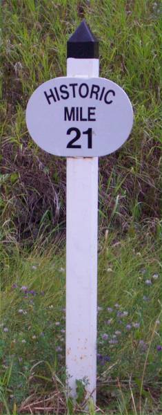
These posts dot the side of the
highway. |
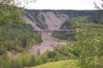
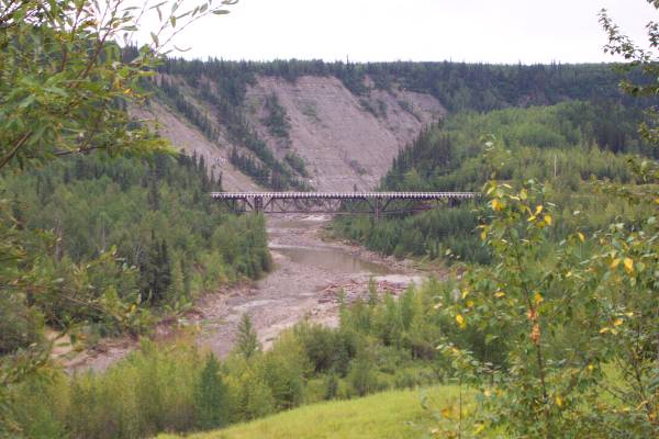
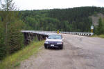
The is the Kiskatinaw River
bridge from a distance. |
|

This is the only bridge of this
type on the highway, using a single V support. |
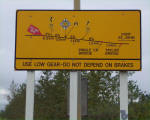
Road grade information. |
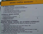
Brake check advisory panel. |
|

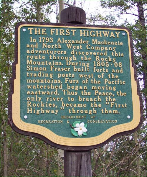
Historic panel describing the
first highway here, used by fur traders in the late eighteenth century. |
My first look at the Peace River. |
The Peace River Bridge can be
seen here. This
link
shows a picture of the original bridge that collapsed in 1957. |
|

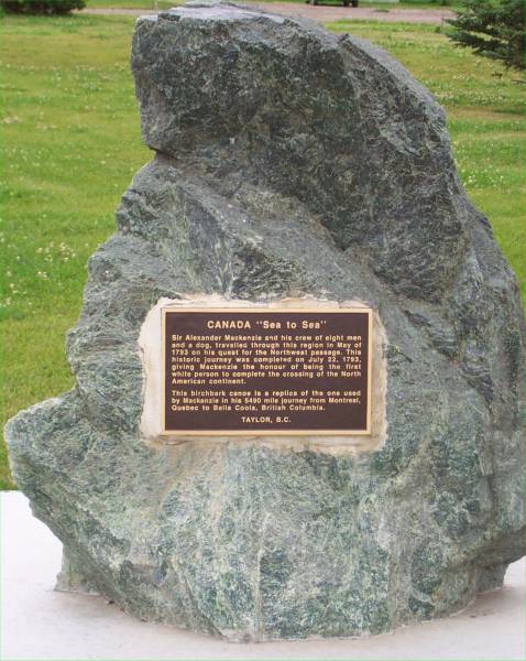
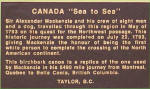
At a visitor center along the
highway, this stone and plaque were dedicated to Sir Alexander MacKenzie.
He and a group of eight others were the first white people to cross the
continent. |
A closer look at the plaque. |
This is the canoe referenced in
the plaque in the previous picture. |
|
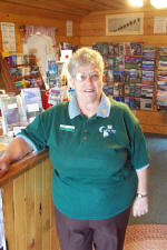
Meet Juanita, who I met at the
visitor center near Taylor. She was very helpful in providing
information to further enhance my journey, |
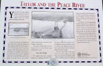
A panel describing Taylor and the
Peace River. |
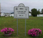
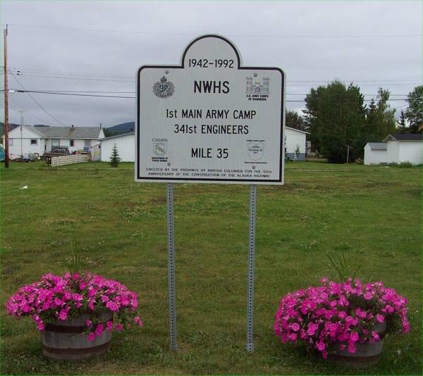
This marked the previous location
of the 1st Main Army camp. |
|
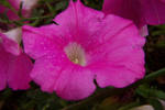
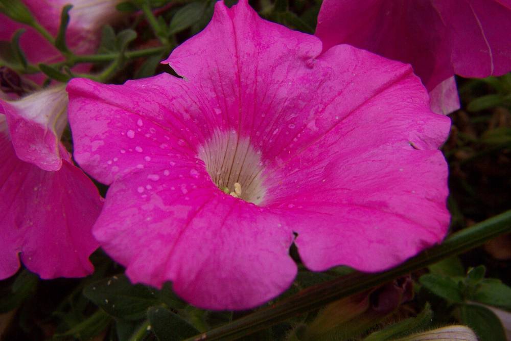
A close-up of a flower seen in
the previous picture. |
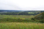
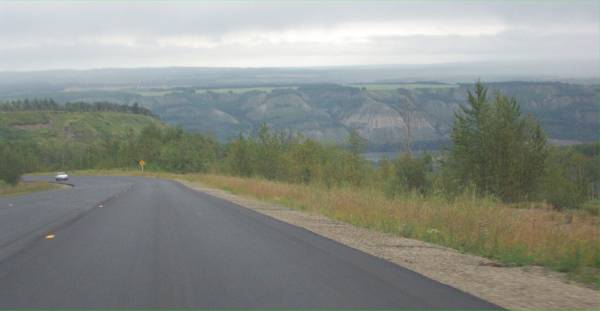
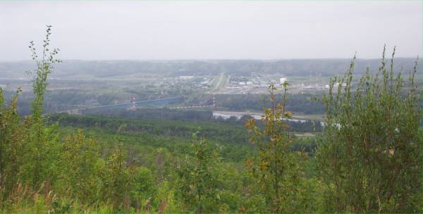
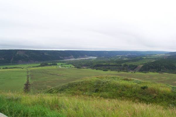
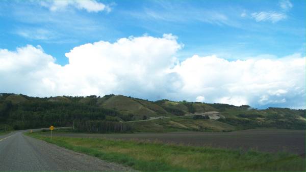
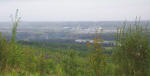
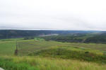
This and the next picture were
taken of the Peace River valley from an overlook enroute to my visit to the
W. A.
C. Bennett power generating facility. |
 |
|
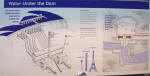
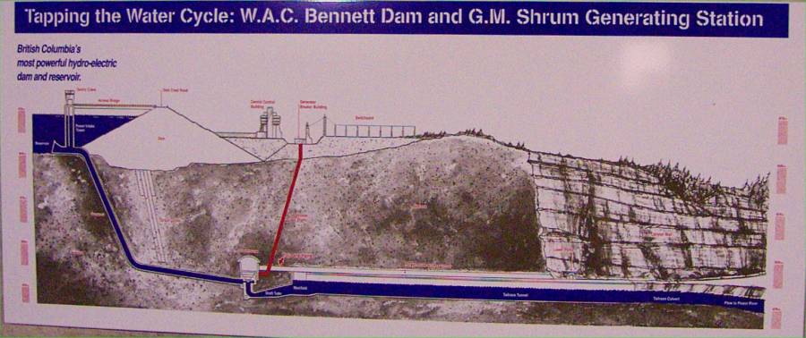
A diagram of the facility. |
One of the ten generators in the
plant. |
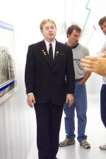
Our tour guide was extremely
informed and provided for a very interesting tour. |
|
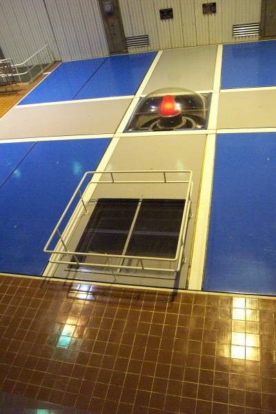
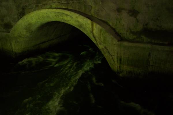
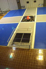
This is in the depths of the
plant, where the water exits the generators. |
Another look at the area where
the water leaves. |

Another diagram showing the inner
workings of the dam. |
|
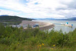
An exterior shot from the east
side of the dam. |
I drove across the dam to get
this picture from the opposite side. |
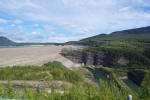
I stopped by the
Peace
Canyon Dam power generating facility. |
|

The Peace River approaching the
dam. |
Another view of the dam. |

A closer look at the dam. |
|
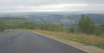
I stopped along the road to get
this picture showing some of the view of the drive back to Fort St. John. |
|
|
Tomorrow I head further up the highway, and hope to be in or beyond Fort
Nelson, BC. Thank you for viewing my trip log!
Routes traveled today: 97 (Alaska Highway) - 29 - 97
Hotel: The Alexander MacKenzie Inn (named
after the first European explorer to cross to continent to the Pacific) -

This page
accessed  times.
Page
created by: igorn@igorn.com
Copyright
© 2001 Igor N. Nikishin
All
Rights Reserved
Pictures
may be used with permission.