Saturday, August 18, 2001
Hello from Dawson Creek, British Columbia!
Start time: 0750
Start odometer: 8459
Click on
picture for larger image, then click on the back button to return.
 I finally made it to the Alaska Highway!!! For a long time, I had hoped to
get to Dawson Creek and drive the highway, so I am happy to be here. I
decided to stop here a little early to get caught up on my literature about the
highway, including information I picked up at the local tourist
desk.
I finally made it to the Alaska Highway!!! For a long time, I had hoped to
get to Dawson Creek and drive the highway, so I am happy to be here. I
decided to stop here a little early to get caught up on my literature about the
highway, including information I picked up at the local tourist
desk.
It was another great weather day, cool to start, and the sky was clear.
Looking at the map, it appeared today was going to be spent mostly
driving. There were a few roadside information displays, but for the most
part, I stopped just to get pictures of the different views I was seeing.
I saw several deer, and many different birds, but the larger game heard me
coming and hid! I plan to hike a bit as I get further north, so I
anticipate a broader scope of viewed wildlife. Interesting to see are the
different type of trucks and transport vehicles, and their cargo.
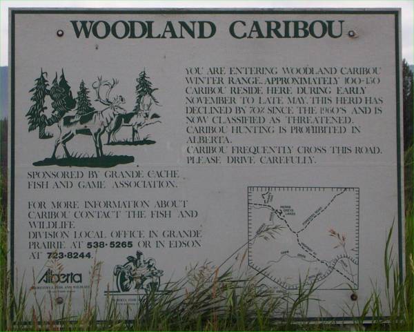
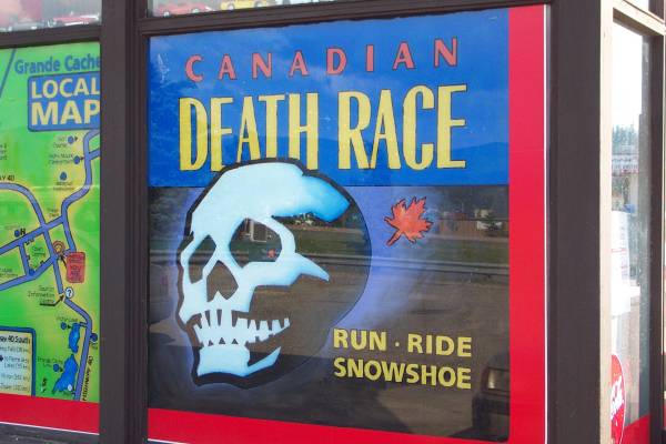
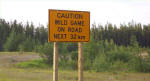
I stopped for gas in Grande Cache, Alberta. I noticed several posters
and banners displayed around the city concerning the town being the home of the
"Death Race." The station attendant described it as a 125 km
race with running, riding, and snowshoeing. One of the races limits it
participants to 24 hours maximum, with some people unofficially take even
longer!
I arrived in Grande Prairie around noon and decided to take a break. I
stopped at a few stores to look at computer supplies, picked up a couple of
CDs, and a replacement headset for my radio, as my current one is in need of
repair. Considering the exchange rate, the prices were pretty
reasonable.
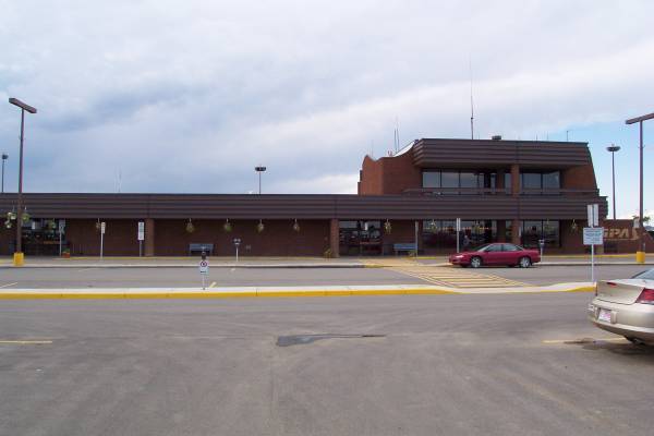
I continued on Alberta Route 43 out of town when I noticed an airport just
off the road. They were having a large new car sale on the grounds of the
airport, so I took a drive through the parking lot. I decided to park and
walk inside the terminal, then stopped by the snack bar for lunch. It
brought back memories of the many meals eaten at airport snack bars during my
airline career.
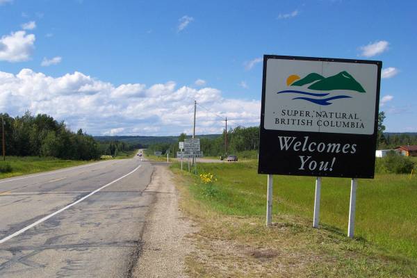
I got back on the road heading northwest, until I crossed into British
Columbia. This also took me into the Pacific Time Zone, and it was nice to
get an extra hour today. Also, as the temperature started increasing,
storm clouds were developing to the south. It was impressive to see them
from such a distance. However, to the west, the sky was filled with puffy
white clouds dotting the blue sky, so I had no rain.
My final stop was in Dawson Creek, at the park commemorating the beginning of
the Alaska Highway. I stopped in the visitor center, where Jennifer C.
provided more materials to aid in my travels along the highway. The other
person working the center was Jennifer S., who also answered questions and
provided suggestions. They did a great job, and their knowledge of the
highway and activity options was impressive. There is a museum on site,
which I visited, learning more about the region, as well as the highway.
I had a nice dinner at the Alaskan Restaurant, and took a drive around the
town. Along one of the roads, the RCMP had a safety check set up. I
stopped to talk with one of the officers, and learned he grew up in the Montreal
area. He had also visited Maine many times. We talked for a few
minutes, and he provided me with a few places to visit in Quebec when I return
to the Northeast. While we spoke, he spent some of the time waving cars
by, but when I left, there were six cars lined up behind me! Hopefully
that gave them time to put on their safety belts.
Tomorrow I continue up the highway. I am armed with "The
Milepost", an annually published magazine that describes the roads and highways of the
Northwest. Their web site has much
information, so take a look if you have time. Thanks for stopping by...
Click on picture for larger image,
hit back button to return to this page.
|
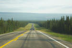
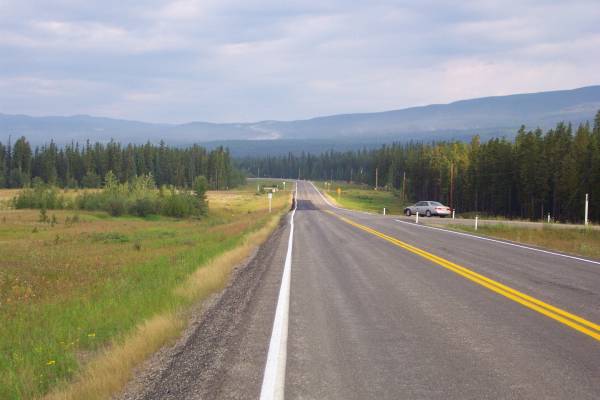
Heading north out of Hinton, this
was how much of Alberta 43 appeared. |
I was able to see road signs not
normally used in the states. |
More of the highway can be seen
beyond the trees upon the hillside. |
|
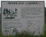
Information about the Woodland
Caribou. |
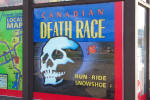
The sign in Grand Cache describe
in the text above. |

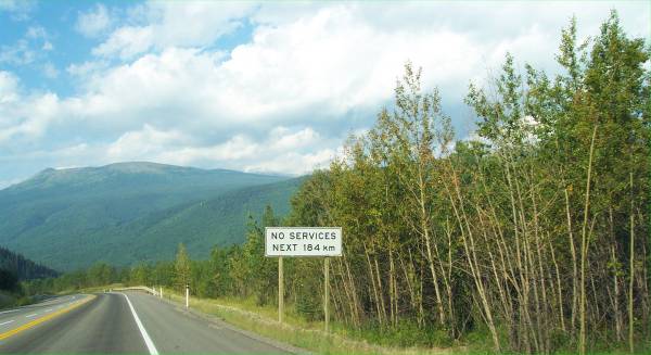
One hundred fifteen miles to the
service area. Interesting mountain views were to be seen in this
region. |
|
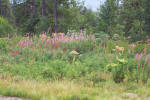
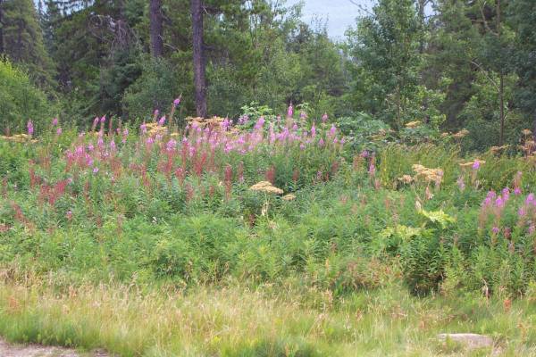
Nice wildflowers lined parts of
the road. |
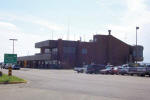
Grand Prairie Airport (YQU)
terminal. |

Another view of the airport. |
|
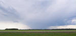
An interesting storm was passing
to the south of my location. |
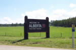
I took this picture since there
was no sign when I first entered Alberta. |

This was my first visit to
British Columbia, which would also be the sixth province I visited so
far on the trip. |
|
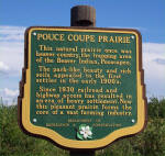
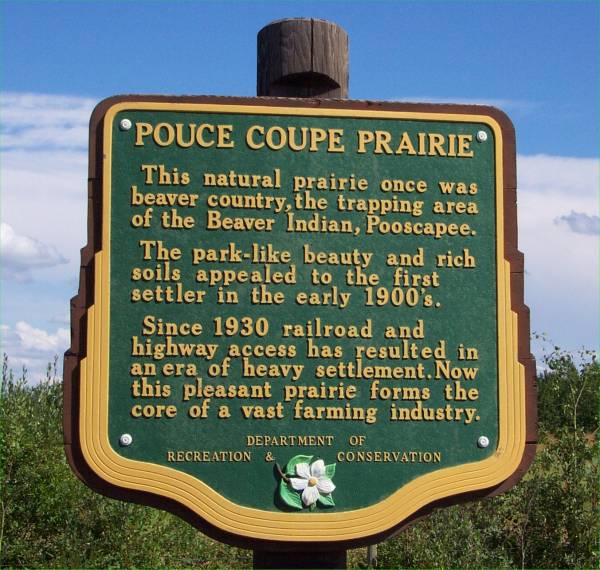
A short story about the
Pouce Coupe
Prairie. |

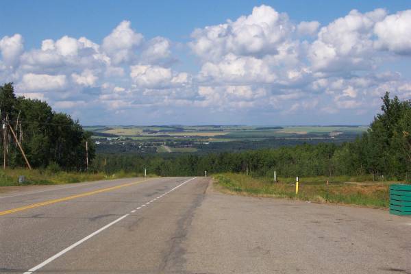
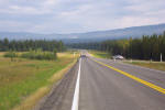
A view into the British Columbian
prairie. |

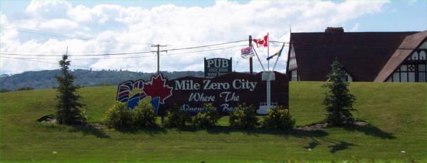
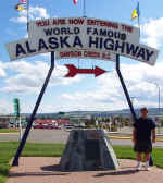
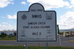
"Mile Zero City",
Dawson Creek, British Columbia. |
|
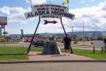
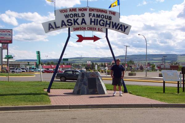
I MADE IT! |
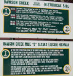
These signs are posted in many
areas along the road. |
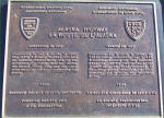
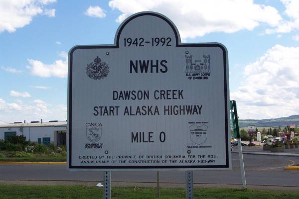
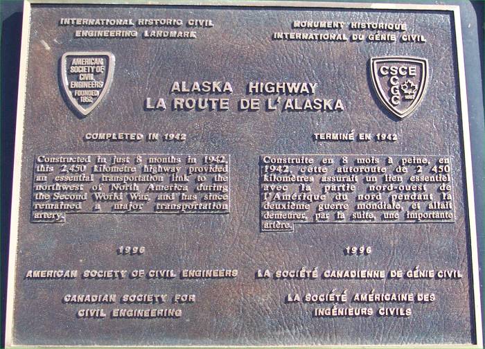
An engineering landmark plaque
dedicated to the Alaska Highway. |
|
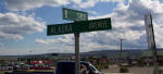
Street sign indicating Alaska
Avenue. |
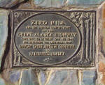
Another plaque marking "Zero
Mile." |
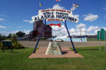
Another view of the Alaska
Highway sign, with the visitor center and museum in the background. |
|
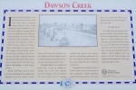
Descriptive panels, such as this
one mentioning Dawson Creek, are located along the highway. |
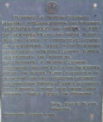
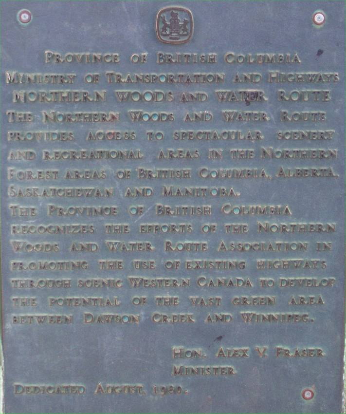
A plaque mentioning the
Northern Woods and Water Routes
Association. |
Historical information about
Dawson Creek and the Alcan Highway. |
|
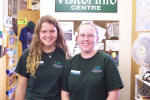
Jennifer C. and Jennifer S. were
very helpful in providing information about the highway. |
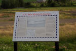
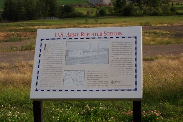
Information about a United States
Army repeater station. |
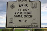
Another marker indicating the
location of the former Alaska Highway control station. |
Routes traveled today: Alberta 40 - Alberta 43 - British Columbia 2 - BC
97 (The Alaska Highway)
Hotel: Peace Villa Hotel -

This page
accessed  times.
Page
created by: igorn@igorn.com
Copyright
© 2001 Igor N. Nikishin
All
Rights Reserved
Pictures
may be used with permission.
 I finally made it to the Alaska Highway!!! For a long time, I had hoped to
get to Dawson Creek and drive the highway, so I am happy to be here. I
decided to stop here a little early to get caught up on my literature about the
highway, including information I picked up at the local tourist
desk.
I finally made it to the Alaska Highway!!! For a long time, I had hoped to
get to Dawson Creek and drive the highway, so I am happy to be here. I
decided to stop here a little early to get caught up on my literature about the
highway, including information I picked up at the local tourist
desk.