Thursday, August 9, 2001
Hello from Minot, North Dakota
Start time: 0745
Start odometer: 6355
Weather: Cloudless sky to start, with
clouds rolling in throughout the day. But still a beautiful
day!
I had a very nice day driving through North Dakota, and find myself in
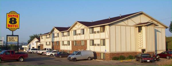
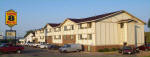
another Super 8, this time in Minot (pronounced like "Why Not".)
It was a pretty day, with a variety of scenery to keep my interest.
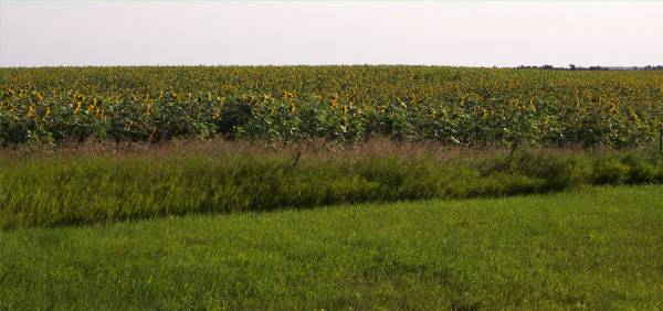
I began this morning driving under a clear blue sky, and passing many
sunflower fields. The yellow against the blue sky was spectacular.
I drove in a northwesterly route, and after a couple of hours, I reached my
first objective. After a vehicle safety inspection by North Dakota State
Police, who were stopping all cars on the road, I entered the
International
Peace Gardens. This area is located on a large piece of land donated
by the U. S. and Canada in 1933, and developed under the representation of the
peaceful relationship between Canada and the United States. I was
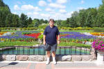
fortunate to meet Brad, a summer worker at the gardens, who gave an excellent
tour of the grounds. It is an incredibly beautiful place, with many lovely
plants, trees, shrubs, statues, fountains, and other items to enhance the
experience. Please see the link for more information on the history and
ideals of the project.
Following my visit to the gardens, I headed south, followed by a short detour
to the west. Route 49 is labeled a scenic highway, so I drove on it for a
few miles. It provided a very different view of North Dakota, with many
rolling hills, lakes, and forests. There were many picturesque scenes
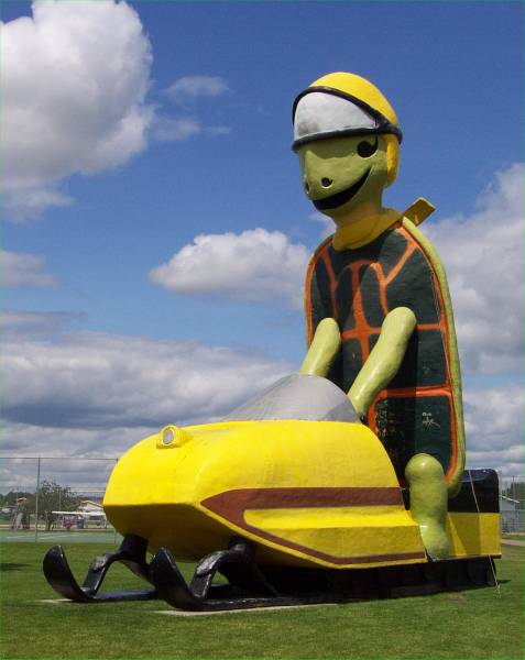
along the road. I continued my journey with a stop in Bottineau to take a
picture of a very tall turtle on a snowmobile.
A large part of this area of North Dakota is known as Turtle Mountain, since it
is a hill approximately 600 feet higher than the surrounding area and
oval in shape. There are many references to turtles in this region,
including the Turtle Mountain Indian Reservation.
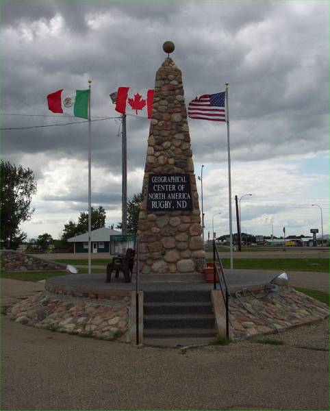
My final "tourist" stop for the day was in Rugby, N. D. This
is the location of the geographical center of North America! There is a
monument at the site, and pictures will be added soon. While I was at the
monument, I was fortunate to meet a very nice couple that happened to be on the
tour I took at the Peace Gardens. Don and Ruth had sold their house last
year and bought a camper, and have been traveling quit a bit since. They
are from Ames, Iowa, and are also headed west towards Washington. I hope
to meet up with them again as I also head that way.
Click on picture for larger image,
hit back button to return to this page.
|
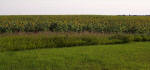
A large field of Sunflowers! |
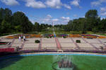
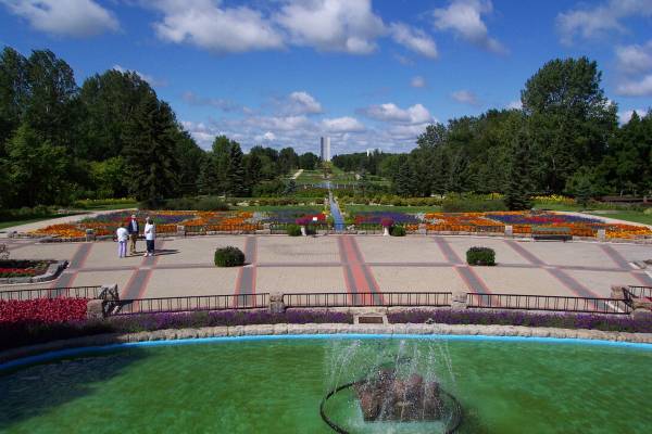
Looking along the main corridor of the Peace Gardens. |
The corridor behind me is along the international border between the United
States and Canada.
|
|
This is Brad showing us certain plants in the garden. |
There were many pretty scenes throughout the park. |
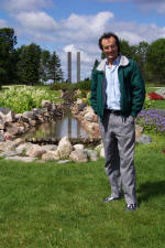
I asked Brad to pose for a picture. The
Peace Towers stand
behind him. |
|
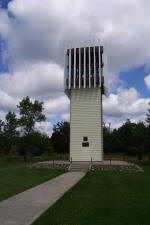
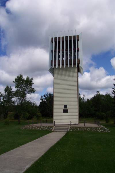
This is a bell tower, as explained in the next picture. This part of
the park is in Manitoba. |
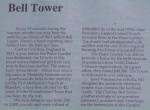
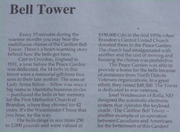
Information about the previous picture. |
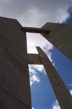
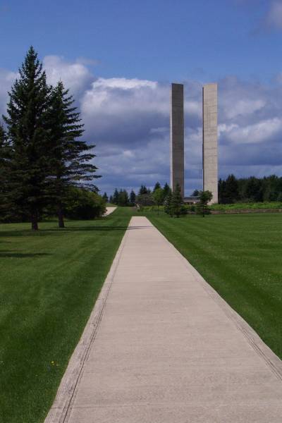
Looking up at the Peace Towers. |
|
This is the Peace Chapel, just west of the Peace Towers. |
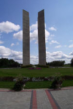
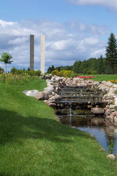
A view of the Peace Towers from the chapel. |
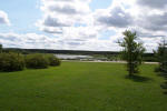
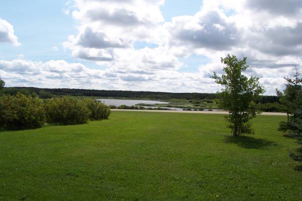
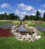
Lake Udall, looking south from the main corridor of the gardens. |
|

Looking west towards the towers. |

A small creek was built through the central area of the park. |
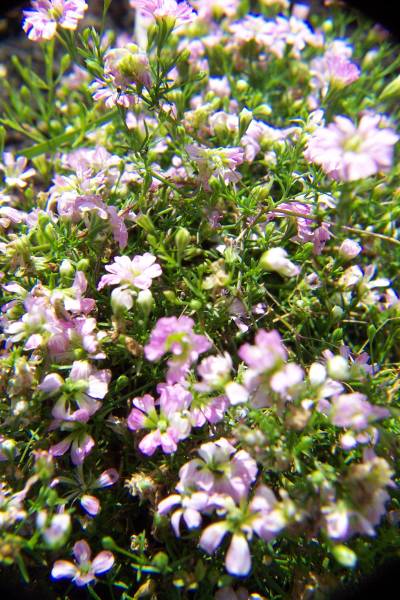
More varieties of flowers than I will ever know... |
|
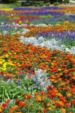
...With very colorful arrangements. |
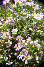
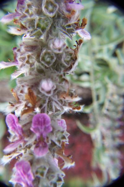
This picture and the next were as a result of me testing my close-up lenses. |
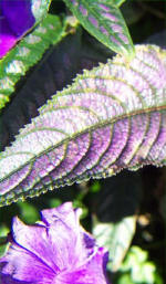
An interesting leaf up close. |
|
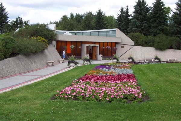
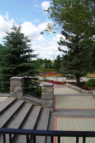
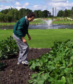
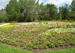
The view after my return to the formal garden located near the Interpretive
Center. |
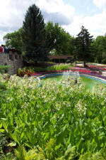
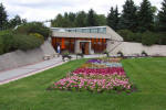
The Interpretive Center is the building beyond the gardens and water
fountain. |

Another attempt to use my close-up lens attachments. |
|
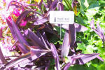
A purple heart. |
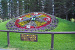
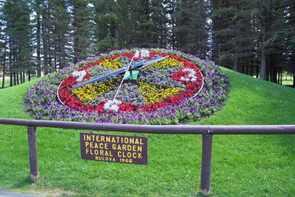
A clock made from flowers! |
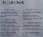
This panel describes the floral clock. |
|
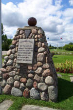
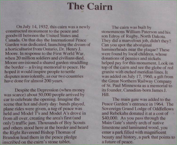
This cairn was located on the border. |
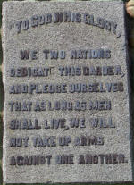
This is the plaque placed on the cairn in the previous picture. |
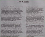
This explains the cairn monument history. |
|
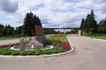
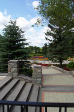
As I departed the gardens, I took one more snapshot, showing the entrance to
the park. I had never heard of this place before, but was very glad to
have experienced it. I hope I am able to return again soon! |

The very tall turtle of Bottineau! |
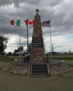
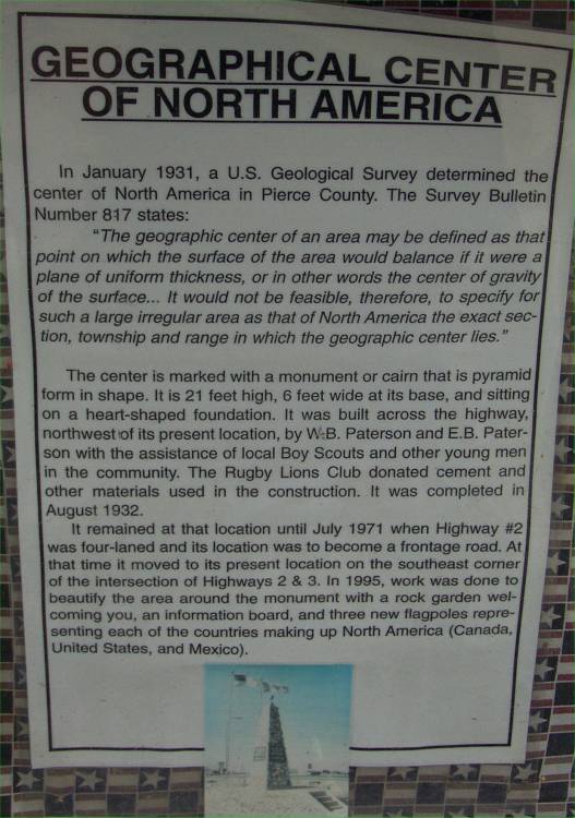
This marks the geographical center of North America. Well actually, it
was moved from its original position due to highway construction. The
center is a few hundred yards away, under a frontage road! But by
visiting it, I got to meet Don and Ruth again! |
|
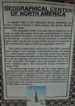
This sign explained the marker in
the previous picture. |
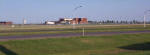
MOT...The Minot airport. |
|
Tomorrow I head towards western North Dakota, and a visit to the Theodore
Roosevelt National Park Thanks for visiting, and I hope to hear from you
soon...
Routes traveled today: North Dakota 17 - US 281 - ND 49 - ND 52 - ND 5 -
ND 66 - ND 3 - US 2 - US 85
Hotel: Super 8 -
Gas: $1.449 (Grafton, ND)

This page
accessed  times.
Page
created by: igorn@igorn.com
Copyright
© 2001 Igor N. Nikishin
All
Rights Reserved
Pictures
may be used with permission.